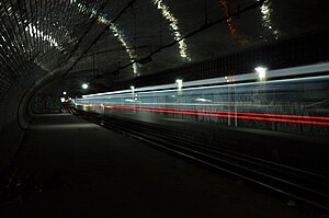
| Champ de Mars | |||||
|---|---|---|---|---|---|
| Paris Métro station | |||||
 Abandoned platforms Abandoned platforms | |||||
| General information | |||||
| Location | Île-de-France France | ||||
| Coordinates | 48°51′07″N 2°18′07″E / 48.851944°N 2.301944°E / 48.851944; 2.301944 | ||||
| Owned by | RATP | ||||
| Operated by | RATP | ||||
| Line(s) | Closed ( | ||||
| Platforms | 2 (2 side platforms) | ||||
| Tracks | 2 | ||||
| History | |||||
| Opened | 13 July 1913 (1913-07-13) | ||||
| Closed | 2 September 1939 (1939-09-03) | ||||
| |||||
Champ de Mars (French pronunciation: [ʃɑ̃ d(ə) maʁs]) is a ghost station on line 8 of the Paris Métro, between the stations of La Motte-Picquet–Grenelle and École Militaire. It is situated in the 7th arrondissement of Paris, to the southwest of Champ de Mars, a public garden, of which it is named after.
History

The station opened as part of the initial section of the line 8 from Beaugrenelle (now Charles Michels on line 10) and Opéra on 13 July 1913.
On 2 September 1939, the station was closed as part of the government's plan that reduced service on the métro network as a cost-saving measure in light of the onset of World War II, with all but 85 stations closed. Most reopened after the war, and although it also was reopened, the station was eventually closed again due to its light traffic which made it unprofitable to operate, hence, becoming a ghost station.
In the early 1960s, more than twenty years later, it was still found on the official maps of the network by the RATP, as were the other closed stations at the time: Croix-Rouge, Arsenal, Saint-Martin, and Cluny. However, they were removed in subsequent maps since the 1970s, barring Cluny: it reopened as Cluny–La Sorbonne in 1988.
A siding and a track connection between lines 8 and 10 (towards the direction of Boulogne) exists south of the station.
The station originally had two accesses, on both sides of Place Joffre. The access on the Champ de Mars side still exists whereas the one on the École militaire side has been converted into a ventilation shaft to lower the temperature in the tunnels below.
Today, a station of line C of the RER is situated to the northwest of Champ de Mars, a public garden, has taken its name and is called Champ de Mars–Tour Eiffel, almost 1 kilometre away. It has a connection to line 6 at the Bir-Hakeim.
Station layout
| Street Level | ||
| B1 | Mezzanine | |
| Platform level | Side platform, not in service | |
| Southbound | ← (No service southbound: La Motte-Picquet–Grenelle) | |
| Northbound | (No service northbound: École Militaire) → | |
| Side platform, not in service | ||
Gallery
References
- "Plan de poche 1963" [Pocket map 1963]. sfjacques1966.free.fr (in French). Archived from the original on 6 October 2018. Retrieved 1 May 2023.
- "Plan de poche 1970" [Pocket map 1970]. sfjacques1966.free.fr (in French). Archived from the original on 6 October 2018. Retrieved 1 May 2023.
- "Où se cachent les stations fantômes de Paris ?". cartes.pariszigzag.fr (in French). Archived from the original on 10 December 2022. Retrieved 7 May 2023.
| 7th arrondissement of Paris | |
|---|---|
| Neighbourhoods |
|
| Primary and secondary schools |
|
| Colleges and universities | |
| Landmarks | |
| Paris Métro stations | |
| Paris RER stations | |
This article related to the Paris Métro is a stub. You can help Misplaced Pages by expanding it. |


