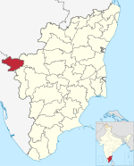
Village in Tamil Nadu, India
| Cherangode | |
|---|---|
| Village | |
  | |
| Coordinates: 11°31′53″N 76°19′31″E / 11.53139°N 76.32528°E / 11.53139; 76.32528 | |
| Country | |
| State | Tamil Nadu |
| District | Nilgiris |
| Taluk | Panthalur |
| Government | |
| • Type | Sarpanch |
| Area | |
| • Total | 74.94 km (28.93 sq mi) |
| Elevation | 956 m (3,136 ft) |
| Population | |
| • Total | 33,506 |
| • Density | 450/km (1,200/sq mi) |
| Languages | |
| • Official | Tamil |
| Time zone | UTC+5:30 (IST) |
| PIN | 643205 |
| STD code | 04262 |
| Vehicle registration | TN-43 |
Cherangode is a village located in Tamil Nadu, India. It is located close to Tamil Nadu's western border with Kerala. As of 2011, the village had a population of 33,506.
Geography
Cherangode is located to the west of the Nilgiri Mountains, about 42 kilometres northwest of the district capital Udhagamandalam. The total area of the village is 7494 hectares.
Demographics
According to the 2011 census, the population of Cherangode was 33,506, including 16,475 males and 17,031 females. The working-age population accounted for 45.21% of the total population. The literacy rate stood at 78.65%, with 13,840 of the male residents and 12,511 of the female residents being literate.
References
- ^ "Population finder 2011". Office of the Registrar General $ Census Commissioner, India. Retrieved 3 October 2023.
- "Map of Cherangode village in Panthalur tahsil, The Nilgiris, India". Village Map. Retrieved 3 October 2023.
| Nilgiris district | |||||||||||
|---|---|---|---|---|---|---|---|---|---|---|---|
| District headquarters |  | ||||||||||
| Country | |||||||||||
| State | |||||||||||
| Region | |||||||||||
| Divisions | |||||||||||
| Taluks | |||||||||||
| Revenue blocks | |||||||||||
| Municipalities | |||||||||||
| Towns and villages |
| ||||||||||
| Geography |
| ||||||||||
| History | |||||||||||
| Protected areas | |||||||||||
| Transport | |||||||||||
| Related | |||||||||||