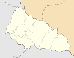
| Chornyi Potik Чорний Потік | |
|---|---|
| Village | |
  | |
| Coordinates: 48°24′29″N 22°59′52″E / 48.40806°N 22.99778°E / 48.40806; 22.99778 | |
| Country | |
| Oblast | |
| Raion | Khust Raion |
| Hromada | Irshava urban hromada |
| Founded | 1600 |
| Elevation | 385 m (1,263 ft) |
| Population | |
| • Total | 1,013 |
| Time zone | UTC+1 (CET) |
| • Summer (DST) | UTC+2 (CEST) |
| Postal code | 90110 |
| Area code | +380 3144 |
| Climate | [ |
Chornyi Potik (Ukrainian: Чорний Потік) is a village located in Khust Raion, Zakarpattia Oblast (province) in western Ukraine. It forms part of Irshava urban hromada, one of the hromadas of Ukraine.
Until 18 July 2020, Chornyi Potik, was located in Irshava Raion. The raion was abolished that day and its territory was merged into Khust Raion as part of the administrative reform of Ukraine, which reduced the number of raions of Zakarpattia Oblast to six.
Demographics
According to the 1989 census, the population of Chornyi Potik was 966, of which 470 were men and 496 were women. According to the 2001 census, 1013 people lived in the village.
Languages
Native language as of the Ukrainian Census of 2001:
| Language | Percentage |
|---|---|
| Ukrainian | 99.01 % |
| Russian | 0.99 % |
References
- "Chornyi Potik (Khust Raion, Zakarpattia Oblast)". weather.in.ua. Retrieved 21 March 2023.
- "Про утворення та ліквідацію районів. Постанова Верховної Ради України № 807-ІХ". Голос України (in Ukrainian). 2020-07-18. Retrieved 2020-10-03.
- "Нові райони: карти + склад" (in Ukrainian). Міністерство розвитку громад та територій України.
- "Кількість наявного та постійного населення по кожному сільському населеному пункту, Херсонська область (осіб) - Регіон, Рік, Категорія населення , Стать (1989(12.01))". Archived from the original on 2014-07-31. Retrieved 2023-03-21.
- "Кількість наявного населення по кожному сільському населеному пункту, Херсонська область (осіб) - Регіон , Рік (2001(05.12))". Archived from the original on 2014-07-31. Retrieved 2023-03-21.
- "Розподіл населення за рідною мовою, Херсонська область (у % до загальної чисельності населення) - Регіон, Рік , Вказали у якості рідної мову (2001(05.12))". Archived from the original on 2014-07-31. Retrieved 2023-03-21.