Townland in County Cork, Ireland
| Clontead Beg | |
|---|---|
| Townland | |
| Irish transcription(s) | |
| • Derivation: | Cluain Téide Bheag |
 | |
 | |
| Coordinates: 51°54′37″N 8°46′30″W / 51.91028°N 8.77500°W / 51.91028; -8.77500 | |
| Country | Ireland |
| County | County Cork |
| Barony | Muskerry East |
| Civil parish | Magourney |
| Settlements | Coachford |
| Government | |
| • Council | Cork County Council |
| • Ward | Blarney-Macroom EA |
| Area | |
| • Total | 92.71 ha (229.08 acres) |
| Irish grid reference | W466733 |
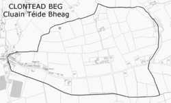
Clontead Beg (from Irish Cluain Téide Bheag) is a townland within the civil parish of Magourney and Catholic parish of Aghabullogue, County Cork, Ireland. It is approximately 229 acres in size, and east of Coachford village.
In the Down Survey (Muskery Map, 1656-8), it is referred to as 'Clonete Beg', but does not appear as a 'denomination' on the Down Survey parish map, nor is it mentioned in the accompanying terrier.
The Ordnance Survey name book (c. 1840) describes the western end of the townland as forming the village of Coachford and the eastern end the 'Derreen Demesne'. Variations of the placename include 'Clontade', 'Clontead', 'Clontadebeg' and 'Clontade Beg'. A suggested Irish version is Cluain Téide Beg, with 'Cluain Téide' interpreted as 'plain or lawn of the green '. O'Murchú (1991) gives an Irish version of Cluain Téide, suggesting 'Téide' as meaning a plateau, or a plain on a hill; essentially 'plain of the flat-topped hill'. The Placenames Database of Ireland gives the townland an Irish name of Cluain Téide Bheag, with 'Cluain' meaning 'meadow' or 'pasture'.
|
|
|
See also
References
- ^ "Cluain Téide Bheag / Clontead Beg". logainm.ie. Placenames Database of Ireland. Retrieved 29 August 2021.
- "Clontead Beg Townland, Co. Cork". townlands.ie. Retrieved 29 August 2021.
- "Down Survey map 1656-8 (Barony of Muskery)". Retrieved 28 April 2014.
- O'Murchú, M. (December 1991). "Place names of the parish of Aghabullogue". Coachford Record. 2.
- Does not include population within Coachford village, part of which is situate in Clontead Beg townland, but separately returned as per Census records.
- ^ Histpop; Area, population and number of houses, Vol. II, Ireland, 1881, page 207
- ^ HistPop; Area, houses, and population, Munster, Ireland,1911 Page 94
- "Grand Jury map of County Cork" (PDF). Retrieved 28 April 2014.