55°42′00″N 3°49′59″W / 55.700°N 3.833°W / 55.700; -3.833
| ClydesdaleLanark (1975–1980) | |
|---|---|
| District | |
 | |
| Population | |
| • 1991 | 57,588 |
| History | |
| • Created | 16 May 1975 |
| • Abolished | 31 March 1996 |
| • Succeeded by | (Part of) South Lanarkshire |
| Status | District |
| • HQ | Lanark |
Clydesdale (pronounced /ˈklaɪdzdeɪl/; Dail Chluaidh in Scottish Gaelic, pronounced [t̪ʰal̪ˠ ˈxl̪ˠuəj]) was a local government district in the Strathclyde region of Scotland from 1975 to 1996. The district was initially called Lanark when created in 1975, but changed its name to Clydesdale in 1980. Clydesdale was an old name for the county of Lanarkshire, one of the historic counties of Scotland. Both the names Clydesdale and Strathclyde reference the area's position in the valley (strath or dale) of the River Clyde.
History
The district was created in 1975 under the Local Government (Scotland) Act 1973, which established a two-tier structure of local government across mainland Scotland comprising upper-tier regions and lower-tier districts. Lanark was one of nineteen districts created within the region of Strathclyde. The district covered the whole area of five former districts from the historic county of Lanarkshire:
The district was initially named "Lanark" after the area's main town. The council changed the name to "Clydesdale" in 1980.
The district was roughly conterminous to Lanarkshire's historic 'upper ward', being its southern part, the largest part in area but more rural and agricultural in character than the 'middle' and 'lower' wards which covered the densely-populated industrial towns in and around the lower Clyde Valley and the city of Glasgow.
The district was abolished in 1996 under the Local Government etc. (Scotland) Act 1994 which replaced regions and districts with unitary council areas. South Lanarkshire council area was formed covering the districts of Clydesdale, East Kilbride, Hamilton, and parts of the City of Glasgow district.
The term Clydesdale continues to be used locally, usually in contexts comparing issues affecting the rural southern territory differently to the more urbanised north, or in names of organisations which focus on the area around Lanark. Four of the multi-member wards used by South Lanarkshire Council since 2007 use the name: Clydesdale East, Clydesdale North, Clydesdale South and Clydesdale West with a combined population of 61,613 in 2019; these roughly correspond to the Clydesdale constituency of the Scottish Parliament established in 1999.
Political control
The first election to the district council was held in 1974, initially operating as a shadow authority alongside the outgoing authorities until it came into its powers on 16 May 1975. Political control of the council from 1975 was as follows:
| Party in control | Years | |
|---|---|---|
| No overall control | 1975–1988 | |
| Labour | 1988–1992 | |
| No overall control | 1992–1996 | |
Premises
The council initially used various offices which had been inherited from its predecessor districts. By 1978 it had moved into the converted and extended former St Mary's Hospital buildings on South Vennel in Lanark, which had been built in the 1860s. Since the council's abolition the building has been an area office for South Lanarkshire Council.
-
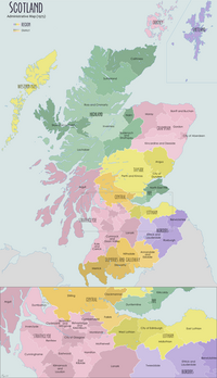
Map of Scotland showing the historic district of Clydesdale
-
 1868 map of Lanarkshire with its three 'wards' labelled, Clydesdale corresponding to the Upper Ward
See also
- 1974 Clydesdale District Council election
- 1988 Clydesdale District Council election
- 1992 Clydesdale District Council election
- Subdivisions of Scotland
- Clydesdale horse
- Clydesdale Bank
- Clydesdale (UK Parliament constituency)
References
- The Statesman's Year-Book 1997-8, page 1294; B. Hunter (ed); Springer, 2016; ISBN 9780230271265
- "Local Government (Scotland) Act 1973", legislation.gov.uk, The National Archives, 1973 c. 65, retrieved 6 January 2023
- Clydesdale, Gazetteer for Scotland
- Clydesdale, Undiscovered Scotland
- "Name change". Press and Journal. Aberdeen. 21 May 1980. p. 7. Retrieved 6 January 2023.
Lanark District Council will be known as Clydesdale District Council from Monday, September 1, 1980.
- Lanarkshire, Gazetteer for Scotland
- "Local Government etc. (Scotland) Act 1994", legislation.gov.uk, The National Archives, 1994 c. 39, retrieved 3 January 2023
- About Us, Clydesdale Housing Association
- About Us, Clydesdale's Heritage (Lanark and District Archaeological Society)
- "Local multi-member ward boundary maps". South Lanarkshire Council. 4 May 2017. Retrieved 28 March 2021.
- "United Kingdom: Scotland | Council Areas and Electoral Wards". City Population. 30 June 2019. Retrieved 28 March 2021.
- Council Area: South Lanarkshire, Scottish Government Statistics
- "Compositions calculator". The Elections Centre. Retrieved 18 January 2023.
- Clyde Valley Telephone Directory, November 1978, page 331
- "Lanarkshire". Historic Hospitals. Retrieved 18 January 2023.
- "Lanark, St Mary's Hospital". Canmore. Historic Environment Scotland. Retrieved 18 January 2023.
- "South Vennel, Lanark". South Lanarkshire Council. Retrieved 18 January 2023.
External links
- Historic map showing Clydesdale divided in Nether and Upper Wards
- Historic map showing Clydesdale in Scotland
- Historic map showing Clydesdale in Scotland
- Historic map showing Clydesdale in Scotland
- Historic map showing Clydesdale in Scotland
| Local government areas of Scotland, in use 1975 to 1996 | ||
|---|---|---|
| Borders |  | |
| Central Region | ||
| Dumfries and Galloway | ||
| Fife | ||
| Grampian | ||
| Highland | ||
| Lothian | ||
| Strathclyde | ||
| Tayside | ||
| Island areas | ||
| The island areas were unitary authorities, combining the powers of a region and a district. | ||
| Council elections in South Lanarkshire | |
|---|---|
| South Lanarkshire Council | |
| Strathclyde Regional Council | |
| Clydesdale District Council | |
| East Kilbride District Council | |
| Hamilton District Council | |