| Collegiate Peaks | |
|---|---|
| central Sawatch Range | |
 View of the Collegiate Peaks from near the Arkansas River just south of Chalk Creek. View of the Collegiate Peaks from near the Arkansas River just south of Chalk Creek. | |
| Highest point | |
| Peak | Mount Harvard |
| Elevation | 14,427 ft (4,397 m) |
| Coordinates | 38°55′28″N 106°19′15″W / 38.92444°N 106.32083°W / 38.92444; -106.32083 |
| Dimensions | |
| Length | 34 mi (55 km) W-E |
| Width | 30 mi (48 km) N-S |
| Area | 587 sq mi (1,520 km) |
| Geography | |
| Country | United States |
| State | Colorado |
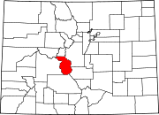
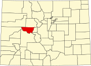
| County | Chaffee and Pitkin |
| Parent range | Sawatch Range, Rocky Mountains |
The Collegiate Peaks (or Collegiate Range) is a name given to a section of the Sawatch Range of the Rocky Mountains located in central Colorado. Drainages to the east include headwaters of the Arkansas River.
The Collegiate Peaks include some of the highest mountains in the Rockies. The section is so named because several of the mountains are named for prominent universities.
In the Arapaho language the Collegiate Peaks were called "hiwoxuu hookuhu'ee" or the Elk's Head.
Prominent peaks
| Rank | Mountain Peak | Elevation | Prominence | Isolation |
|---|---|---|---|---|
| 1 | Mount Harvard NGS | 14,421 ft 4396 m |
2,327 ft 709 m |
14.92 mi 24 km |
| 2 | La Plata Peak | 14,343 ft 4372 m |
1,841 ft 561 m |
6.28 mi 10.1 km |
| 3 | Mount Belford NGS | 14,204 ft 4329 m |
1,317 ft 401 m |
3.3 mi 5.31 km |
| 4 | Mount Princeton NGS | 14,204 ft 4329 m |
2,156 ft 657 m |
– |
| 5 | Mount Yale NGS | 14,202 ft 4329 m |
1,876 ft 572 m |
5.55 mi 8.93 km |
| 6 | Mount Oxford NGS | 14,160 ft 4316 m |
633 ft 193 m |
1.22 mi 1.97 km |
| 7 | Mount Columbia NGS | 14,079 ft 4291 m |
873 ft 266 m |
1.9 mi 3.05 km |
| 8 | Missouri Mountain NGS | 14,074 ft 4290 m |
827 ft 252 m |
1.31 mi 2.11 km |
| 9 | Huron Peak NGS | 14,012 ft 4271 m |
1,403 ft 428 m |
3.21 mi 5.16 km |
| 10 | Grizzly Peak NGS | 13,995 ft 4266 m |
1,908 ft 582 m |
6.77 mi 10.89 km |
| 11 | Ice Mountain PB | 13,958 ft 4254 m |
991 ft 302 m |
2.11 mi 3.39 km |
| 12 | Mount Hope PB | 13,939 ft 4249 m |
853 ft 260 m |
2.91 mi 4.68 km |
| 13 | Emerald Peak PB | 13,911 ft 4240 m |
544 ft 166 m |
1.3 mi 2.09 km |
| 14 | North Apostle PB | 13,847 ft 4220 m |
360 ft 110 m |
0.37 mi 0.59 km |
| 15 | Rinker Peak PB | 13,789 ft 4203 m |
903 ft 275 m |
1.53 mi 2.46 km |
| 16 | Peak 13,762 (Silver King Peak) PB | 13,769 ft 4197 m |
822 ft 251 m |
1.69 mi 2.72 km |
| 17 | Garfield Peak PB | 13,767 ft 4196 m |
340 ft 104 m |
0.83 mi 1.34 km |
| 18 | Sayres Benchmark NGS PB | 13,745 ft 4189 m |
958 ft 292 m |
1.92 mi 3.09 km |
| 19 | Turner Peak | 13,233 ft 4033 m |
1,157 ft 353 m |
3.88 mi 6.24 km |
| 20 | Sewanee Peak | 13,132 ft 4003 m |
538 ft 164 m |
0.73 mi 1.18 km |
See also
References
- "U.S. Board on Geographic Names".
- "Colorado Places: Their Native American Names". Center for Native American and Indigenous Studies (CNAIS). 2020-07-24. Retrieved 2024-01-12.
- ^ The elevation of this summit has been converted from the National Geodetic Vertical Datum of 1929 (NGVD 29) to the North American Vertical Datum of 1988 (NAVD 88). National Geodetic Survey
External links
- "Collegiate Peaks". Peakbagger.com.
| Municipalities and communities of Chaffee County, Colorado, United States | ||
|---|---|---|
| County seat: Salida | ||
| City |  | |
| Towns | ||
| CDPs | ||
| Unincorporated communities | ||
| Municipalities and communities of Pitkin County, Colorado, United States | ||
|---|---|---|
| County seat: Aspen | ||
| City |  | |
| Towns | ||
| CDPs | ||
| Unincorporated communities | ||
| Ghost towns | ||
| Footnotes | ‡This populated place also has portions in an adjacent county or counties | |
| State of Colorado | |
|---|---|
| Denver (capital) | |
| Topics |
|
| Society | |
| Cities |
|
| Counties |
|
| Regions |
|