| This article uses bare URLs, which are uninformative and vulnerable to link rot. Please consider converting them to full citations to ensure the article remains verifiable and maintains a consistent citation style. Several templates and tools are available to assist in formatting, such as reFill (documentation) and Citation bot (documentation). (August 2022) (Learn how and when to remove this message) |
| Crucero Carmita | |
|---|---|
| Village | |
 Train #1343 attraction, with the Santa Clara–Caibarién Road in the background Train #1343 attraction, with the Santa Clara–Caibarién Road in the background | |
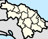
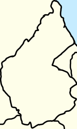
 Map of Crucero Carmita (red) in Luis Arcos Bergnes (orange) in Camajuani. Map of Crucero Carmita (red) in Luis Arcos Bergnes (orange) in Camajuani. | |
   | |
| Coordinates: 22°27′24″N 79°47′36″W / 22.45667°N 79.79333°W / 22.45667; -79.79333 | |
| Country | Cuba |
| Province | Villa Clara |
| Municipality | Camajuaní |
| Popular Council | Carmita |
| Elevation | 78 m (256 ft) |
| Population | |
| • Total | 704 |
| Postal Code | 52500 |
Crucero Carmita also known as El Crucero de Carmita is a village in the ward of Luis Arcos Bergnes (or Carmita), Camajuaní, Villa Clara, Cuba. It had a population of 704 people and has 261 houses. Nearby towns are Fusté, San José, Dolores, Corona, Aguijón, and Santana.
Location
The town is located on the junction of the Road to Luis Arcos Bergnes, to Carmita and Vega Alta, and the Road of Camajuaní. To the north is the settlement of Fusté, to the west is the town of El Berro in the municipality of Santa Clara, and to the east is the settlement of Santa Fé and the town of Blanquizal. In the center of the town is the #1343 Old Train of the former Central Carmita, a sugar mill in Luis Arcos Bergnes, signaling the start of the road to Carmita.
On the southern part of the town is the neighborhood of Reparto Nuevo (New Reparto), with it also having Zone 52 of Camajuaní. On the north part is the reparto of Reparto Viejo (Old Reparto), west of the Road to Luis Arcos Bergnes.
Education
There is one school in Crucero Carmita, which is the Julio Pino Primary School.
Economy
According at the DMPF (Departamento de control de la Dirección Municipal de Planificación Física or Management Control Department Municipal Physical Planning in English) of Camajuani, Crucero Carmita is a settlement linked to sources of employment or economic development.
The town has a pharmacy, named the Farmacia del Crucero.
References
- "Crucero Carmita (Camajuaní) Street Guide and Map".
- "Crucero Carmita, Camajuaní, Cuba on the Elevation Map. Topographic Map of Crucero Carmita, Camajuaní, Cuba".
- "Crucero Carmita, Camajuani, Villa Clara, Cuba Postal Code - Pin Code of Crucero Carmita, Camajuani, Villa Clara, Cuba - Crucero Carmita, Camajuani, Villa Clara, Cuba Zip Code".
- https://www.azcodigopostal.com/cuba/place-crucero-carmita-2605/
- "Crucero Carmita (Cuba) map - nona.net". nona.net. Retrieved 2022-07-21.
- lezumbalaberenjena (2013-03-17), Repartos nuevos, al sur de la carretera de Camajuaní en El Crucero de Carmita, en Camajuaní, Provincia Villa Clara, Cuba - 2013, retrieved 2023-07-03
- lezumbalaberenjena (2013-03-17), Reparto viejo, al norte de la entrada al central Luis Arcos Bergnes (antiguo Carmita) en el Crucero de Carmita, en Camajuaní, Provincia Villa Clara, Cuba - 2013, retrieved 2023-07-03
- "Portal del Ciudadano en Camajuaní - Educación". www.soycamajuani.gob.cu. Archived from the original on 2023-05-27. Retrieved 2022-12-23.
- Barroso, Joel Jiménez; Figueroa Vidal, Dr. Arq. Carlos. R. "Diagnóstico estratégico de la situación habitacional del municipio de Camajuaní" (PDF). p. 67.
- Asamblea, Comunicadora Social de la (2022-02-02). "Portal del Ciudadano en Camajuaní - Seguimos hacia adelante". Portal del Ciudadano en Camajuaní (in European Spanish). Retrieved 2023-05-20.