| Dáka | |
|---|---|
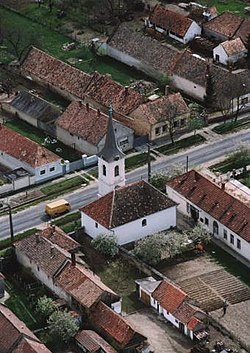
 Aerial photo of Dáka Aerial photo of Dáka | |
 Flag Flag Coat of arms Coat of arms | |
 | |
| Coordinates: 47°17′16″N 17°25′41″E / 47.28775°N 17.42816°E / 47.28775; 17.42816 | |
| Country | Hungary |
| Region | Central Transdanubia |
| County | Veszprém |
| Subregion | Pápai |
| Rank | Village |
| Area | |
| • Total | 25.40 km (9.81 sq mi) |
| Population | |
| • Total | 648 |
| • Density | 26/km (66/sq mi) |
| Time zone | UTC+1 (CET) |
| • Summer (DST) | UTC+2 (CEST) |
| Postal code | 8592 |
| Area code | +36 89 |
| KSH code | 20154 |
| Website | https://daka.hu/ |
Dáka is a village in Veszprém county, Hungary.
References
- ^ Dáka at the Hungarian Central Statistical Office (Hungarian).
- Dáka at the Hungarian Central Statistical Office (Hungarian). 1 January 2008
External links
This Veszprém county location article is a stub. You can help Misplaced Pages by expanding it. |