| Dapeng Bay | |
|---|---|
| 大鵬灣 (Chinese) | |
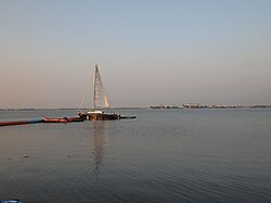
  Dapeng Bay is located at the south of Donggang Township Dapeng Bay is located at the south of Donggang Township | |
 | |
| Location | Donggang, Pingtung County, Taiwan |
| Coordinates | 22°26′46″N 120°28′30″E / 22.44611°N 120.47500°E / 22.44611; 120.47500 |
| Type | Lagoon |
| River sources | Linbian River(林邊溪) |
| Managing agency | Dapeng Bay National Scenic Area Administration,Tourism Bureau,Ministry of Transportation and Communications |
| Designation | national scenic areas |
| Average depth | 3 m (9.8 ft) |
| Dapeng Bay | |||||||||
|---|---|---|---|---|---|---|---|---|---|
| Traditional Chinese | 大鵬灣 | ||||||||
| Simplified Chinese | 大鹏湾 | ||||||||
| Literal meaning | Peng or Roc Bay | ||||||||
| |||||||||
Dapeng Bay or Dapeng Wan is a lagoon in Donggang Township, Pingtung County, Taiwan. It is the largest lagoon on the southwest coastline of Taiwan Island.
Scenic Area
The Dapeng Bay National Scenic Area is a nationally protected area that includes the bay as well as nearby Liuqiu Island.
Transportation
The bay is accessible within walking distance west of Zhen'an Station of Taiwan Railways Administration.
References
- Dapeng Wan (Approved - N) at GEOnet Names Server, United States National Geospatial-Intelligence Agency
External links
- Dapeng Bay National Scenic Area (governmental site)
- "Map: Dapeng Bay, 2013 Tour de Taiwan". Cycling iQ. Archived from the original on 31 August 2014. Retrieved 31 August 2014.
- "Taiwan from the Air--Chopper Shots: %. Dapeng Bay". Archived from the original on 31 August 2014.
This article about a location in Taiwan is a stub. You can help Misplaced Pages by expanding it. |