| Davit Bek Դավիթ Բեկ | |
|---|---|
 | |
  | |
| Coordinates: 39°19′05″N 46°29′43″E / 39.31806°N 46.49528°E / 39.31806; 46.49528 | |
| Country | |
| Province | Syunik |
| Municipality | Kapan |
| Population | |
| • Total | 796 |
| Time zone | UTC+4 (AMT) |
Davit Bek (Armenian: Դավիթ Բեկ) is a village in the Kapan Municipality of the Syunik Province in Armenia. Located in the Kashun river valley, 28 kilometers from the regional center of Kapan, it lies 1150 meters above sea level. It is named after the Armenian patriotic leader David Bek.
The village is the birthplace of Aram Manukian, the Armenian revolutionary leader and the founder of the First Republic of Armenia. The Surp Gayane Church of Davit Bek was opened in 2008.
Etymology
The village was previously known as Zeyva or Zeyva Mure before being renamed to Davit Bek on June 29, 1949, in honor of the 17th century Armenian military commander Davit Bek who founded the Principality of Kapan.
Description
Davit Bek is located in a forested valley among the Bargushat range of the Zangezur Mountains of Southern Armenia. It has a mild climate and beautiful nature. Its local Armenian residents are mostly engaged in agriculture such as grain cultivation, tobacco, fruit, vegetable, and livestock farming. The houses are large and built traditionally of stone. A rest house by the name of Karmrakar is located in the vicinity of the village.
History
Lying 3 kilometers away from the village is the medieval church and village of Takh whose inhabitants relocated to present-day Davit Bek in the 19th century. Earlier inhabitation of the area of Davit Bek is evidenced by a 10th-century tombstone on the far side of the village. In the 20th century, the village was part of the Ghapan region of the Armenian SSR (1920–1991). During that time, a secondary school, cultural center, kindergarten, liberty, maternity hospital and veterinary clinic were built. In 1981, the Kapan branch of the “Masis” footwear production opened in Davit Bek. In addition, a reservoir for irrigation purposes was built here.
Demographics
The 2011 Armenia census reported its population as 796, down from 809 at the 2001 census. The population is almost entirely ethnic Armenian and belongs to the Armenian Apostolic Church.
| Year | Pop. | ±% p.a. | ||
|---|---|---|---|---|
| 1897 | 714 | — | ||
| 1926 | 761 | +0.22% | ||
| 1939 | 859 | +0.94% | ||
| 1959 | 815 | −0.26% | ||
| 1970 | 931 | +1.22% | ||
| 1979 | 800 | −1.67% | ||
| 2001 | 809 | +0.05% | ||
| 2004 | 771 | −1.59% | ||
| ||||
| Source: | ||||
Gallery
-
 WWII monument
-
 St. Stepanos Church (1866)
-
 St. Gayane Church
-
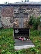
 Monument to fallen residents of Davit Bek in the First Nagorno-Karabakh War
References
- Statistical Committee of Armenia. "The results of the 2011 Population Census of the Republic of Armenia" (PDF).
- "Syunik regional e-Governance System" (in Armenian). Syunik Province provincial government. Click on link entitled "Համայնքներ" (community) and search for the place by Armenian name.
- ^ Hakobyan, T. Kh.; Melik-Bakhshyan, St. T.; Barseghyan, H. Kh. (1988). "Դավիթ Բեկ" [Davit Bek]. Հայաստանի և հարակից շրջանների տեղանունների բառարան [Dictionary of Toponymy of Armenia and Adjacent Territories] (in Armenian). Vol. 2. Yerevan State University Publishing House. p. 44.
- ^ Հայաստանի Հանրապետության բնակավայրերի բառարան [Republic of Armenia settlements dictionary] (PDF) (in Armenian). Yerevan: Cadastre Committee of the Republic of Armenia. 2008. Archived from the original (PDF) on 11 March 2018. p. 66
- "Marzes of Armenia and Yerevan City in Figures, 2010" (PDF). Statistical Committee of Armenia.
- Report of the results of the 2001 Armenian Census, Statistical Committee of Armenia
This article about a location in Syunik Province, Armenia is a stub. You can help Misplaced Pages by expanding it. |
