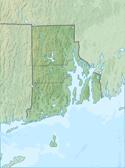
| Diamond Hill Reservoir | |
|---|---|
| Pawtucket Upper Reservoir | |
 | |
| Location | Cumberland, Providence County, Rhode Island, United States |
| Coordinates | 41°59′23″N 71°23′55″W / 41.9897°N 71.3985°W / 41.9897; -71.3985 |
| Type | Reservoir |
| Basin countries | United States |
| Built | 1971 |
| Surface area | 160 ha (400 acres) |
| Water volume | 19,340,000 m (683,000,000 cu ft) |

Diamond Hill Reservoir (also known as the Pawtucket Upper Reservoir) is a reservoir in Cumberland, Providence County, Rhode Island near Diamond Hill.
The earthen Diamond Hill Reservoir Dam was constructed in 1971 with a height of 80 feet (24 m), and a length of 2,000 feet (610 m) at its crest. It impounds the Abbott Run waterway for municipal drinking water. Both dam and reservoir are owned and operated by the city of Pawtucket's Water Supply Board.
The reservoir it creates has a normal surface area of 390 acres (160 ha), a maximum capacity of 15,680 acre-feet (19.34 million cubic metres), and a normal storage of 11,000 acre⋅ft (14 million m). Immediately adjacent to the south is the Arnold Mills Reservoir.
References
- "Diamond Hill Reservoir". Archived from the original on 2012-10-13. Retrieved 2012-08-20.
| Waterbodies of Rhode Island | |
|---|---|
| Bays and sounds | |
| Canals, estuaries, and rivers | |
| Lakes and ponds |
|
| Reservoirs | |
41°59′23″N 71°23′54″W / 41.98974°N 71.39847°W / 41.98974; -71.39847