| Dobra | |
|---|---|
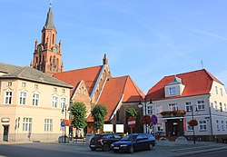
 Town center with the Saint Clare church and the town hall Town center with the Saint Clare church and the town hall | |
 Coat of arms Coat of arms | |
 | |
| Coordinates: 53°35′0″N 15°18′20″E / 53.58333°N 15.30556°E / 53.58333; 15.30556 | |
| Country | |
| Voivodeship | West Pomeranian |
| County | Łobez |
| Gmina | Dobra |
| Government | |
| • Mayor | Krzysztof Wrzesień |
| Area | |
| • Total | 2.32 km (0.90 sq mi) |
| Highest elevation | 92 m (302 ft) |
| Lowest elevation | 72 m (236 ft) |
| Population | |
| • Total | 2,215 |
| • Density | 950/km (2,500/sq mi) |
| Time zone | UTC+1 (CET) |
| • Summer (DST) | UTC+2 (CEST) |
| Postal code | 72-210 |
| Area code | +48 91 |
| Car plates | ZLO |
| Voivodeship roads | |
| Website | http://www.dobragmina.pl |
Dobra (German: Daber), also known as Dobra Nowogardzka, is a town in Łobez County, West Pomeranian Voivodeship, in northwestern Poland, with 2,215 inhabitants as of December 2021.
History

In the Middle Ages a Slavic gród existed in present-day Dobra. In the 10th century the area became part of the emerging Polish state under Mieszko I of Poland. It was granted town rights before 1331. In the 13th and 14th centuries a castle was built, rebuilt later in the 16th century, and heavily damaged in the 17th to 19th centuries. In 1647, due to the plague epidemic, the population of Dobra fell from over 600 to 48 people. From the 18th century, it was part of Prussia, and from 1871 to 1945 it was also part of Germany. In 1895, a narrow-gauge railway was built, connecting the town with Stargard. Following the defeat of Nazi Germany in World War II it became again part of Poland.
Gallery
-
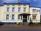
The oldest preserved townhouse in Dobra
-
Old timber framed house
-
Saint Clare church
-
 Library
References
- ^ "Local Data Bank". Statistics Poland. Retrieved 2022-07-30. Data for territorial unit 3218014.
- ^ "Historia Dobrej, Gmina Dobra" (in Polish). Retrieved July 17, 2019.
External links
| Łobez County | ||
|---|---|---|
| Seat |  | |
| Urban-rural gminas | ||
| Rural gmina | ||
| Gmina Dobra | ||
|---|---|---|
| Town and seat |  | |
| Villages | ||
This West Pomeranian Voivodeship location article is a stub. You can help Misplaced Pages by expanding it. |