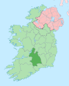
Village in Munster, Ireland
| Dolla An Doladh | |
|---|---|
| Village | |
 Dolla welcome sign Dolla welcome sign | |
 | |
| Coordinates: 52°47′52″N 8°11′25″W / 52.79777°N 8.19039°W / 52.79777; -8.19039 | |
| Country | Ireland |
| Province | Munster |
| County | County Tipperary |
| Time zone | UTC+0 (WET) |
| • Summer (DST) | UTC-1 (IST (WEST)) |
Dolla (Irish: An Doladh) is a village in County Tipperary, Ireland, at the crossroads of the R497 and R499 regional roads. It is located at the foot of the northern flank of the Silvermine Mountains, 8 km (5 mi) south of Nenagh. The village is in a civil parish of the same name.
Services in Dolla include a public house, petrol station, shop-pub and a post office. The Silvermines GAA Club pitch and club house are also located in Dolla.
The Garda Station is a protected structure under the County Development Plan. The structure was a former RIC barracks and was built c. 1890. The structure is the oldest building within the settlement boundary.
Notable people
- Sean Mackey, engineer
- Martin Ryan, publican
See also
References
- ^ "Placenames Database of Ireland". Dublin City University. Retrieved 22 August 2024.
- "Dolla Settlement Plan" (PDF). Tipperary County Council. Retrieved 13 February 2015.
External links
This article related to the geography of County Tipperary, Ireland is a stub. You can help Misplaced Pages by expanding it. |
