| Donon Light Railway | |||||||||||||||||||||||||||||||||||||||||||||||||||||||||||||||||||||||||||||||||||||||||||||||||||||||||||||||||||||||||||||||||||||||||||||||||||||||||||||||||||||||||||||||||||||||||||||||||||||||||||||||||||||||
|---|---|---|---|---|---|---|---|---|---|---|---|---|---|---|---|---|---|---|---|---|---|---|---|---|---|---|---|---|---|---|---|---|---|---|---|---|---|---|---|---|---|---|---|---|---|---|---|---|---|---|---|---|---|---|---|---|---|---|---|---|---|---|---|---|---|---|---|---|---|---|---|---|---|---|---|---|---|---|---|---|---|---|---|---|---|---|---|---|---|---|---|---|---|---|---|---|---|---|---|---|---|---|---|---|---|---|---|---|---|---|---|---|---|---|---|---|---|---|---|---|---|---|---|---|---|---|---|---|---|---|---|---|---|---|---|---|---|---|---|---|---|---|---|---|---|---|---|---|---|---|---|---|---|---|---|---|---|---|---|---|---|---|---|---|---|---|---|---|---|---|---|---|---|---|---|---|---|---|---|---|---|---|---|---|---|---|---|---|---|---|---|---|---|---|---|---|---|---|---|---|---|---|---|---|---|---|---|---|---|---|---|---|---|---|---|
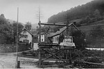
 Forest railway in the Donon mountains Forest railway in the Donon mountains | |||||||||||||||||||||||||||||||||||||||||||||||||||||||||||||||||||||||||||||||||||||||||||||||||||||||||||||||||||||||||||||||||||||||||||||||||||||||||||||||||||||||||||||||||||||||||||||||||||||||||||||||||||||||
| Overview | |||||||||||||||||||||||||||||||||||||||||||||||||||||||||||||||||||||||||||||||||||||||||||||||||||||||||||||||||||||||||||||||||||||||||||||||||||||||||||||||||||||||||||||||||||||||||||||||||||||||||||||||||||||||
| Coordinates | 48°29′08″N 7°09′57″E / 48.48557°N 7.16586°E / 48.48557; 7.16586 | ||||||||||||||||||||||||||||||||||||||||||||||||||||||||||||||||||||||||||||||||||||||||||||||||||||||||||||||||||||||||||||||||||||||||||||||||||||||||||||||||||||||||||||||||||||||||||||||||||||||||||||||||||||||
| Technical | |||||||||||||||||||||||||||||||||||||||||||||||||||||||||||||||||||||||||||||||||||||||||||||||||||||||||||||||||||||||||||||||||||||||||||||||||||||||||||||||||||||||||||||||||||||||||||||||||||||||||||||||||||||||
| Line length | • Schirmeck–Herkules: 11.8 km (7.3 mi) • Herkules–Colas: 20.0 km (12.4 mi) • Herkules–Moussey: 12.5 km (7.8 mi) | ||||||||||||||||||||||||||||||||||||||||||||||||||||||||||||||||||||||||||||||||||||||||||||||||||||||||||||||||||||||||||||||||||||||||||||||||||||||||||||||||||||||||||||||||||||||||||||||||||||||||||||||||||||||
| Track gauge | 700 mm (2 ft 3+9⁄16 in) | ||||||||||||||||||||||||||||||||||||||||||||||||||||||||||||||||||||||||||||||||||||||||||||||||||||||||||||||||||||||||||||||||||||||||||||||||||||||||||||||||||||||||||||||||||||||||||||||||||||||||||||||||||||||
| |||||||||||||||||||||||||||||||||||||||||||||||||||||||||||||||||||||||||||||||||||||||||||||||||||||||||||||||||||||||||||||||||||||||||||||||||||||||||||||||||||||||||||||||||||||||||||||||||||||||||||||||||||||||
The Donon Light Railway (German: Dononbahn) was a 44.3 km (27.5 mi) long narrow-gauge 700 mm (2 ft 3+9⁄16 in) gauge forest railway in the Donon mountains. It ran from Schirmeck in the Alsatian-speaking Alsace to Allarmont, Colas and Moussey in the French-speaking Vosges.
History
The Donon Light Railway was built by the Germans as a forest railway at a time when Alsace belonged to the German Reich according to the Treaty of Frankfurt (1871). It was officially intended for logging, but had also a military and strategic significance from the very beginning, as it could quickly be used as a military railway in case the French wanted to recapture the area.
In 1886 forester Bierau, a forestry engineer stationed in Rothau, laid a network of forest railways in the state forests. Unloaded wagons were pulled up into the forest by horses, and after being loaded they rolled downhill by gravity. In 1892 an unusually violent storm devastated the forests of the Vosges, and hundreds of thousands of cubic metres of timber had to be transported to the sawmills. To minimise the transportation effort and cost, the German forestry administration procured two 50 hp 0-6-0 Krauss locomotives, at the suggestion of Bierau.
Track construction
The originally 6 km (3.7 mi) long horse-drawn tram was made of rails with a weight of 12.5 kg/m (25.2 lb/yd) and a height of 7 cm (2.8 in) on unimpregnated fir wood sleepers. It was lengthened after the storm of 1892. It then had 31 km (19 mi) of fixed track weighing 16 kg/m (32.3 lb/yd) on oak sleepers and 3 km (1.9 mi) of portable track. The unusual track gauge of 700 mm was chosen, among other things, so that the French could not use the tracks with their Decauville and Péchot-Bourdon locomotives, which had a gauge of 600 mm (1 ft 11+5⁄8 in), in the event of a military attack.

Instead of the rail frames of the Decauville Railways, which were common in France, Bierau used a system of tie rods developed by him. These were beneficial especially in curves and on steep gradients, as the track gauge could be adjusted slightly wider than on the straight sections of the line. He used a system without sleepers, where the rails were laid directly on the forest floor and only connected by strong tie rods. So-called angle brackets were used, which pressed themselves into the ground or had to be buried in it. The rails were as long as possible in straight sections to minimise the number of rail joints, but in curves shorter rails were preferred.
Route
The 700 mm (2 ft 3+9⁄16 in) gauge track ran from Schirmeck to Herkules. There, a branch line ran to Moussey.
Locomotives
In addition to the two Krauss locomotives, eight identical O&K steam locomotives (O&K works numbers 8244-8247 and 8291-8294) were used on the Donon Light Railway and Abreschviller Forest Railway.
Military use and decommissioning
During World War I, the Dordon Light Railway was used for military purposes, as the front line ran through this mountainous area as predicted. After 1919 the railway was closed down and the tracks were dismantled. Forester Bierau, like many Alsatians born on the other side of the Rhine, had to leave Alsace.
References
- ^ Profile of the Donon Light Railway:
Schirmeck–Colas and Herkules–Moussey. - Colas (French Vosges). Published by W. Springer's Sons, Strasbourg in Alsace, approved by the Office of the Deputy General in Berlin, Department III b, in or before 1916.
- ^ Infrastructure ferroviaire de France – reseaux speciaux.
- ^ Jean-Georges Trouillet: Les chemins de fer forestiers.
- Article by Claude Jérôme, published in L'Essor, a journal issued by the Society of History and Archeology of Schirmeck.
- Hermann Stoetzer: Waldwegebaukunde nebst Darstellung der Waldeisenbahnen: Ein Handbuch für Praktiker und Leitfaden für den Unterricht. Published by Sauerländer’s Verlag, 1903, p. 201–202.
- Former route on a modern map.
- Stoomloc 7 – J. Pellenbarg.
- Constructors narrow-gauge railway in Schirmeck railway station, 1925–1927.
External links
 Media related to Donon Light Railway at Wikimedia Commons
- To commemorate the visit of railways built and operated by Kodeis B (commander of the railway troops) in the period from 28 May to 3 June 1918, Goswin von Haag, Captain & Commander of the Railway Troops


