| Doylestown Airport | |||||||||||
|---|---|---|---|---|---|---|---|---|---|---|---|
| Summary | |||||||||||
| Airport type | Public | ||||||||||
| Owner | Bucks County Airport Authority (BCAA) | ||||||||||
| Operator | Leading Edge Aviation | ||||||||||
| Serves | Doylestown, Pennsylvania, U.S. | ||||||||||
| Location | 18901 | ||||||||||
| Built | 05/1942 | ||||||||||
| Elevation AMSL | 393.7 ft / 120.0 m | ||||||||||
| Coordinates | 40°19′59″N 75°07′19″W / 40.33306°N 75.12194°W / 40.33306; -75.12194 | ||||||||||
| Website | https://www.doylestownairport.com/ | ||||||||||
| Map | |||||||||||
  | |||||||||||
| Runways | |||||||||||
| |||||||||||
| Statistics (2022) | |||||||||||
| |||||||||||
| Source: https://www.airnav.com/airport/kdyl | |||||||||||

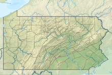
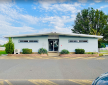
Doylestown Airport (IATA: DYL, ICAO: KDYL, FAA LID: DYL) is a public airport in Bucks County, Pennsylvania, owned by the Bucks County Airport Authority (BCAA). It is two nautical miles north of Doylestown, Pennsylvania and has a single fixed-base operator, Leading Edge Aviation, Civil Air Patrol squadron 907, flight training, and aircraft rentals.
History
The airport was founded in May 1942 as a dual use airport and farm. Between 1957 and 1960, the airport was converted from a pig farm that was owned and managed by John Van Sant, a popular aviator in Pennsylvania and founder of the Van Sant Airport. John Van Sant led the development of Vansant airport after the Bucks County Airport Authority purchase of Doylestown Airport in 1962. The airport has been continually managed by the Bucks County Airport Authority (BCAA).
Facilities
Doylestown Airport covers 200 acres (81 ha) at an elevation of 394 feet (120 m) above mean sea level. Its one runway, 5/23, is asphalt 3,002 by 60 feet (916 x 18 m).
As of 27 January 2022, the airport had an average of 72,635 aircraft operations per year, 119 per day: 69% local general aviation, 24% transient general aviation, 7% air taxi and <1% military. 136 aircraft are based at the airport: 122 single-engine, 11 multi-engine, 2 helicopter, and 1 glider.
Expansion proposals
In 2017, commissioners voted unanimously in favor to secure a $660,000 loan to the Bucks County Airport Authority. The airport will be borrowing funs to purchase property adjacent to the airport in Buckingham, containing wooded land and a barn. A chairman stated the county is looking to add a terminal and additional parking in this space.
See also
References
- ^ FAA Airport Form 5010 for DYL PDF, effective 2009-07-02.
- "Pennsylvania Airport History". PennDOT Bureau of Aviation. Archived from the original on 2011-06-07. Retrieved 2007-07-16.
- Dorfman, Marjorie (2005-08-24). "Van Sant Airport: Tribute to Aviation". HappyNews.com. Archived from the original on 2007-09-27. Retrieved 2007-07-16.
External links
- Official website
- Doylestown Airport webcam
- Doylestown Airport (DYL) at PennDOT Bureau of Aviation
- FAA Terminal Procedures for DYL, effective November 28, 2024
- Resources for this airport:
- FAA airport information for DYL
- AirNav airport information for KDYL
- ASN accident history for DYL
- FlightAware airport information and live flight tracker
- NOAA/NWS weather observations: current, past three days
- SkyVector aeronautical chart, Terminal Procedures