| This article is an orphan, as no other articles link to it. Please introduce links to this page from related articles; try the Find link tool for suggestions. (July 2016) |
| Drielaker See | |
|---|---|
 Aerial View of the Drielaker See from the North, May 2013 Aerial View of the Drielaker See from the North, May 2013 | |
 | |
| Coordinates | 53°8′4″N 8°15′8″E / 53.13444°N 8.25222°E / 53.13444; 8.25222 |
| Primary inflows | Drielaker Kanal |
| Primary outflows | Drielaker Kanal |
| Basin countries | Germany |
| Max. length | 0.6 km (0 mi) |
| Max. width | 0.3 km (0 mi) |
| Surface area | 10.4 ha (25.70 acres) |
| Average depth | 17 m (56 ft) |
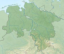
The Drielaker See is a coastal lake in Osternburg subdistrict of Drielake in the municipal area of Oldenburg, Niedersachsen.
Description
The 10.4 ha lake was created during the construction of the Autobahn A 29 in the 1980s. The reason for this evacuation was for the construction of the ramps for the 26 meter high motorway viaduct. Today it is used a recreational area with close proximity to the port an commercial areas.
The Drielaker See is used by the Sport Fishing Club of Oldenburg (Sportfischer-Verein Oldenburg e.V.) for angling. The Hemmelsbäker Canal runs directly from the northeastern side of the lake, which leads into the Hunte about 100 meters further north.
References
- "Drielaker See Bei 26135 Oldenburg." Badeseen in Niedersachsen. Antenne Niedersachsen, n.d. Web. 17 Feb. 2016. <https://web.archive.org/web/20160224061909/http://www.antenne.com/service/badeseen/drielaker-see/>.
External links
- www.anglermap.de: Gewässersteckbrief Drielaker See, Last accessed on November 5, 2014.