| Dong 동구 | |
|---|---|
| Autonomous District | |
| Korean transcription(s) | |
| • Hanja | 東區 |
| • Revised Romanization | Dong-gu |
| • McCune–Reischauer | Tong-ku |
 | |
 Flag Flag | |
 | |
| Country | South Korea |
| Region | Yeongnam |
| Provincial level | Busan |
| Administrative divisions | 17 administrative dong |
| Government | |
| • Mayor | Kim Jin-hong(김진홍) |
| Area | |
| • Total | 9.86 km (3.81 sq mi) |
| Population | |
| • Total | 86,308 |
| • Dialect | Gyeongsang |
| Website | Dong District Office |
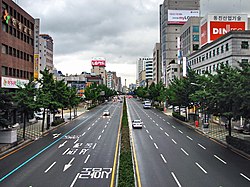
Dong District (Korean: 동구; RR: Dong-gu; lit. east district) is a gu in central Busan, South Korea. It was one of the first 6 gu of Busan established in 1957.
Busan Station is located in Dong-gu.
Dong-gu has a status of sister localities with Gwangsan District, Gwangju and Zhifu District, Yantai City, China.
Administrative divisions

Dong-gu is divided into 4 legal dong, which altogether comprise 17 administrative dong, as follows:
- Choryang-dong (5 administrative dong)
- Sujeong-dong (5 administrative dong)
- Jwacheon-dong (2 administrative dong)
- Beomil-dong (5 administrative dong)
Politics
The area is represented in the National Assembly by the West District and East District Busan (South Korean Legislature Constituency)
Education
| This section needs expansion. You can help by adding to it. (March 2016) |
International schools include:
- Overseas Chinese High School, Busan
- Chinese Korea Busan School (kindergarten and elementary school)
Tourist attractions
The district contains a famous staircase, the 168 stairs, that has souvenir shops and tourist attractions along the way.
See also
References
- "Population statistics". Korea Ministry of the Interior and Safety. 2024.
- "Foreign Schools in Busan." Busan Metropolitan City. Retrieved on January 13, 2019.
- "[Monthly KOREA] Catching the Sunrise in Busan". Korea.net. 2020-11-13. Retrieved 2024-08-09.
- 이, 우영 (2024-03-14). 초량 산복도로 경사지 '야외 영화관' 생긴다. Busan Ilbo (in Korean). Retrieved 2024-08-09.
External links
- Dong-gu website (in English)
- Dong-gu: Busan Metropolitan Government (in English)
| Districts of Busan | |
|---|---|
| Districts | |
| County | |
35°07′46″N 129°02′44″E / 35.1294°N 129.0455°E / 35.1294; 129.0455
This South Korea location article is a stub. You can help Misplaced Pages by expanding it. |