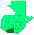
| El Rodeo | |
|---|---|
| Settlement in Escuintla, Guatemala | |
 | |
| Coordinates: 14°23′26″N 90°49′53″W / 14.39056°N 90.83139°W / 14.39056; -90.83139 | |
| Country | |
| Department | Escuintla |
| Municipality | Escuintla |
| Population | |
| • Total | 14,125 |
El Rodeo is a town in the Escuintla Department of Guatemala, about 35 kilometers southwest of Guatemala City. It is located at an altitude of 2,483 m (8,146 ft) above sea level on the southern slopes of an active volcano called Volcán de Fuego — Spanish for Volcano of Fire.
History
The town, with a population estimated at 14,125 was reported to have been buried by volcanic material following the 2018 Volcán de Fuego eruption on 3 June 2018. The town was in the early process of evacuation when the eruption happened.
Other nearby towns also covered by the superheated pyroclastic flow include San Miguel Los Lotes, and Alotenango. At least 109 people were confirmed dead, and about 192 people are reported missing.
References
- ^ Guatemala 2002 Census Archived 2007-06-30 at the Wayback Machine (.zip file)
- El Rodeo - Departamento de Escuintla - informacion. Pueblos 20. (in Spanish). Accessed 4 June 2014.
- ^ At least 33 dead in Guatemala as volcano erupts, burying an entire village. The Washington Post. Susan Hogan and Avi Selk. June 4, 2018.
- ^ "Guatemala volcano: Dozens die as Fuego volcano erupts". BBC News. 3 June 2018. Retrieved 3 June 2018.
- Aldea El Rodeo, el rostro de la tragedia. Luis Gonzalez, Republica. 4 June 2018. (In Spanish).
- Guatemala volcano death toll rises to 109. Associated Press. Published by Mercury News. 7 June 2018.
- More than 190 missing after Guatemala volcano eruption. CNN News. 6 June 2018.
- "Guatemala volcano: Nearly 200 missing and 75 dead". BBC News. 5 June 2018. Retrieved 5 June 2018.
| Capital: Escuintla | ||
| Municipalities |  | |