| Encampment River | |
|---|---|
 Encampment River in Wyoming Encampment River in Wyoming | |
| Physical characteristics | |
| Source | |
| • coordinates | 40°52′34″N 106°43′02″W / 40.87611°N 106.71722°W / 40.87611; -106.71722 |
| Mouth | |
| • location | Confluence with North Platte |
| • coordinates | 41°18′41″N 106°42′59″W / 41.31139°N 106.71639°W / 41.31139; -106.71639 |
| • elevation | 6,959 ft (2,121 m) |
| Basin features | |
| Progression | North Platte—Platte— Missouri—Mississippi |
| Tributaries | |
| • left | Damfino Creek |
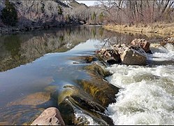
The Encampment River is a 44.7-mile-long (71.9 km) tributary of the North Platte River. The river's source is east of Buck Mountain in the Park Range of Jackson County, Colorado. The river flows north and passes to the east of the town of Encampment, Wyoming, then through the town of Riverside, Wyoming before its confluence with the North Platte.
See also
References
- ^ U.S. Geological Survey Geographic Names Information System: Encampment River
- U.S. Geological Survey. National Hydrography Dataset high-resolution flowline data. The National Map Archived 2012-03-29 at the Wayback Machine, accessed March 21, 2011
This article related to a river in Wyoming is a stub. You can help Misplaced Pages by expanding it. |
This article related to a river in Colorado is a stub. You can help Misplaced Pages by expanding it. |