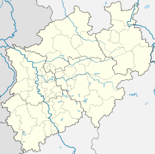
| Essen/Mülheim Airport Flughafen Essen/Mülheim | |||||||||||
|---|---|---|---|---|---|---|---|---|---|---|---|
 | |||||||||||
| Summary | |||||||||||
| Airport type | Public | ||||||||||
| Serves | Mülheim/Essen and the eastern Rhine-Ruhr area, Germany | ||||||||||
| Elevation AMSL | 129 m / 423 ft | ||||||||||
| Coordinates | 51°24′12″N 006°56′24″E / 51.40333°N 6.94000°E / 51.40333; 6.94000 | ||||||||||
| Website | flughafen-essen-muelheim.de | ||||||||||
| Maps | |||||||||||
 | |||||||||||
| Runways | |||||||||||
| |||||||||||
| Source: German AIP at Eurocontrol | |||||||||||
Essen/Mülheim Airport (IATA: ESS, ICAO: EDLE), is a minor unscheduled airport located 6 km (3.7 mi) south-west of Essen and 3 km (1.9 mi) south-east of Mülheim, North Rhine-Westphalia. It serves the western Rhine-Ruhr metropolitan region, the largest urban agglomeration in Germany.
Airlines and destinations
There are no scheduled flights to or from the airport, it is mainly used for flight training, general aviation and business charters. The nearest passenger airports are Düsseldorf Airport and Dortmund Airport. Essen/Mülheim is home to blimps used for aerial advertising.
See also
References
External links
![]() Media related to Flughafen Essen/Mülheim at Wikimedia Commons
Media related to Flughafen Essen/Mülheim at Wikimedia Commons