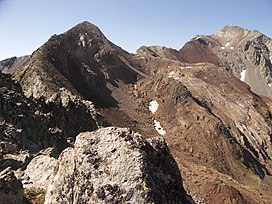
| Estaragne | |
|---|---|
 | |
| Highest point | |
| Elevation | 3,006 m (9,862 ft) |
| Coordinates | 42°47′50″N 0°07′46″E / 42.79722°N 0.12944°E / 42.79722; 0.12944 |
| Geography | |
 | |
| Parent range | Néouvielle massif (Pyrenees) |
The Estaragne (Pic d'Estaragne) is a French Pyrenean summit, culminating at 3,006 m (9,862 ft) m.
Topography
The peak is located in the Hautes-Pyrénées department, in the Néouvielle massif, near Saint-Lary-Soulan in the Pyrenees National Park and near the Néouvielle National Nature Reserve.
History
The etymology of the name "Estaragne" is unclear, although there is a small valley and stream with the same name just to the northeast of the peak.
Ecology
The peak itself is bare, but the upper slopes have a sub-alpine climate. Meadows predominate with patches of trees and shrubs. Snow cover usually starts in late October and lasts until June. the most common shrubs are Rhododendron ferrugineum and Vaccinium myrtillus; and the most common grasses are Nardus stricta and Festuca eskia.
Access
There are at least two relatively easy summer access routes:
- From the east, the shorter route, starts by leaving the sharp turn of the D 929 at the bridge crossing over the Estaragne stream, it then ascends the small hollow and turns southwards up to the col d'Estaragne.
- From the north, starting at the Cap de Long Lake, the longer route advances up valley of the Cap de Long creek.
See also
References
- "Estaragne". Summitpost. Archived from the original on 8 June 2014.
- ^ "Pic d'Estaragne (3006m) et Pic de Campbieil (3173m) dans le massif du Néouvielle". Altituderando. Archived from the original on 9 August 2013.
- Aymard, Robert (1995). Les Pyrénées au miroir de leur toponymie, volume 1 (in French). Uzos, France: Aymard. p. 83. OCLC 36130057.
- Lavandier, Pierre (1974). "Ecologie d'un torrent Pyrénéen de haute montagne I. - Caractéristiques physiques". Annales de Limnologie (in French). 10 (2): 173–219. doi:10.1051/limn/1974012.
- ^ Pornon, André; Escaravage, Nathalie; Lamaze, Thierry (2007). "Complementarity in mineral nitrogen use among dominant plant species in a subalpine community". American Journal of Botany. 94 (11): 1778–1785. doi:10.3732/ajb.94.11.1778. PMID 21636372.
- Lavandier, Pierre (1979). "Cycle biologique, régime alimentaire, production d'Arcynopteryx compacta (Plecoptera, Perlodidae) dans un torrent de haute altitude". Bulletin de la Société d'Histoire Naturelle de Toulouse (in French). 115: 140–150.
External links
- "Aerial view of Turon de Néouvielle". Google Maps.