| Etang de la Gruère | |
|---|---|
 | |
    | |
| Location | Canton of Jura |
| Coordinates | 47°14′20″N 7°2′48″E / 47.23889°N 7.04667°E / 47.23889; 7.04667 |
| Type | artificial lake, bog |
| Basin countries | Switzerland |
| Max. length | 600 m (2,000 ft) |
| Surface area | 0.08 km (0.031 sq mi) |
| Max. depth | 4.5 m (15 ft) |
| Surface elevation | 998 m (3,274 ft) |
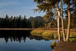
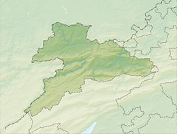
Etang de la Gruère is a small lake in the Jura range near Saignelégier, Canton of Jura, Switzerland. The lake and the surrounding bog is a nature preserve. The lake was formed in the 17th century, when a dam was built for a mill.
See also
References
- Area retrieved from Google Earth (July 2013)
External links
- Gruère Pond short description
 Media related to Etang de la Gruère at Wikimedia Commons
This Canton of Jura location article is a stub. You can help Misplaced Pages by expanding it. |
This article related to a lake in Switzerland is a stub. You can help Misplaced Pages by expanding it. |