| Faistos Φαιστός | |
|---|---|
| Municipality | |
  | |
| Coordinates: 35°03′N 24°52′E / 35.050°N 24.867°E / 35.050; 24.867 | |
| Country | Greece |
| Administrative region | Crete |
| Regional unit | Heraklion |
| Area | |
| • Municipality | 410.8 km (158.6 sq mi) |
| Population | |
| • Municipality | 23,921 |
| • Density | 58/km (150/sq mi) |
| Time zone | UTC+2 (EET) |
| • Summer (DST) | UTC+3 (EEST) |
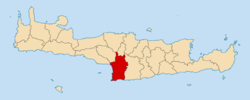
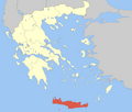
Faistos (Greek: Φαιστός) is a municipality in Heraklion regional unit, Crete, Greece. The seat of the municipality is the village Moires. It is named after the ancient city Phaistos, located in the municipality. The municipality has an area of 410.810 km (158.615 sq mi).
Municipality
The municipality Faistos was formed at the 2011 local government reform by the merger of the following 3 former municipalities, that became municipal units:
Geography
Climate
| Climate data for Faistos, Greece | |||||||||||||
|---|---|---|---|---|---|---|---|---|---|---|---|---|---|
| Month | Jan | Feb | Mar | Apr | May | Jun | Jul | Aug | Sep | Oct | Nov | Dec | Year |
| Mean daily maximum °F (°C) | 59.0 (15.0) |
59.1 (15.1) |
61.7 (16.5) |
68.0 (20.0) |
74.1 (23.4) |
80.8 (27.1) |
83.3 (28.5) |
82.8 (28.2) |
79.5 (26.4) |
74.1 (23.4) |
67.3 (19.6) |
61.9 (16.6) |
71.0 (21.7) |
| Mean daily minimum °F (°C) | 48.4 (9.1) |
48.2 (9.0) |
49.3 (9.6) |
53.8 (12.1) |
59.5 (15.3) |
66.6 (19.2) |
71.4 (21.9) |
71.6 (22.0) |
67.3 (19.6) |
62.1 (16.7) |
56.1 (13.4) |
51.3 (10.7) |
58.8 (14.9) |
| Source: <Yr.no >"Weather forecast for Phaistos". Weather statistics for Phaistos, Crete (Greece). Yr.no. 2016. Retrieved 13 September 2016. | |||||||||||||
References
- "Αποτελέσματα Απογραφής Πληθυσμού - Κατοικιών 2021, Μόνιμος Πληθυσμός κατά οικισμό" [Results of the 2021 Population - Housing Census, Permanent population by settlement] (in Greek). Hellenic Statistical Authority. 29 March 2024.
- ^ "ΦΕΚ A 87/2010, Kallikratis reform law text" (in Greek). Government Gazette.
- "Population & housing census 2001 (incl. area and average elevation)" (PDF) (in Greek). National Statistical Service of Greece. Archived from the original (PDF) on 2015-09-21.
| Administrative division of the Crete Region | ||
|---|---|---|
| Regional unit of Chania |  | |
| Regional unit of Heraklion | ||
| Regional unit of Lasithi | ||
| Regional unit of Rethymno | ||
| ||
| Subdivisions of the municipality of Faistos | |
|---|---|
| Municipal unit of Moires | |
| Municipal unit of Tympaki | |
| Municipal unit of Zaros |
|