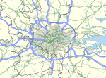
Farnborough/Aldershot built-up area and Aldershot Urban Area are names used by the Office for National Statistics (ONS) to refer to a conurbation spanning the borders of Surrey, Berkshire and Hampshire in England, and covering an area of 81.9 km. The ONS found a population of 266,358 in 2021 (up 4.66% from the 2011 figure of 254,499 residents).
A conurbation consisting of Aldershot and Farnborough, together with Frimley and Camberley was identified as a conurbation since at least the mid 20th century. These four places had a total population of 70,000 in 1931 which grew to 91,700 by 1961.
Most of the conurbation lies alongside the River Blackwater which gives a wider area including Fleet (which is not geographically in the Blackwater Valley) the alternate name of Blackwater Valley.
The area forms part of the London metropolitan area and borders the Metropolitan green belt. It almost adjoins the somewhat lower density Reading/Wokingham Urban Area at Sandhurst.
Subdivisions
It was given these subdivisions in the 2011 census:

| Geography code | Area name | 2011 Population | District | Notes |
|---|---|---|---|---|
| E35000108 | Farnborough | 65,034 | Rushmoor, Borough of Guildford | Subdivision includes Cove and Ash Vale |
| E35000207 | Aldershot | 57,211 | Rushmoor, Borough of Guildford, Borough of Waverley | Subdivision includes Ash, Hale and Tongham |
| E35000239 | Wyke | 276 | Borough of Guildford | |
| E35000279 | Sandhurst | 20,495 | Bracknell Forest | |
| E35000513 | Blackwater | 7,195 | Hart District | |
| E35000638 | Badshot Lea | 1,582 | Borough of Waverley | |
| E35000977 | Deepcut | 2,128 | Surrey Heath | |
| E35001045 | Frimley | 19,094 | Surrey Heath | |
| E35001069 | Yateley | 14,829 | Hart District | |
| E35001198 | Farnham | 25,604 | Borough of Waverley | |
| E35001352 | Camberley | 38,038 | Surrey Heath | Includes the village of Hawley |
| E35001431 | Shortfield Common | 911 | Borough of Waverley |
References
- ^ UK Census (2011), "Local Area Report – Farnborough/AldershotBuilt-up Area (E34004885)", Nomis, Office for National Statistics, retrieved 11 April 2021
- "United Kingdom: Countries and Major Urban Areas - Population Statistics, Maps, Charts, Weather and Web Information".
- Freeman, Thomas (1966), The conurbations of Great Britain, Manchester University Press, p. 278, retrieved 10 April 2021
- "Hart, Rushmoor & Surrey Heath Strategic Housing Market AssessmentNovember 2016" (PDF). Hart District Council. 2016. Retrieved 10 April 2021.
- "British urban pattern: population data" (PDF). ESPON project 1.4.3 Study on Urban Functions. European Spatial Planning Observation Network. March 2007. p. 119. Retrieved 8 March 2019.
- "2011 Census - Usual resident population". ONS. 12 February 2013. Retrieved 25 February 2016.
51°14′N 0°45′W / 51.24°N 0.75°W / 51.24; -0.75
Categories: