| Flußbach | |
|---|---|
| Municipality | |
 Coat of arms Coat of arms | |
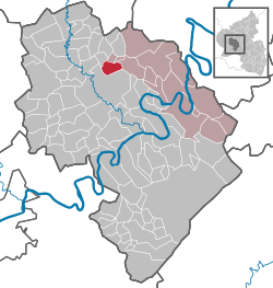
Location of Flußbach within Bernkastel-Wittlich district
 | |
  | |
| Coordinates: 50°01′01″N 6°55′34″E / 50.01693°N 6.92614°E / 50.01693; 6.92614 | |
| Country | Germany |
| State | Rhineland-Palatinate |
| District | Bernkastel-Wittlich |
| Municipal assoc. | Traben-Trarbach |
| Government | |
| • Mayor (2019–24) | Hans-Josef Drees |
| Area | |
| • Total | 6.86 km (2.65 sq mi) |
| Elevation | 225 m (738 ft) |
| Population | |
| • Total | 434 |
| • Density | 63/km (160/sq mi) |
| Time zone | UTC+01:00 (CET) |
| • Summer (DST) | UTC+02:00 (CEST) |
| Postal codes | 54516 |
| Dialling codes | 06571 |
| Vehicle registration | WIL |
| Website | www.flussbach.de |
Flußbach is an Ortsgemeinde – a municipality belonging to a Verbandsgemeinde, a kind of collective municipality – in the Bernkastel-Wittlich district in Rhineland-Palatinate, Germany.
Geography
Flußbach is found in the outermost Southern Eifel, nestled in a side valley in the outlying hills of the Wittlich Depression. The municipal area is covered by 57% woods. The nearest middle centre is Wittlich to the south. Flußbach belongs to the Verbandsgemeinde of Traben-Trarbach.
History
Flußbach was part of the Electorate of Trier. Beginning in 1794, Flußbach lay under French rule. In 1814 it was assigned to the Kingdom of Prussia at the Congress of Vienna. Since 1947, it has been part of the then newly founded state of Rhineland-Palatinate.
Politics
Municipal council
The council is made up of 8 council members, who were elected by proportional representation at the municipal election held on 7 June 2009, and the honorary mayor as chairman.
The municipal election held on 7 June 2009 yielded the following results:
| Year | WG Sausen | Bürgerliste | Total |
|---|---|---|---|
| 2009 | 3 | 5 | 8 seats |
Coat of arms
The municipality's arms might be described thus: Per fess argent a cross gules and azure a bar-gemel couped wavy of the first.
Economy and infrastructure
To the east of the municipal area runs the Autobahn A 1 on which nearest interchange is Hasborn about 3 km away. A railway station is to be found in Wittlich on the Moselstrecke (line along the Moselle). Also worth noting is the village square in the village centre.
References
- Direktwahlen 2019, Landkreis Bernkastel-Wittlich, Landeswahlleiter Rheinland-Pfalz, accessed 8 August 2021.
- "Bevölkerungsstand 2022, Kreise, Gemeinden, Verbandsgemeinden" (PDF) (in German). Statistisches Landesamt Rheinland-Pfalz. 2023.
- Kommunalwahl Rheinland-Pfalz 2009, Gemeinderat
- Flußbach’s arms Archived 2011-07-19 at the Wayback Machine
External links
- Municipality’s official webpage (in German)
This Bernkastel-Wittlich location article is a stub. You can help Misplaced Pages by expanding it. |
