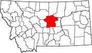
Unincorporated community in Montana, United States
| Forest Grove, Montana | |
|---|---|
| Unincorporated community | |
 | |
| Coordinates: 46°59′29″N 109°04′49″W / 46.99139°N 109.08028°W / 46.99139; -109.08028 | |
| Country | United States |
| State | Montana |
| Counties | Fergus |
| Elevation | 4,078 ft (1,242 m) |
| Time zone | UTC-7 (MST) |
| • Summer (DST) | UTC-6 (MDT) |
| ZIP code | 59441 |
Forest Grove (or Forestgrove) is an unincorporated community in Fergus County, Montana, United States. Forest Grove has a post office with the ZIP code 59441.
The town began in 1885 when sheep and cattle ranchers arrived in the area. The community sits on Forest Grove Road between the unincorporated community of Piper and the town of Grass Range. The road itself starts off at Montana Secondary Highway 238 from the west and terminates at Grass Range to the east where it becomes Grass Range's Main Street. Through the community run two creeks, Surenough Creek and the South Fork McDonald Creek. The post office sits on Surenuff Road, along with the Saint Paul's Episcopal Church and local cemetery.
To the south of the community is Beargulch Pictographs, showcasing around 2,000 pictographs and petroglyphs by Native Americans and early settlers.
Climate
Lewistown 11ESE is a weather station near Forest Grove. Lewistown 11ESE has a humid continental climate (Köppen Dfb), with long, snowy winters and short, warm summers.
| Climate data for Lewistown 11ESE, Montana, 1991–2020 normals, 2008-2020 extremes: 5028ft (1533m) | |||||||||||||
|---|---|---|---|---|---|---|---|---|---|---|---|---|---|
| Month | Jan | Feb | Mar | Apr | May | Jun | Jul | Aug | Sep | Oct | Nov | Dec | Year |
| Record high °F (°C) | 61 (16) |
61 (16) |
72 (22) |
82 (28) |
82 (28) |
91 (33) |
96 (36) |
99 (37) |
96 (36) |
87 (31) |
72 (22) |
59 (15) |
99 (37) |
| Mean maximum °F (°C) | 52.8 (11.6) |
51.9 (11.1) |
59.5 (15.3) |
71.8 (22.1) |
75.9 (24.4) |
84.2 (29.0) |
90.0 (32.2) |
91.8 (33.2) |
87.8 (31.0) |
75.5 (24.2) |
64.2 (17.9) |
51.8 (11.0) |
93.2 (34.0) |
| Mean daily maximum °F (°C) | 32.8 (0.4) |
33.1 (0.6) |
41.0 (5.0) |
49.0 (9.4) |
58.6 (14.8) |
66.8 (19.3) |
77.3 (25.2) |
77.6 (25.3) |
67.2 (19.6) |
52.5 (11.4) |
39.2 (4.0) |
33.6 (0.9) |
52.4 (11.3) |
| Daily mean °F (°C) | 23.8 (−4.6) |
24.1 (−4.4) |
31.3 (−0.4) |
39.1 (3.9) |
48.3 (9.1) |
56.4 (13.6) |
65.5 (18.6) |
65.5 (18.6) |
55.8 (13.2) |
43.4 (6.3) |
31.5 (−0.3) |
25.4 (−3.7) |
42.5 (5.8) |
| Mean daily minimum °F (°C) | 14.8 (−9.6) |
15.0 (−9.4) |
21.6 (−5.8) |
29.3 (−1.5) |
38.0 (3.3) |
46.1 (7.8) |
53.7 (12.1) |
53.4 (11.9) |
44.3 (6.8) |
34.4 (1.3) |
23.8 (−4.6) |
17.2 (−8.2) |
32.6 (0.3) |
| Mean minimum °F (°C) | −10.8 (−23.8) |
−7.5 (−21.9) |
−1.5 (−18.6) |
13.8 (−10.1) |
25.3 (−3.7) |
34.6 (1.4) |
43.3 (6.3) |
41.2 (5.1) |
30.3 (−0.9) |
19.4 (−7.0) |
1.5 (−16.9) |
−9.2 (−22.9) |
−20.0 (−28.9) |
| Record low °F (°C) | −23 (−31) |
−24 (−31) |
−26 (−32) |
−1 (−18) |
17 (−8) |
26 (−3) |
39 (4) |
34 (1) |
21 (−6) |
2 (−17) |
−19 (−28) |
−30 (−34) |
−30 (−34) |
| Average precipitation inches (mm) | 0.76 (19) |
0.88 (22) |
1.19 (30) |
2.07 (53) |
3.78 (96) |
3.55 (90) |
1.87 (47) |
1.75 (44) |
1.68 (43) |
1.54 (39) |
1.03 (26) |
0.85 (22) |
20.95 (531) |
| Average snowfall inches (cm) | 19.6 (50) |
22.0 (56) |
17.1 (43) |
22.5 (57) |
6.5 (17) |
0.2 (0.51) |
0.0 (0.0) |
0.0 (0.0) |
2.3 (5.8) |
11.1 (28) |
16.5 (42) |
17.0 (43) |
134.8 (342.31) |
| Source 1: NOAA | |||||||||||||
| Source 2: XMACIS2 (temp records, monthly max/mins & 2008-2020 snowfall) | |||||||||||||
References
- United States Postal Service Zip Code Lookup Tool
- "Forestgrove". Montana Place Names Companion. Montana Historical Society. Retrieved April 2, 2021.
- "Community cornerstone: Forest Grove Church still stands thanks to loc…". Archived from the original on April 12, 2020.
- "Beargulch Pictographs". Montana Office of Tourism. Retrieved April 3, 2021.
- "Data of Meteorological Station Lewistown 11Ese, Montana". geographic.org. Retrieved January 13, 2024.
- "Lewistown 11ESE, Montana 1991-2020 Monthly Normals". Retrieved January 13, 2024.
- "xmACIS". National Oceanic and Atmospheric Administration. Retrieved January 13, 2024.
External links
- U.S. Geological Survey Geographic Names Information System: Forestgrove, Montana
- Forest Grove – VisitMontana
- Hope for Forest Grove - Billings Gazette (YouTube)
| Municipalities and communities of Fergus County, Montana, United States | ||
|---|---|---|
| County seat: Lewistown | ||
| City |  | |
| Towns | ||
| CDPs | ||
| Other communities | ||
| Ghost town | ||
| Indian reservation | ||
| Footnotes | ‡This populated place also has portions in an adjacent county or counties | |
This Fergus County, Montana state location article is a stub. You can help Misplaced Pages by expanding it. |