| Forest Hill | |
|---|---|
| Neighborhood of San Francisco | |
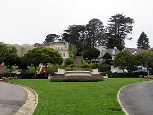
 Entrance to Forest Hill from Dewey Boulevard Entrance to Forest Hill from Dewey Boulevard | |
 | |
| Coordinates: 37°44′53″N 122°27′47″W / 37.748°N 122.463°W / 37.748; -122.463 | |
| Government | |
| • Supervisor | Myrna Melgar |
| • Assemblymember | Catherine Stefani (D) |
| • State Senator | Scott Wiener (D) |
| • U.S. House | Nancy Pelosi (D) |
| Area | |
| • Total | 0.93 km (0.359 sq mi) |
| • Land | 0.93 km (0.359 sq mi) |
| Population | |
| • Total | 2,800 |
| • Density | 3,345/km (8,663/sq mi) |
| ZIP Code | 94116 |
| Area code | Area code 415 |
| Website | https://foresthill-association.com/ |
Forest Hill is a neighborhood in San Francisco, California. Forest Hill is one of eight master-planned residence parks in San Francisco. Forest Hill is located near the middle of the City of San Francisco, southeast of the Inner Sunset and northeast of West Portal. Boundaries are roughly Seventh Avenue/Laguna Honda Boulevard to the north and east, Taraval Street to the south, and 14th Avenue to the west.
The area south of Dewey Boulevard is known as Laguna Honda or the Forest Hill Extension. The name Laguna Honda means "deep lagoon" in Spanish and presumably refers to the Laguna Honda Reservoir at the intersection of Laguna Honda Boulevard and Clarendon Avenue.
History
The property for Forest Hill was purchased by a private firm, the Newell-Murdoch Company, from the heirs of Adolph Sutro. Development of the neighborhood began in 1912. Like other "residence parks" in San Francisco, Forest Hill was intended as a racially exclusive, white-only enclave for economic elites. Advertisements emphasized the deed restrictions that disallowed apartment buildings and other multi-family homes and ownership by racial minorities. Deed restrictions were in place in Forest Hills until at least the 1930s, and the residence parks remained racially homogenous for much of the 20th century.
There are restrictions that safeguard the person of taste and refinement who seeks exclusiveness. There are no Mongols, Africans or "shack builders" allowed in Forest Hill. When a man selects a homesite in this tract it is done with the positive assurance that there will be nothing disagreeable to mar the serenity of the most fastidious.
— 1913 newspaper advertisement
The streets in Forest Hill were originally built for horse and carriage, making them unusually wide. These streets in Forest Hill did not conform to San Francisco's standards regarding width and grade, and therefore were not initially approved nor maintained by the City until 1978. Landscape architect Mark Daniels developed the master plan for Forest Hill. Several homes and the neighborhood clubhouse were designed by California Arts and Crafts Movement architect Bernard Maybeck. Harold G. Stoner also contributed to the architecture of the area, designing several houses as part of projects for Lang Realty.
See also
References
- ^ "Statewide Database". UC Regents. Archived from the original on February 1, 2015. Retrieved December 29, 2014.
- "California's 11th Congressional District - Representatives & District Map". Civic Impulse, LLC.
- ^ "Forest Hill neighborhood in San Francisco, California (CA), 94116". City-Data.com.
- "Researching Residence Parks". SF West History. 10 (4). Oct–Dec 2014.
- Kamiya, Gary. "A Walking Tour of San Francisco's Hidden Waters". San Francisco Magazine. Modern Luxury. Retrieved 2014-03-28.
- ^ Brandi, Richard; Bradley, Denise (October 2016). Gardens in the City: San Francisco Residence Parks, 1906–1940 (PDF). Western Neighborhoods Project.
-
- "Along The Color Line". The Crisis. August 1913. p. 169.
- "Sales in Forest Hill Now Aggregate $600,000". San Francisco Chronicle. October 19, 1912. p. 9 – via Newspapers.com.
- Newell-Murdoch Company (October 10, 1912). "–are you living or just rooming? [advertisement]". San Francisco Call and Post. p. 12 – via Newspapers.com.
- Newell-Murdoch Company (April 26, 1913). "When is a Man's Property Worth More than his Good Name? The Answer – When He Seeks to Borrow Money [advertisement]". San Francisco Chronicle. p. 5 – via Newspapers.com.
- "Area A7". Home Owners' Loan Corporation. 1937 – via Mapping Inequality: Redlining in New Deal America.
- Newell-Murdoch Company (March 13, 1913). "The most talked of residence park in California [advertisement]". San Francisco Chronicle. p. 3.
- "Forest Hill". OutsideLands.org. Western Neighborhoods Project. Retrieved 19 March 2022.
- "Mark Daniels: Landscape Architect of Forest Hill, Sea Cliff and More". Western Neighborhoods Project, Outsidelands.org, April 2, 2003.
- McCoy, Esther (1960). Five California Architects. New York: Reinhold Publishing Corporation. p. 6. ASIN B000I3Z52W.
- "Mt. Davidson » Harold G. Stoner". Mt. Davidson. Retrieved 2021-04-12.
- "Streetwise: Forest Hill". OutsideLands.org. Western Neighborhoods Project. Retrieved 2021-04-12.
External links
![]() Media related to Forest Hill, San Francisco at Wikimedia Commons
Media related to Forest Hill, San Francisco at Wikimedia Commons
| Neighborhoods in San Francisco | ||
|---|---|---|
| Downtown |  | |
| North of Downtown | ||
| Outside Lands | ||
| Western Addition | ||
| Southern | ||
| See also | ||