(Redirected from Forumad Rural District )
Rural district in Semnan province, Iran
For the village, see Farumad .
Rural District in Semnan, Iran
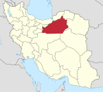
Farumad Rural District (Persian : دهستان فرومد) is in the Central District of Meyami County , Semnan province, Iran . Its capital is the village of Farumad .
Demographics
Population
At the time of the 2006 National Census, the rural district's population (as a part of the former Meyami District of Shahrud County ) was 3,472 in 1,037 households. There were 2,575 inhabitants in 891 households at the following census of 2011. The 2016 census measured the population of the rural district as 2,614 in 934 households, by which time the district had been separated from the county in the establishment of Meyami County. The rural district was transferred to the new Central District. The most populous of its 49 villages was Farumad , with 1,529 people.
See also
Iran portal
References
OpenStreetMap contributors (24 April 2023). "Farumad Rural District (Meyami County)" (Map). OpenStreetMap
^ "Census of the Islamic Republic of Iran, 1395 (2016)" . AMAR (in Persian). The Statistical Center of Iran. p. 20. Archived from the original (Excel) on 17 November 2020. Retrieved 19 December 2022.
^ Rahimi, Mohammadreza (2 June 2013). "Letter of approval regarding country divisions in Semnan province" . Islamic Parliament Research Council (in Persian). Ministry of Interior, Board of Ministers. Archived from the original on 25 September 2011. Retrieved 22 November 2023.
Mousavi, Mirhossein (25 August 1391). "Creation and establishment of 11 rural districts including villages, farms and places in Shahrud County under Semnan province" . Islamic Parliament Research Center (in Persian). Ministry of Interior, Board of Ministers. Archived from the original on 15 November 2012. Retrieved 20 December 2023.
"Census of the Islamic Republic of Iran, 1385 (2006)" . AMAR (in Persian). The Statistical Center of Iran. p. 20. Archived from the original (Excel) on 20 September 2011. Retrieved 25 September 2022."Census of the Islamic Republic of Iran, 1390 (2011)" . Syracuse University (in Persian). The Statistical Center of Iran. p. 20. Archived from the original (Excel) on 20 January 2023. Retrieved 19 December 2022.
Semnan province , IranCapital
Counties and cities Sights
Hecatompylos Bayazid Shrine Complex
Shahmirzad Hasan Juri's burial place,ShahroodGrand Bazar of Semnan
Chehel-Dokhtar tower,Damghan
mehmandost tower , Damghan
Gate of Semnan citadel
Darband cave , Mehdishahr
Shirband cave , Damghan
Siahkuh palaces , Garmsar
Kohan Dej castle , Semnan
Gerdkuh castle , DamghanSepahsalar caravansary , Damghan
Semnan museum
Shahrood museum
Tarikhaneh Temple populated places
Categories :
Text is available under the Creative Commons Attribution-ShareAlike License. Additional terms may apply.
**DISCLAIMER** We are not affiliated with Wikipedia, and Cloudflare.
The information presented on this site is for general informational purposes only and does not constitute medical advice.
You should always have a personal consultation with a healthcare professional before making changes to your diet, medication, or exercise routine.
AI helps with the correspondence in our chat.
We participate in an affiliate program. If you buy something through a link, we may earn a commission 💕
↑

