Unincorporated community and Census-designated place in Indiana, United States
| Foster, Indiana | |
|---|---|
| Unincorporated community and Census-designated place | |
   | |
| Coordinates: 40°08′30″N 87°28′07″W / 40.14167°N 87.46861°W / 40.14167; -87.46861 | |
| Country | United States |
| State | Indiana |
| County | Warren |
| Township | Mound |
| Founded | 1893 |
| Named for | William R. Foster |
| Area | |
| • Total | 1.29 sq mi (3.33 km) |
| • Land | 1.29 sq mi (3.33 km) |
| • Water | 0.00 sq mi (0.00 km) |
| Elevation | 630 ft (190 m) |
| Population | |
| • Total | 104 |
| • Density | 80.87/sq mi (31.24/km) |
| Time zone | UTC-5 (Eastern (EST)) |
| • Summer (DST) | UTC-4 (EDT) |
| ZIP code | 47993 |
| Area code | 765 |
| GNIS feature ID | 2806489 |
Foster is a small unincorporated community in Mound Township, Warren County, in the U.S. state of Indiana.
History
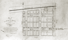
Foster was platted April 25, 1893 on land donated by William R. Foster, an early settler. At one time the town had a post office, blacksmith shop, railroad depot, two stores, a stockyard, a threshing machine, a grain elevator and a sawmill. Currently it consists of a few private residences, a couple of small shops and a motel.
A post office was established at Foster in 1883, and remained in operation until it was discontinued in 1905.
Geography

Foster is located just north of U.S. Route 136 about 5 miles (8.0 km) west of Covington and about 3 miles (4.8 km) east of the Indiana-Illinois border. The Vermilion Valley Railroad (originally the New York Central Railroad) passes through Fowler, and the north fork of Spring Creek flows along its western edge.
Demographics
| Census | Pop. | Note | %± |
|---|---|---|---|
| 2020 | 104 | — | |
| U.S. Decennial Census | |||
References
- "2020 U.S. Gazetteer Files". United States Census Bureau. Retrieved March 16, 2022.
- ^ U.S. Geological Survey Geographic Names Information System: Foster, Indiana
- Baker, Ronald L.; Carmony, Marvin (1975). Indiana Place Names. Bloomington, Indiana: Indiana University Press. p. 54.
- A History of Warren County, Indiana (175th Anniversary Edition). Warren County Historical Society. 2002. p. 71.
- "Warren County". Jim Forte Postal History. Archived from the original on April 9, 2005. Retrieved July 10, 2016.
- "USGS detail on Foster". Retrieved September 28, 2007.
- "Census of Population and Housing". Census.gov. Retrieved June 4, 2016.
| Municipalities and communities of Warren County, Indiana, United States | ||
|---|---|---|
| County seat: Williamsport | ||
| Towns | ||
| Townships | ||
| CDPs | ||
| Other communities | ||
| Ghost towns | ||
| Footnotes | ‡This populated place also has portions in an adjacent county or counties | |
This Warren County, Indiana location article is a stub. You can help Misplaced Pages by expanding it. |
