| This article does not cite any sources. Please help improve this article by adding citations to reliable sources. Unsourced material may be challenged and removed. Find sources: "Fotscherbach" – news · newspapers · books · scholar · JSTOR (October 2020) (Learn how and when to remove this message) |
| Fotscherbach | |
|---|---|
 Fotscherbach Fotscherbach | |
| Location | |
| Country | Austria |
| State | Tyrol |
| Physical characteristics | |
| Source | |
| • location | Stubai Alps |
| Mouth | |
| • location | Melach |
| • coordinates | 47°12′51″N 11°12′51″E / 47.2142°N 11.2142°E / 47.2142; 11.2142 |
| Length | ~ 12.30 km (7.64 mi) |
| Basin features | |
| Progression | Melach→ Inn→ Danube→ Black Sea |
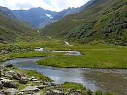
The Fotscherbach is a river of Tyrol, Austria.
The Fotscherbach has a length of 12.30 km (7.64 mi). It originates in the Stubai Alps on a height of 2200 m (AA) (7,200 ft). It flows in northern direction to the village of Sellrain where it dischanges from the right into the Melach. The water has A/B grade quality.
This Tyrol location article is a stub. You can help Misplaced Pages by expanding it. |
This article related to a river in Austria is a stub. You can help Misplaced Pages by expanding it. |