| Juan Manuel Valdez Airport Güiria Airport | |||||||||||
|---|---|---|---|---|---|---|---|---|---|---|---|
| Summary | |||||||||||
| Airport type | Public | ||||||||||
| Operator | Government | ||||||||||
| Serves | Güiria, Venezuela | ||||||||||
| Elevation AMSL | 42 ft / 13 m | ||||||||||
| Coordinates | 10°34′25″N 62°18′45″W / 10.57361°N 62.31250°W / 10.57361; -62.31250 | ||||||||||
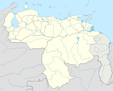
| Map | |||||||||||
 | |||||||||||
| Runways | |||||||||||
| |||||||||||
| Source: WAD GCM Google Maps | |||||||||||
The Juan Manuel Valdez Airport or Güiria Airport (Spanish: Aeropuerto Juan Manuel Valdez), formerly known as Cristóbal Colón Airport, (IATA: GUI, ICAO: SVGI) is an airport serving Güiria, in the state of Sucre in Venezuela.
The Guiria non-directional beacon (Ident: GUI) is located on the field.
See also
References
- Airport information for SVGI from DAFIF (effective October 2006)
- Airport information for GUI at Great Circle Mapper.
- Google Maps - Güiria
- GUI NDB
External links
Portals:| Airports in Venezuela | |
|---|---|
| Major international | |
| Minor international | |
| Domestic | |
| Unscheduled |
|
This Venezuela-related article is a stub. You can help Misplaced Pages by expanding it. |
This article about an airport in Venezuela is a stub. You can help Misplaced Pages by expanding it. |