| Fashion District | |
|---|---|
| District of Downtown Los Angeles | |
| LA Fashion District | |
 | |
| Coordinates: 34°02′14″N 118°15′23″W / 34.037168°N 118.256404°W / 34.037168; -118.256404 | |
| Country | |
| State | |
| County | County of Los Angeles |
| City | |
| Area code | 213 |
| Website | https://fashiondistrict.org |


The Los Angeles Fashion District, previously known as the Garment District, is a business improvement district (BID) in, and often cited as a sub-neighborhood of, Downtown Los Angeles. The neighborhood caters to wholesale selling and has more than 4,000 overwhelmingly independently owned and operated retail and wholesale businesses selling apparel, footwear, accessories, and fabrics.
Status and boundaries
The Fashion District has no official, government-recognized status.
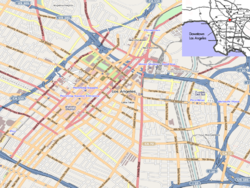
It is recognized as a subdistrict of Downtown by the Downtown Los Angeles Neighborhood Council (DLANC), which states its boundaries as:
- to the west, Main Street
- to the south, Washington Blvd. (west of Alameda Street) and 26th St. (east of Alameda St.)
- to the east, the Los Angeles River (DLANC definition) or by the Fashion District's definition, Paloma Street, three blocks east of San Pedro Street.
- to the north, generally 7th St. and Skid Row and the Arts District
In earlier documents, the DLANC defined the eastern parts of what it now terms the Fashion District as the Warehouse District, Produce District, and Southern Industrial District.
History
The identification of a "garment district" is relatively new in Los Angeles' history as a large city. In 1972 the Los Angeles Times defined the L.A. Garment District as being along Los Angeles Street from 3rd to 11th Street, an area that today straddles the border of Skid Row and the very northwest end of the current Fashion District. At the time, the newspaper stated that 2,000 garment manufacturers were located in that area, which was "virtually unknown to most Los Angeles residents".
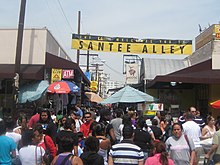
By 1982 the district was a roughly 20 block area from Maple to Main and 7th to 12th streets and had become a popular place for Angelenos to seek fashions at cheaper prices. There were about 500 retail outlets, and key destinations for shoppers included the Cooper Building, the Fashion Center Building and "The Alley", now known as Santee Alley.
Workers are mostly Latin American and Asian immigrants.
BID organization
The LA Fashion District BID states that it "has pioneered a collaborative effort among area stakeholders that continues to foster a clean, safe, and vibrant environment for everyone who experiences the district. We are promoting increased business activity, enhancing property values, and attracting further investment in the area.". It is 1 of 9 BIDs in Downtown LA and 1 of over 40 BIDs in the City of Los Angeles. A binding assessment levied on property owners funds BID activities, and a 15-member Board of Directors elected by district property owners oversees the organization.
Points of interest
- Santee Alley, 210 E. Olympic Boulevard
- FIDM, 919 S. Grand Avenue
References
- Gardetta, Dave (July 7, 2008). "Downtown 2.0: Santee Alley". LAmag - Culture, Food, Fashion, News & Los Angeles.
- "Boundary Map – Downtown LA Neighborhood Council".
- "The LA Fashion District covers 107-blocks in downtown Los Angeles". Fashiondistrict.org. Archived from the original on 2020-03-20. Retrieved 2020-03-10.
- "Los Angeles Fashion District Map Legend" (PDF). Fashiondistrict.org.
- ""Vision Downtown", Downtown Los Angeles Neighborhood Council, sources dated 2012-3" (PDF). Archived (PDF) from the original on 2020-09-22. Retrieved 2020-08-27.
- Boyarsky, Nancy and Bill (February 6, 1972). "The Raveled Street of Wear". Los Angeles Times. p. 394 ("West" supplement, p. 4).
- Yoshihara, Nancy (March 7, 1982). "Garment District Goes Boom". Los Angeles Times.
- Bonacich, Edna (Apr 26, 1990). "Asian and Latino Immigrants in the Los Angeles Garment Industry: An Exploration of the Relationship Between Capitalism and Racial Oppression". Institute for Social Science Research. Archived from the original on August 18, 2022. Retrieved August 27, 2020 – via escholarship.org.
- Bonacich, Edna (1998). "Latino immigrant workers in the Los Angeles apparel industry". New Political Science. 20 (4): 459–473. doi:10.1080/07393149808429841.
External links
- LA Fashion District Walking Map & Guide
- LA Fashion District site
- LA Flower District
- Santee Alley Website
| Streets in Los Angeles County | |||||||||||||||||
|---|---|---|---|---|---|---|---|---|---|---|---|---|---|---|---|---|---|
| City of Los Angeles (including enclaves and semi-enclaves) |
| ||||||||||||||||
| Other valleys |
| ||||||||||||||||
| South Bay / Gateway Cities |
| ||||||||||||||||
| Canyon and mountain roads |
| ||||||||||||||||
| Alleyways | |||||||||||||||||
| Intersections and traffic circles | |||||||||||||||||
| Historic roads | |||||||||||||||||
| In popular culture |
| ||||||||||||||||
| All un-suffixed roads are streets unless otherwise noted. | |||||||||||||||||
34°02′14″N 118°15′23″W / 34.037168°N 118.256404°W / 34.037168; -118.256404
Categories: