| Giang Thành district Huyện Giang Thành | |
|---|---|
| District | |
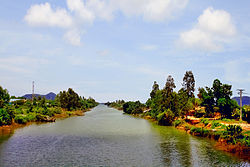
 View of Thoại Hà Canal View of Thoại Hà Canal | |
| Country | |
| Region | Mekong Delta |
| Province | Kiên Giang |
| Capital | None |
| Area | |
| • Total | 157.315 sq mi (407.443 km) |
| Population | |
| • Total | 34,860 |
| Time zone | UTC+7 (Indochina Time) |
Giang Thành is a rural district of the Mekong Delta region of Vietnam. It was established in 2009 from 5 communes in northern Kiên Lương district. As of 2009 the district had a population of 28,910. The district covers an area of 407.443 km. The capital of the district is under construction.
Communes
The district is divided into 5 communes:
- Phú Lợi
- Phú Mỹ
- Tân Khánh Hòa (considered as the district seat)
- Vĩnh Điều
- Vĩnh Phú
