| Glasau | |
|---|---|
| Municipality | |
 Coat of arms Coat of arms | |
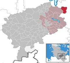
Location of Glasau within Segeberg district
 | |
  | |
| Coordinates: 54°03′N 10°31′E / 54.050°N 10.517°E / 54.050; 10.517 | |
| Country | Germany |
| State | Schleswig-Holstein |
| District | Segeberg |
| Municipal assoc. | Trave-Land |
| Government | |
| • Mayor | Henning Frahm |
| Area | |
| • Total | 18.82 km (7.27 sq mi) |
| Elevation | 42 m (138 ft) |
| Population | |
| • Total | 879 |
| • Density | 47/km (120/sq mi) |
| Time zone | UTC+01:00 (CET) |
| • Summer (DST) | UTC+02:00 (CEST) |
| Postal codes | 23719 |
| Dialling codes | 04525 |
| Vehicle registration | SE |
| Website | www.amt-trave- land.de |
Glasau is a municipality in the district of Segeberg, in Schleswig-Holstein, Germany. It is named after the estate and the manor house of the same name. Sarau is the largest village in the municipality; about half of the population lives there.
History
From March 29, 1945 until May 5, 1945 a concentration camp was established near Glasau. It was a subcamp to the Neuengamme concentration camp.
See also
Notes
- "Bevölkerung der Gemeinden in Schleswig-Holstein 4. Quartal 2022" (XLS) (in German). Statistisches Amt für Hamburg und Schleswig-Holstein.
- The camp is listed as No. 466 Glasau bei Sarau, Kreis Segeberg, in the official German list Archived April 23, 2009, at the Wayback Machine (in German)
This Segeberg location article is a stub. You can help Misplaced Pages by expanding it. |