| Golasowice | |
|---|---|
| Village | |
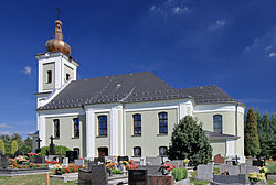
 Lutheran church Lutheran church | |
 Coat of arms Coat of arms | |
 | |
 | |
| Coordinates: 49°55′28″N 18°41′36″E / 49.92444°N 18.69333°E / 49.92444; 18.69333 | |
| Country | |
| Voivodeship | Silesian |
| County | Pszczyna |
| Gmina | Pawłowice |
| First mentioned | 1293 |
| Area | 8.06 km (3.11 sq mi) |
| Population | 1,210 |
| • Density | 150/km (390/sq mi) |
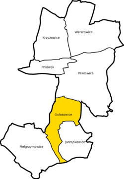
Golasowice is a village in the administrative district of Gmina Pawłowice, within Pszczyna County, Silesian Voivodeship, in southern Poland. It lies approximately 5 kilometres (3 mi) south-west of Pawłowice, 20 km (12 mi) west of Pszczyna, and 43 km (27 mi) south-west of the regional capital Katowice.
History
The village was first mentioned in a document issued by Przemysław of Racibórz on October 25, 1293, allowing Wojan from Pawłowice to (re)colonize 50 Franconian lans on German law between Bzie and Golasowice. Later it was also mentioned in a Latin document of Diocese of Wrocław called Liber fundationis episcopatus Vratislaviensis from around 1305. After Silesian Wars the area became a part of the Kingdom of Prussia. In 1765 a Lutheran parish was established here, served by a church that survived to modern times.
In the Upper Silesia plebiscite 385 out of 501 voted in favour of remaining in Germany, 114 for joining Poland. Nonetheless, the village became a part of Poland. In the interwar period it was one of only four municipalities in the Upper Silesian (thus excluding Cieszyn Silesia) part of autonomous Silesian Voivodeship which had Protestant majority (75,3% in 1933).
References
- "Central Statistical Office (GUS) - TERYT (National Register of Territorial Land Apportionment Journal)" (in Polish). 2008-06-01.
- Maroń, Franciszek (1969). "Rozwój sieci parafialnej w diecezji katowickiej aż do końca XV wieku" [The development of a net of parish in Diocese of Katowice until the end of the 15th century]. Śląskie Studia Historyczno-Teologiczne (in Polish): 125. Archived from the original on 2019-02-28. Retrieved 2015-05-22.
- Schulte, Wilhelm (1889). Codex Diplomaticus Silesiae T.14 Liber Fundationis Episcopatus Vratislaviensis (in German). Breslau.
{{cite book}}: CS1 maint: location missing publisher (link) - "Liber fundationis episcopatus Vratislaviensis" (in Latin). Retrieved 13 July 2014.
- Kreis Pless Archived 2015-05-02 at the Wayback Machine
- Czembor, Henryk (1993). Ewangelicki Kościół Unijny na polskim Górnym Śląsku (in Polish). Katowice: Dom Wydawniczy i Księgarski "Didache". p. 45.
| Gmina Pawłowice | ||
|---|---|---|
| Seat |  | |
| Other villages | ||
This Pszczyna County location article is a stub. You can help Misplaced Pages by expanding it. |