| Site of Special Scientific Interest | |
 View over Goss Moor View over Goss Moor | |
  | |
| Coordinates | 50°24′17″N 4°53′04″W / 50.4047°N 4.8845°W / 50.4047; -4.8845 |
|---|---|
| Interest | Biological |
| Area | 701.9 hectares (7.019 km; 2.710 sq mi) |
| Notification | 1988 (1988) |

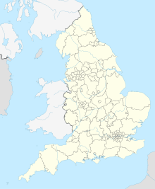
Goss Moor is a national nature reserve in Cornwall, England, 12 kilometres (7.5 mi) south-west of Bodmin in the parishes of St Dennis, St Columb Major, Roche and St Enoder. It is the largest continuous mire complex in south-west Britain and consists of mainly peatland and lowland heath. Together with the neighbouring moor to the east, it forms the Goss And Tregoss Moors Site of Special Scientific Interest (SSSI), as well as the Breney Common and Goss and Tregoss Moors Special Area of Conservation (SAC).
History
Before 1838, Davies Gilbert wrote that the flat country round it (St Dennis) is destroyed in the most efficacious manner, having been turned over and over again down to the solid rock, in what is termed streaming for tin. Between 1908 and 1916 steam powered suction and cutter dredges were used for the mining of alluvial tin on the moor. Drilling took place in 1908 and 1909 but the position of the boreholes and what they contained have been lost. Approximately 70 tons of tin concentrate was extracted and the dredges were later moved to Breney Common, Molinnis and Red Moor. The area was designated as the Goss and Tregoss Moors Site of Special Scientific Interest in 1988.
Matthew Taylor, who had been Member of Parliament for Truro and St Austell from 1987 to 2010, chose the title Baron Taylor of Goss Moor when he was appointed a life peer in the 2010 Dissolution Honours.
Geography
Goss Moor is 12 kilometres (7.5 mi) south-west of Bodmin and is overlooked by Castle an Dinas to the north, and the church of St Dennis in the south. The River Fal rises on the moor at Pentivale and flows 17 kilometres (11 mi) to the English Channel at Carrick Roads. The A30 road once ran through the middle of Goss Moor. This was a major bottleneck for traffic and had been subject to a long running campaign for expansion which was strongly opposed. In late 2004 a decision was finally reached and the dual carriageway running to the north of moor was opened on 25 June 2007. Much of the existing road is now converted to a cycle lane which opened on 11 May 2008. The Atlantic Coast railway line between Par and Newquay also crosses Goss Moor.
Scarce or rare species
It is home to a number of scarce and rare species including:
- plants
- yellow centaury (Cicendia filiformis), marsh clubmoss.
- invertebrates
- small red and variable damselfly.
- butterflies
- silver-studded blue, marsh fritillary, small pearl-bordered fritillary, grizzled skipper
- moths
- narrow-bordered bee hawk and double line.
A 2003 study found twelve different poor fen sub-communities.
References
- ^ "Goss And Tregoss Moors" (PDF). Natural England. 1988. Archived from the original (PDF) on 24 October 2012. Retrieved 27 October 2011.
- "Breney Common and Goss and Tregoss Moors". Joint Nature Conservation Committee. Retrieved 30 October 2011.
- Gilbert, Davies (1838). The Parochial History of Cornwall, Founded on the Manuscript Histories of Mr Hals and Mr Tonkin; with additions and various appendices. London: J B Nichols and Son. p. 309.
- Bristow, Colin M (1995). "Joseph Henry Collins 1841-1916". Proceedings of the Ussher Society: 451-2. Retrieved 6 March 2015.
- "Lord Taylor of Goss Moor". MPs and Lords. UK Parliament. Retrieved 29 September 2021.
- "NCA 152: Cornish Killas Key Facts & Data" (PDF). Natural England. p. 23. Archived from the original (PDF) on 5 June 2014. Retrieved 6 March 2015.
- "A30 Goss Moor Briefing". Cornwall Friends of the Earth. Archived from the original on 25 May 2007. Retrieved 23 May 2007.
- "Moor dualling plans get go-ahead". BBC. 29 November 2004. Retrieved 23 May 2007.
- "New Multi Use Trail at Goss Moor". Natural England. 6 May 2008. Archived from the original on 7 September 2008. Retrieved 25 August 2008.
- Southall, E. J.; Dale, M. P.; Kent, M. (September 2003). "Spatial and temporal analysis of vegetation mosaics for conservation: poor fen communities in a Cornish valley mire". Journal of Biogeography. 30: 1427–1443. doi:10.1046/j.1365-2699.2003.00924.x. ISSN 0305-0270. Retrieved 25 August 2008.