Name
Location
Type
Completed Date designated
Grid ref. Entry number Image
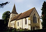
Andrews Endowed C of E Primary School
Holybourne , Alton, East Hampshire School
Modern
13 March 1951
SU7321040820 51°09′43″N 0°57′16″W / 51.161954°N 0.95442°W / 51.161954; -0.95442 (Andrews Endowed C of E Primary School)
1338937 Andrews Endowed C of E Primary School More images
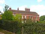
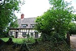
Bonham's Farm House
Holybourne, Alton
House
Late 17th century
31 March 1977
SU7421841758 51°10′13″N 0°56′23″W / 51.170258°N 0.939814°W / 51.170258; -0.939814 (Bonham's Farm House)
1094173 Upload Photo
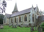
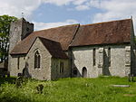
Holy Rood Church
Holybourne, Alton
Church
Norman
13 March 1951
SU7324941244 51°09′57″N 0°57′14″W / 51.165761°N 0.953776°W / 51.165761; -0.953776 (Holy Rood Church)
1179586 Holy Rood Church More images
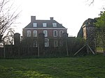
Westbrooke House
Alton House
Circa early 18th century
13 March 1951
SU7161839211 51°08′52″N 0°58′39″W / 51.14769°N 0.977502°W / 51.14769; -0.977502 (Westbrooke House)
1094199 Upload Photo
Wyards Farm House
Beech House
1691
13 March 1951
SU6982638894 51°08′42″N 1°00′11″W / 51.145061°N 1.003179°W / 51.145061; -1.003179 (Wyards Farm House)
1179568 Upload Photo
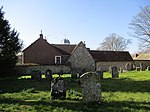
Church of St Mary
Bentley Parish Church
12th century
31 July 1963
SU7840844694 51°11′46″N 0°52′45″W / 51.196095°N 0.879255°W / 51.196095; -0.879255 (Church of St Mary)
1094090 Church of St Mary More images
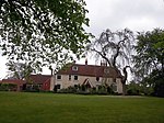
Coldrey
Lower Froyle , BentleyTimber Framed House
Mid 16th century
31 July 1963
SU7710743697 51°11′14″N 0°53′53″W / 51.187308°N 0.898084°W / 51.187308; -0.898084 (Coldrey)
1302259 Coldrey More images
Marelands
Bentley
House
16th century
31 July 1963
SU7936243863 51°11′19″N 0°51′57″W / 51.188492°N 0.865788°W / 51.188492; -0.865788 (Marelands)
1094060 Marelands More images
Former chapel immediately west of Hall Farmhouse
Bentworth Boiler House
1985
31 May 1985
SU6630839977 51°09′19″N 1°03′12″W / 51.155215°N 1.053264°W / 51.155215; -1.053264 (Former chapel immediately west of Hall Farmhouse)
1094156 Former chapel immediately west of Hall Farmhouse
Church of St Mary
Bentworth
Parish Church
Late 12th century
31 July 1963
SU6654040289 51°09′29″N 1°03′00″W / 51.157994°N 1.049889°W / 51.157994; -1.049889 (Church of St Mary)
1094149 Church of St Mary More images
Hall Farmhouse
Bentworth
Farmhouse
17th century
31 July 1963
SU6632839982 51°09′19″N 1°03′11″W / 51.155258°N 1.052977°W / 51.155258; -1.052977 (Hall Farmhouse)
1338928 Hall Farmhouse More images
Barn 30m north of West Court
Binsted Barn
15th century
15 August 1985
SU7658141140 51°09′52″N 0°54′22″W / 51.164391°N 0.906153°W / 51.164391; -0.906153 (Barn 30m north of West Court)
1338987 Upload Photo
Bramshott Manor
Bramshott , Bramshott and LiphookHouse
c. 1300
16 March 1954
SU8422632851 51°05′20″N 0°47′56″W / 51.088799°N 0.798777°W / 51.088799; -0.798777 (Bramshott Manor)
1094484 Bramshott Manor
Bramshott Vale
Bramshott, Bramshott and Liphook
House
Early 18th century
16 March 1954
SU8371132899 51°05′22″N 0°48′22″W / 51.089306°N 0.806117°W / 51.089306; -0.806117 (Bramshott Vale)
1094496 Bramshott Vale More images
Church of St Mary
Bramshott, Bramshott and Liphook
Parish Church
c. 1220
16 March 1954
SU8426632896 51°05′21″N 0°47′54″W / 51.089198°N 0.798195°W / 51.089198; -0.798195 (Church of St Mary)
1094480 Church of St Mary More images
Passfield House
Passfield, Bramshott and Liphook
House
16th century
16 March 1954
SU8244034507 51°06′14″N 0°49′26″W / 51.103946°N 0.823894°W / 51.103946; -0.823894 (Passfield House)
1351147 Upload Photo
Tudor Gatehouse at Bramshott Place (King George's Hospital)
Bramshott and Liphook Gatehouse
Early 16th century
23 January 1986
SU8450832219 51°04′59″N 0°47′42″W / 51.083076°N 0.794899°W / 51.083076; -0.794899 (Tudor Gatehouse at Bramshott Place (King George's Hospital))
1236791 Tudor Gatehouse at Bramshott Place (King George's Hospital) More images
Barn at Old Ditcham Farm
Buriton Barn
17th century
16 March 1954
SU7603620324 50°58′38″N 0°55′06″W / 50.977317°N 0.918317°W / 50.977317; -0.918317 (Barn at Old Ditcham Farm)
1094618 Upload Photo
Church of St Mary
Buriton
Parish Church
12th century
16 March 1954
SU7401520016 50°58′29″N 0°56′50″W / 50.97481°N 0.947161°W / 50.97481; -0.947161 (Church of St Mary)
1302500 Church of St Mary More images
The Manor House
Buriton
Country House
16th century
16 March 1954
SU7403620082 50°58′31″N 0°56′49″W / 50.975401°N 0.946849°W / 50.975401; -0.946849 (The Manor House)
1094597 The Manor House More images
The Old Rectory
Buriton
House
1986
16 March 1954
SU7388820049 50°58′30″N 0°56′56″W / 50.975123°N 0.948963°W / 50.975123; -0.948963 (The Old Rectory)
1094622 Upload Photo
Chawton House
Chawton Country House
c. 1580
31 July 1963
SU7087937026 51°07′41″N 0°59′19″W / 51.128137°N 0.988495°W / 51.128137; -0.988495 (Chawton House)
1093975 Chawton House More images
Church of St Nicholas
Chawton
Parish Church
Medieval
31 July 1963
SU7079137033 51°07′42″N 0°59′23″W / 51.128211°N 0.989751°W / 51.128211; -0.989751 (Church of St Nicholas)
1093974 Church of St Nicholas More images
The Manor House
Chawton
House
Late C20
31 July 1963
SU7081337079 51°07′43″N 0°59′22″W / 51.128622°N 0.989428°W / 51.128622; -0.989428 (The Manor House)
1093971 The Manor House More images
Church of St Michael
Chalton , Clanfield Parish Church
late 12th century or 13th century
16 March 1954
SU7320015945 50°56′18″N 0°57′35″W / 50.938313°N 0.959585°W / 50.938313; -0.959585 (Church of St Michael)
1302399 Church of St Michael More images
Manor Farmhouse
Chalton, Clanfield
Farmhouse
15th century
12 March 1986
SU7328715978 50°56′19″N 0°57′30″W / 50.938598°N 0.95834°W / 50.938598; -0.95834 (Manor Farmhouse)
1351091 Manor Farmhouse
The Priory
Chalton, Clanfield
House
post 1540
12 March 1986
SU7317515928 50°56′17″N 0°57′36″W / 50.938163°N 0.959944°W / 50.938163; -0.959944 (The Priory)
1178520 The Priory
Church of St Peter Ad Vincula
Colemore , Colemore and Priors Dean Parish Church
11th century
16 March 1954
SU7060030762 51°04′19″N 0°59′37″W / 51.071854°N 0.993704°W / 51.071854; -0.993704 (Church of St Peter Ad Vincula)
1237037 Church of St Peter Ad Vincula More images
Priors Dean Church
Priors Dean , Colemore and Priors DeanChurch
1634
16 March 1954
SU7278329601 51°03′40″N 0°57′46″W / 51.061143°N 0.962785°W / 51.061143; -0.962785 (Priors Dean Church)
1237077 Priors Dean Church More images
Forge Sound
East Meon House
c. 1600
29 January 1982
SU6817522107 50°59′40″N 1°01′48″W / 50.99433°N 1.029937°W / 50.99433; -1.029937 (Forge Sound)
1302212 Upload Photo
Glenthorne and Forecourt Rail
East Meon
House
C20
16 March 1954
SU6807622133 50°59′40″N 1°01′53″W / 50.994576°N 1.031342°W / 50.994576; -1.031342 (Glenthorne and Forecourt Rail)
1094591 Upload Photo
Peak Farmhouse
East Meon
Farmhouse
1728
16 March 1954
SU6664325413 51°01′27″N 1°03′04″W / 51.024234°N 1.051157°W / 51.024234; -1.051157 (Peak Farmhouse)
1302347 Upload Photo
Church of St James
East Tisted Parish Church
Medieval
31 July 1963
SU7013032281 51°05′08″N 1°00′00″W / 51.085568°N 1.000117°W / 51.085568; -1.000117 (Church of St James)
1351138 Church of St James More images
Church of All Saints
Farringdon Parish Church
12th century
31 July 1963
SU7123735443 51°06′50″N 0°59′01″W / 51.113861°N 0.983692°W / 51.113861; -0.983692 (Church of All Saints)
1179147 Church of All Saints More images
Cruck Cottage
Farringdon
House
15th century
11 October 1985
SU7115635326 51°06′46″N 0°59′06″W / 51.112819°N 0.984872°W / 51.112819; -0.984872 (Cruck Cottage)
1093984 Cruck Cottage More images
Manor House Farmhouse
Farringdon
House
16th century
16 December 1982
SU7116135502 51°06′52″N 0°59′05″W / 51.114401°N 0.984766°W / 51.114401; -0.984766 (Manor House Farmhouse)
1302182 Manor House Farmhouse
Church of the Holy Trinity
Privett , Froxfield and Privett Parish Church
1876 to 1878
15 May 1978
SU6767226966 51°02′17″N 1°02′10″W / 51.038077°N 1.036198°W / 51.038077; -1.036198 (Church of the Holy Trinity)
1237168 Church of the Holy Trinity More images
Trees Cottage
Bydean Farm, Froxfield
Cruck house
Mid 14th century
23 January 1986
SU7055026079 51°01′47″N 0°59′43″W / 51.029756°N 0.995329°W / 51.029756; -0.995329 (Trees Cottage)
1094460 Upload Photo
Froyle Place
Upper Froyle , Froyle Country House
of medieval origin
31 July 1963
SU7555442817 51°10′47″N 0°55′14″W / 51.179604°N 0.920486°W / 51.179604; -0.920486 (Froyle Place)
1179185 Froyle Place
Hodges Farmhouse
Lower Froyle , FroyleFarmhouse
Later
31 July 1963
SU7577944407 51°11′38″N 0°55′01″W / 51.193869°N 0.916933°W / 51.193869; -0.916933 (Hodges Farmhouse)
1302202 Hodges Farmhouse
Husseys
Lower Froyle, Froyle
House
18th century
31 July 1963
SU7650544332 51°11′35″N 0°54′24″W / 51.193098°N 0.906561°W / 51.193098; -0.906561 (Husseys)
1302242 Upload Photo
Manor House
Upper Froyle, Froyle
House
17th century
31 July 1963
SU7546442630 51°10′41″N 0°55′19″W / 51.177935°N 0.921813°W / 51.177935; -0.921813 (Manor House)
1094104 Upload Photo
Silvester's Farmhouse
Lower Froyle, Froyle
Farmhouse
Elizabethan
31 July 1963
SU7620244176 51°11′30″N 0°54′39″W / 51.191736°N 0.91093°W / 51.191736; -0.91093 (Silvester's Farmhouse)
1178980 Upload Photo
Church of St Peter and St Paul
Upper Green, Hawkley
Church
On site of medieval church
23 January 1986
SU7458629162 51°03′25″N 0°56′14″W / 51.056966°N 0.937152°W / 51.056966; -0.937152 (Church of St Peter and St Paul)
1094438 Church of St Peter and St Paul More images
Hill Place
Empshott , HawkleyHouse
c. 1670
16 March 1954
SU7548531242 51°04′32″N 0°55′26″W / 51.075549°N 0.923894°W / 51.075549; -0.923894 (Hill Place)
1351181 Upload Photo
Suters
Headley House
15th century
15 August 1985
SU8216836235 51°07′10″N 0°49′39″W / 51.11952°N 0.827385°W / 51.11952; -0.827385 (Suters)
1093985 Upload Photo
Church of All Saints
Catherington , Horndean Parish Church
Late 12th century
16 March 1954
SU6964914516 50°55′33″N 1°00′37″W / 50.925904°N 1.010387°W / 50.925904; -1.010387 (Church of All Saints)
1094569 Church of All Saints More images
Church of St Nicholas
Kingsley Chapel
1778
31 May 1963
SU7785437852 51°08′05″N 0°53′19″W / 51.134659°N 0.888661°W / 51.134659; -0.888661 (Church of St Nicholas)
1157331 Church of St Nicholas More images
Lasham House
Lasham House
Early 18th century
31 July 1963
SU6756242347 51°10′35″N 1°02′06″W / 51.176377°N 1.034891°W / 51.176377; -1.034891 (Lasham House)
1094109 Upload Photo
Church of St Peter
West Liss , Liss Parish Church
Circa early 13th century
16 March 1954
SU7705128679 51°03′08″N 0°54′08″W / 51.052298°N 0.90209°W / 51.052298; -0.90209 (Church of St Peter)
1351203 Church of St Peter More images
Dragon House
Petersfield House
Early 18th century
29 July 1949
SU7482123064 51°00′08″N 0°56′06″W / 51.00211°N 0.935056°W / 51.00211; -0.935056 (Dragon House)
1179494 Dragon House More images
Goodyers
Petersfield
House
16th century
19 July 1949
SU7446823172 51°00′11″N 0°56′24″W / 51.003127°N 0.940064°W / 51.003127; -0.940064 (Goodyers)
1339220 Upload Photo
Heath Lodge
Petersfield
House
Late 18th century
19 July 1949
SU7497322857 51°00′01″N 0°55′59″W / 51.000229°N 0.932933°W / 51.000229; -0.932933 (Heath Lodge)
1093531 Upload Photo
The Old College (Register Office)
Petersfield
House
1729
29 July 1949
SU7491523619 51°00′26″N 0°56′01″W / 51.007088°N 0.933603°W / 51.007088; -0.933603 (The Old College (Register Office))
1301953 The Old College (Register Office) More images
9 and 11 Dragon Street
Petersfield
House
Early 18th century
29 July 1949
SU7480823104 51°00′09″N 0°56′07″W / 51.002471°N 0.935233°W / 51.002471; -0.935233 (9 and 11 Dragon Street)
1339229 Upload Photo
1 The Square
Petersfield
House
Early 16th century
29 July 1949
SU7459723298 51°00′15″N 0°56′18″W / 51.004243°N 0.9382°W / 51.004243; -0.9382 (1 The Square)
1093564 1 The Square More images
Ropley House
Ropley House
Mid 18th century
31 July 1963
SU6361031968 51°05′01″N 1°05′36″W / 51.083513°N 1.093247°W / 51.083513; -1.093247 (Ropley House)
1157351 Upload Photo
Soames Place
Ropley
House
15th century
31 July 1963
SU6545330696 51°04′19″N 1°04′02″W / 51.07187°N 1.067169°W / 51.07187; -1.067169 (Soames Place)
1339059 Upload Photo
Blackmoor House
Blackmoor , Selborne Flats
1869
2 August 1973
SU7798732870 51°05′23″N 0°53′16″W / 51.089851°N 0.887836°W / 51.089851; -0.887836 (Blackmoor House)
1094553 Upload Photo
Church of St Matthew
Blackmoor, Selborne
Parish Church
1868
31 July 1963
SU7805033563 51°05′46″N 0°53′12″W / 51.096073°N 0.886787°W / 51.096073; -0.886787 (Church of St Matthew)
1351142 Church of St Matthew More images
Blackmoor War Memorial
Blackmoor, Selborne
War memorial
1920
18 July 1986
SU7800733588 51°05′47″N 0°53′15″W / 51.096303°N 0.88739558°W / 51.096303; -0.88739558 (Blackmoor War Memorial)
1174603 Blackmoor War Memorial More images
Manor Farmhouse
Shalden Farmhouse
16th century
31 May 1985
SU6959742049 51°10′24″N 1°00′21″W / 51.173454°N 1.005843°W / 51.173454; -1.005843 (Manor Farmhouse)
1179466 Manor Farmhouse
Church of All Saints
Steep Parish Church
12th century
16 March 1954
SU7458825298 51°01′20″N 0°56′17″W / 51.022225°N 0.937918°W / 51.022225; -0.937918 (Church of All Saints)
1351171 Church of All Saints More images
Coldhayes
Steep Marsh, Steep
Country House
1869
23 January 1986
SU7564826943 51°02′13″N 0°55′21″W / 51.036877°N 0.922465°W / 51.036877; -0.922465 (Coldhayes)
1351190 Upload Photo
Church of St Mary Magdalene
West Tisted Parish Church
11th century
31 July 1963
SU6501929211 51°03′31″N 1°04′25″W / 51.058567°N 1.073629°W / 51.058567; -1.073629 (Church of St Mary Magdalene)
1351153 Church of St Mary Magdalene More images
Church of St Leonard
Hartley Mauditt , Worldham Parish Church
Early 12th century
31 July 1963
SU7429736105 51°07′10″N 0°56′23″W / 51.119424°N 0.939849°W / 51.119424; -0.939849 (Church of St Leonard)
1094509 Church of St Leonard More images
Church of St Mary
East Worldham , WorldhamParish Church
13th century
31 July 1963
SU7506038128 51°08′15″N 0°55′43″W / 51.137513°N 0.928529°W / 51.137513; -0.928529 (Church of St Mary)
1351156 Church of St Mary More images
Hartley Mauditt House
Hartley Mauditt , Worldham, East HampshireHouse
after 1820
18 July 1986
SU7424036540 51°07′24″N 0°56′26″W / 51.123343°N 0.940574°W / 51.123343; -0.940574 (Hartley Mauditt House)
1351158 Upload Photo


