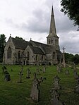
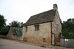
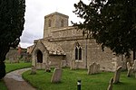
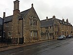
Name
Location
Type
Completed Date designated
Grid ref. Entry number Image
Ashton Mill
Ashton , East Northamptonshire Corn Mill
C17-19
12 May 1969
TL0516688217 52°28′54″N 0°27′10″W / 52.481752°N 0.452844°W / 52.481752; -0.452844 (Ashton Mill)
1040278 Ashton Mill More images
Home Farm Cottage
Ashton Wold , AshtonHouse
1900–1901
13 November 1998
TL0892987904 52°28′42″N 0°23′51″W / 52.478202°N 0.397559°W / 52.478202; -0.397559 (Home Farm Cottage)
1245640 Upload Photo
Home Farm, Farmbuildings
Ashton Wold, Ashton
Dovecote
1900–1901
13 November 1998
TL0895787934 52°28′42″N 0°23′50″W / 52.478466°N 0.397137°W / 52.478466; -0.397137 (Home Farm, Farmbuildings)
1271732 Upload Photo
Home Farm, the Old Dairy
Ashton Wold, Ashton
Dairy
1900–1901
13 November 1998
TL0895287896 52°28′41″N 0°23′50″W / 52.478126°N 0.397223°W / 52.478126; -0.397223 (Home Farm, the Old Dairy)
1271734 Upload Photo
All Saints Chancel
Barnwell All Saints , Barnwell Church
13th century
23 May 1967
TL0486984417 52°26′52″N 0°27′30″W / 52.44766°N 0.458409°W / 52.44766; -0.458409 (All Saints Chancel)
1294446 All Saints Chancel More images
Biggin Hall
Benefield Country House
Medieval origins
23 May 1967
TL0108889137 52°29′27″N 0°30′45″W / 52.49079°N 0.512592°W / 52.49079; -0.512592 (Biggin Hall)
1040213 Biggin Hall More images
Church of St Mary
Lower Benefield , BenefieldChurch
Medieval
23 May 1967
SP9881288470 52°29′07″N 0°32′47″W / 52.485212°N 0.546299°W / 52.485212; -0.546299 (Church of St Mary)
1189042 Church of St Mary More images
Church of the Holy Trinity
Blatherwycke Church
11th century to 14th century
23 May 1967
SP9743595762 52°33′04″N 0°33′52″W / 52.550993°N 0.564436°W / 52.550993; -0.564436 (Church of the Holy Trinity)
1040093 Church of the Holy Trinity More images
Fermyn Woods Hall, and attached Stables and ancillary Buildings
Brigstock Country House
Early/mid 17th century
23 May 1967
SP9581687120 52°28′25″N 0°35′27″W / 52.473613°N 0.590792°W / 52.473613; -0.590792 (Fermyn Woods Hall, and attached Stables and ancillary Buildings)
1189160 Fermyn Woods Hall, and attached Stables and ancillary Buildings More images
Manor House
Brigstock
Hall House
12th-century origins
26 May 1967
SP9452785228 52°27′25″N 0°36′37″W / 52.456833°N 0.610298°W / 52.456833; -0.610298 (Manor House)
1040166 Upload Photo
Bulwick Hall and attached Entrance Loggia and Garden Room
Bulwick Park, Bulwick
Country House
c. 1676
23 May 1967
SP9588794050 52°32′09″N 0°35′16″W / 52.535882°N 0.587752°W / 52.535882; -0.587752 (Bulwick Hall and attached Entrance Loggia and Garden Room)
1293383 Bulwick Hall and attached Entrance Loggia and Garden Room More images
Gates and Gatepiers about 150m south-west of Bulwick Hall
Bulwick Park, Bulwick
Gate
Early 18th century
23 May 1967
SP9580293904 52°32′05″N 0°35′21″W / 52.534584°N 0.589047°W / 52.534584; -0.589047 (Gates and Gatepiers about 150m south-west of Bulwick Hall)
1374888 Upload Photo
Church of St John the Baptist
Caldecott , Chelveston cum Caldecott Church
Mid 13th century
23 May 1967
SP9884569126 52°18′41″N 0°33′05″W / 52.311358°N 0.551517°W / 52.311358; -0.551517 (Church of St John the Baptist)
1040380 Church of St John the Baptist More images
Church of St Andrew
Collyweston Church
11th century
23 May 1967
SK9960702885 52°36′53″N 0°31′49″W / 52.614614°N 0.530274°W / 52.614614; -0.530274 (Church of St Andrew)
1374873 Church of St Andrew More images
Church of St Peter
Deene Park, Deene
Bust
1722
23 May 1967
SP9519092748 52°31′27″N 0°35′54″W / 52.524302°N 0.598398°W / 52.524302; -0.598398 (Church of St Peter)
1040134 Church of St Peter More images
Church of St Mary
Duddington , Duddington-with-Fineshade Church
mid and late 12th century
23 May 1967
SK9877400884 52°35′48″N 0°32′35″W / 52.596783°N 0.54317°W / 52.596783; -0.54317 (Church of St Mary)
1040104 Church of St Mary More images
Glebe House and attached Steps and Railings
Easton on the Hill House
1988
23 May 1967
TF0093704591 52°37′47″N 0°30′36″W / 52.6297°N 0.510117°W / 52.6297; -0.510117 (Glebe House and attached Steps and Railings)
1225510 Upload Photo
Priest's House
Easton on the Hill Priests House
Early 16th century
23 May 1967
TF0097204548 52°37′46″N 0°30′35″W / 52.629307°N 0.509614°W / 52.629307; -0.509614 (Priest's House)
1225369 Priest's House More images
RAF Wittering: Nuclear Fissile Core Stores, Buildings A09, A10, A11, A14, A15, A27, VW28, A29 and A33
Easton on the Hill, East Northamptonshire
Nuclear Fissile Core Store
Built 1952
11 July 2011
TF0148201667 52°36′12″N 0°30′11″W / 52.603321°N 0.502965°W / 52.603321; -0.502965 (RAF Wittering: Nuclear Fissile Core Stores, Buildings A09, A10, A11, A14, A15, A27, VW28, A29 and A33)
1402763 Upload Photo
Church of St Leonard
Glapthorn Church
12th century
23 May 1967
TL0242290202 52°30′00″N 0°29′33″W / 52.500112°N 0.492625°W / 52.500112; -0.492625 (Church of St Leonard)
1371965 Church of St Leonard More images
Church of All Saints
Great Addington Church
12th century
23 May 1967
SP9586275114 52°21′57″N 0°35′37″W / 52.365703°N 0.593552°W / 52.365703; -0.593552 (Church of All Saints)
1040381 Church of All Saints More images
Church of All Saints and Chest Tomb attached to North Aisle
Hargrave Church
Late 12th century
23 May 1967
TL0365970638 52°19′27″N 0°28′50″W / 52.324059°N 0.480464°W / 52.324059; -0.480464 (Church of All Saints and Chest Tomb attached to North Aisle)
1191820 Church of All Saints and Chest Tomb attached to North Aisle More images
Harringworth Lodge
Harringworth Hunting Lodge
13th century origins
23 May 1967
SP9320895269 52°32′50″N 0°37′37″W / 52.547302°N 0.626895°W / 52.547302; -0.626895 (Harringworth Lodge)
1040116 Harringworth Lodge More images
Church of St Peter and St Paul
Hemington Church
13th-century origins
23 May 1967
TL0918884996 52°27′07″N 0°23′41″W / 52.452018°N 0.394698°W / 52.452018; -0.394698 (Church of St Peter and St Paul)
1040226 Church of St Peter and St Paul More images
College House
Higham Ferrers House
1633
23 September 1950
SP9604668651 52°18′27″N 0°35′34″W / 52.307585°N 0.592696°W / 52.307585; -0.592696 (College House)
1040389 Upload Photo
5 Market Square
Higham Ferrers
House
Mid 17th century
23 September 1950
SP9601968497 52°18′22″N 0°35′35″W / 52.306205°N 0.593136°W / 52.306205; -0.593136 (5 Market Square)
1371874 Upload Photo
Hall Farmhouse
King's Cliffe Farmhouse
Late Medieval
23 May 1967
TL0075997066 52°33′44″N 0°30′54″W / 52.562107°N 0.515035°W / 52.562107; -0.515035 (Hall Farmhouse)
1225654 Upload Photo
Church of All Saints
Laxton Church
12th century
23 May 1967
SP9505596011 52°33′13″N 0°35′58″W / 52.553651°N 0.599454°W / 52.553651; -0.599454 (Church of All Saints)
1233912 Church of All Saints More images
Laxton Hall and attached Steps and Balustrade
Laxton Park, Laxton
Country House
Late 18th century
23 May 1967
SP9597997065 52°33′47″N 0°35′08″W / 52.562962°N 0.585526°W / 52.562962; -0.585526 (Laxton Hall and attached Steps and Balustrade)
1276360 Laxton Hall and attached Steps and Balustrade More images
Church of St John the Baptist
Slipton , Lowick Church
13th century
23 May 1967
SP9525779341 52°24′14″N 0°36′04″W / 52.403798°N 0.601235°W / 52.403798; -0.601235 (Church of St John the Baptist)
1040269 Church of St John the Baptist More images
Flight of Steps with Urns adjacent to north Front of Drayton House
Drayton Park, Lowick
Steps
Early 18th century
31 July 1987
SP9630680064 52°24′36″N 0°35′08″W / 52.410113°N 0.585613°W / 52.410113; -0.585613 (Flight of Steps with Urns adjacent to north Front of Drayton House)
1040297 Upload Photo
Flight of Steps with Urns about 90m east of east Front of Drayton House
Drayton Park, Lowick, East Northamptonshire
Steps
Early 18th century
31 July 1987
SP9637680132 52°24′39″N 0°35′04″W / 52.410711°N 0.584564°W / 52.410711; -0.584564 (Flight of Steps with Urns about 90m east of east Front of Drayton House)
1040301 Upload Photo
Retaining Wall, Steps and Urns extending about 80m from south to east Front of Drayton House
Drayton Park, Lowick
Garden Wall
Late 16th century
31 July 1987
SP9637580078 52°24′37″N 0°35′05″W / 52.410226°N 0.584594°W / 52.410226; -0.584594 (Retaining Wall, Steps and Urns extending about 80m from south to east Front of Drayton House)
1040299 Upload Photo
Stables attached to south-west of Drayton House
Drayton Park, Lowick
Wall
mid/late 17th century
23 May 1967
SP9636079957 52°24′33″N 0°35′05″W / 52.409141°N 0.58485°W / 52.409141; -0.58485 (Stables attached to south-west of Drayton House)
1192040 Upload Photo
Statue of Bacchus about 25m east of east Front of Drayton House
Drayton Park, Lowick
Statue
c. 1718
31 July 1987
SP9633280100 52°24′38″N 0°35′07″W / 52.410432°N 0.58522°W / 52.410432; -0.58522 (Statue of Bacchus about 25m east of east Front of Drayton House)
1371924 Upload Photo
Statue of Flora around 25m east of east Front of Drayton House
Drayton Park, Lowick
Statue
c. 1718
31 July 1987
SP9635780087 52°24′37″N 0°35′05″W / 52.41031°N 0.584856°W / 52.41031; -0.584856 (Statue of Flora around 25m east of east Front of Drayton House)
1192227 Upload Photo
Statue of Samson and the Philistine about 110m east of east Front of Drayton House
Drayton Park, Lowick, East Northamptonshire
Statue
Early 18th century
31 July 1987
SP9639480155 52°24′39″N 0°35′03″W / 52.410915°N 0.584293°W / 52.410915; -0.584293 (Statue of Samson and the Philistine about 110m east of east Front of Drayton House)
1371923 Upload Photo
Walls, Gatepier and attached Banqueting House and Balustrade about 80m east of Drayton House
Drayton Park, Lowick, East Northamptonshire
Balustrade
Late 17th century
23 May 1967
SP9634780146 52°24′39″N 0°35′06″W / 52.410842°N 0.584986°W / 52.410842; -0.584986 (Walls, Gatepier and attached Banqueting House and Balustrade about 80m east of Drayton House)
1040298 Upload Photo
Walls, Gatepiers, Gates and Screens south and east of Drayton House ; and Banqueting House, Balustrade, Statue and Cistern
Drayton Park, Lowick
Balustrade
late C17/early 18th century
23 May 1967
SP9646079966 52°24′33″N 0°35′00″W / 52.409205°N 0.583378°W / 52.409205; -0.583378 (Walls, Gatepiers, Gates and Screens south and east of Drayton House; and Banqueting House, Balustrade, Statue and Cistern)
1371922 Upload Photo
Church of St Margaret
Luddington-in-the-Brook , LuddingtonChurch
13th century to 15th century
23 May 1967
TL1031383665 52°26′23″N 0°22′43″W / 52.439831°N 0.37859°W / 52.439831; -0.37859 (Church of St Margaret)
1040228 Church of St Margaret More images
Manor House
Nassington Manor House
Early 16th century
23 May 1967
TL0628896176 52°33′11″N 0°26′02″W / 52.553059°N 0.433788°W / 52.553059; -0.433788 (Manor House)
1065895 Upload Photo
Bramston House Central Building
Oundle House
Late 17th century
18 June 1955
TL0420088072 52°28′50″N 0°28′02″W / 52.480634°N 0.467108°W / 52.480634; -0.467108 (Bramston House Central Building)
1039859 Upload Photo
Bramston House East Wing
Oundle
House
18th century
18 June 1955
TL0421588086 52°28′51″N 0°28′01″W / 52.480757°N 0.466883°W / 52.480757; -0.466883 (Bramston House East Wing)
1039860 Upload Photo
Branston House West Wing
Oundle
House
Early 18th century
18 June 1955
TL0418788062 52°28′50″N 0°28′02″W / 52.480547°N 0.467303°W / 52.480547; -0.467303 (Branston House West Wing)
1190599 Upload Photo
Latham's Hospital
Oundle
Almshouses
1830
18 June 1955
TL0428588308 52°28′58″N 0°27′57″W / 52.482739°N 0.465784°W / 52.482739; -0.465784 (Latham's Hospital)
1039800 Latham's Hospital
Oundle School Memorial Chapel
Oundle
School
1922-3
7 June 1974
TL0383388338 52°28′59″N 0°28′21″W / 52.483094°N 0.472428°W / 52.483094; -0.472428 (Oundle School Memorial Chapel)
1039825 Upload Photo
Paine's Almshouses
Oundle
Wall
Early 17th century
18 June 1955
TL0384788113 52°28′52″N 0°28′20″W / 52.48107°N 0.472292°W / 52.48107; -0.472292 (Paine's Almshouses)
1039816 Paine's Almshouses
Stable Block and Barn to West of No 16 including linking Wall and Gate Piers
Oundle
Gate
18 June 1955
TL0400588065 52°28′50″N 0°28′12″W / 52.480608°N 0.469981°W / 52.480608; -0.469981 (Stable Block and Barn to West of No 16 including linking Wall and Gate Piers)
1039780 Upload Photo
The White Lion Public House
Oundle
Public House
Early 17th century
18 June 1955
TL0425588164 52°28′53″N 0°27′59″W / 52.48145°N 0.46627°W / 52.48145; -0.46627 (The White Lion Public House)
1039840 Upload Photo
Upper House
Oundle
House
18 June 1955
TL0426488191 52°28′54″N 0°27′58″W / 52.481691°N 0.466129°W / 52.481691; -0.466129 (Upper House)
1039841 Upload Photo
12 North Street
Oundle
House
1661
7 June 1974
TL0425788183 52°28′54″N 0°27′58″W / 52.481621°N 0.466235°W / 52.481621; -0.466235 (12 North Street)
1293575 Upload Photo
4 and 6 Market Place
Oundle
House
Early 18th century
18 June 1955
TL0412588075 52°28′50″N 0°28′06″W / 52.480675°N 0.468211°W / 52.480675; -0.468211 (4 and 6 Market Place)
1293722 Upload Photo
13 Market Place
Oundle
House
Late 17th century
18 June 1955
TL0416788112 52°28′52″N 0°28′03″W / 52.481°N 0.467582°W / 52.481; -0.467582 (13 Market Place)
1372120 Upload Photo
Church of St Mary and All Saints
Pilton Church
Late 12th century
23 May 1967
TL0247784546 52°26′57″N 0°29′37″W / 52.449272°N 0.493552°W / 52.449272; -0.493552 (Church of St Mary and All Saints)
1294190 Church of St Mary and All Saints More images
Churchyard Cross about 8m south of South Aisle of Church of St Peter
Raunds Cross
14th century or 15th century
26 April 1950
TL0004073068 52°20′48″N 0°31′58″W / 52.346569°N 0.532823°W / 52.346569; -0.532823 (Churchyard Cross about 8m south of South Aisle of Church of St Peter)
1371901 Upload Photo
No 59, Thorpe St (Thorpe House) and attached Wall to South
Raunds
Farmhouse
Mid 16th century
26 April 1950
SP9989472344 52°20′24″N 0°32′07″W / 52.340089°N 0.53518°W / 52.340089; -0.53518 (No 59, Thorpe St (Thorpe House) and attached Wall to South)
1040345 Upload Photo
Rushden Hall
Rushden Country House/Offices
14th century or 15th century
9 December 1949
SP9560566323 52°17′12″N 0°35′59″W / 52.286739°N 0.599822°W / 52.286739; -0.599822 (Rushden Hall)
1225991 Upload Photo
Church of St Mary
Southwick Church
14th century
23 May 1967
TL0208592081 52°31′01″N 0°29′49″W / 52.517062°N 0.497012°W / 52.517062; -0.497012 (Church of St Mary)
1190967 Church of St Mary More images
Stanwick Hall
Stanwick Country House
17th century
26 April 1950
SP9753171197 52°19′49″N 0°34′13″W / 52.330205°N 0.570185°W / 52.330205; -0.570185 (Stanwick Hall)
1192263 Stanwick Hall More images
The Old Rectory
Stanwick
House
1717
26 April 1950
SP9793571469 52°19′57″N 0°33′51″W / 52.332578°N 0.564179°W / 52.332578; -0.564179 (The Old Rectory)
1286673 Upload Photo
Church of St Rumbald
Stoke Doyle Church
c1722-25
23 May 1967
TL0265486261 52°27′53″N 0°29′26″W / 52.464652°N 0.490421°W / 52.464652; -0.490421 (Church of St Rumbald)
1040178 Church of St Rumbald More images
Church of All Saints
Sudborough Cross
Saxon
23 May 1967
SP9676882108 52°25′42″N 0°34′42″W / 52.428401°N 0.578232°W / 52.428401; -0.578232 (Church of All Saints)
1226485 Church of All Saints More images
Church of St Mary the Virgin
Tansor Church
Late 11th century
23 May 1967
TL0535390894 52°30′21″N 0°26′57″W / 52.505773°N 0.449246°W / 52.505773; -0.449246 (Church of St Mary the Virgin)
1191175 Church of St Mary the Virgin More images
Church of St John the Baptist
Achurch , Thorpe Achurch Church
Early 13th century
23 May 1967
TL0213883136 52°26′12″N 0°29′56″W / 52.436664°N 0.498969°W / 52.436664; -0.498969 (Church of St John the Baptist)
1040142 Church of St John the Baptist More images
Church of St James
Thrapston Church
13th century
23 May 1967
SP9970378698 52°23′50″N 0°32′10″W / 52.397228°N 0.536096°W / 52.397228; -0.536096 (Church of St James)
1265715 Church of St James More images
Church of St Nicholas
Twywell Church
12th century
23 May 1967
SP9518078183 52°23′36″N 0°36′10″W / 52.393404°N 0.602695°W / 52.393404; -0.602695 (Church of St Nicholas)
1226021 Church of St Nicholas More images
Church of St Michael and All Angels
Wadenhoe Church
Late 12th century
23 May 1967
TL0086383284 52°26′18″N 0°31′04″W / 52.438231°N 0.517673°W / 52.438231; -0.517673 (Church of St Michael and All Angels)
1227141 Church of St Michael and All Angels More images
Manor House
Warmington Manor House
1677
23 May 1967
TL0770391284 52°30′32″N 0°24′52″W / 52.508819°N 0.414511°W / 52.508819; -0.414511 (Manor House)
1191298 Manor House More images
Manor House Farmhouse
Woodford Farmhouse
1987
23 May 1967
SP9666776838 52°22′52″N 0°34′52″W / 52.381056°N 0.581237°W / 52.381056; -0.581237 (Manor House Farmhouse)
1225978 Upload Photo
Church of St Mary
Woodnewton Church
11th century to 15th century
23 May 1967
TL0321094572 52°32′21″N 0°28′47″W / 52.539236°N 0.479666°W / 52.539236; -0.479666 (Church of St Mary)
1065862 Church of St Mary More images
Church of St Mary Magdalene
Yarwell Church
13th century
23 May 1967
TL0709497761 52°34′02″N 0°25′17″W / 52.567145°N 0.421394°W / 52.567145; -0.421394 (Church of St Mary Magdalene)
1225878 Church of St Mary Magdalene More images


