Name
Location
Type
Completed Date designated
Grid ref. Entry number Image
Church House
Abbots Bromley , East Staffordshire House
Mid C20
10 January 1953
SK0794424630 52°49′09″N 1°53′01″W / 52.81915°N 1.883565°W / 52.81915; -1.883565 (Church House)
1038414 Upload Photo
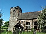
Church of St Nicholas
Abbots Bromley, East Staffordshire
Parish Church
c. 1300
12 January 1966
SK0793524560 52°49′07″N 1°53′01″W / 52.818521°N 1.8837°W / 52.818521; -1.8837 (Church of St Nicholas)
1374461 Church of St Nicholas More images
The Butter Cross
Abbots Bromley, East Staffordshire
Village Cross
17th century
12 January 1966
SK0804224576 52°49′07″N 1°52′56″W / 52.818663°N 1.882112°W / 52.818663; -1.882112 (The Butter Cross)
1038424 The Butter Cross More images
Barton Hall
Barton-under-Needwood , East StaffordshireHouse
Late 18th century
17 September 1952
SK1894218847 52°46′01″N 1°43′15″W / 52.766892°N 1.720706°W / 52.766892; -1.720706 (Barton Hall)
1374405 Barton Hall
Church of St James
Barton-under-Needwood, East Staffordshire
Parish Church
1517
12 March 1964
SK1879218535 52°45′51″N 1°43′23″W / 52.764093°N 1.722947°W / 52.764093; -1.722947 (Church of St James)
1038545 Church of St James More images
5 Brookside Road
Barton-under-Needwood, East Staffordshire
House
Late Medieval
10 December 1958
SK1847218394 52°45′46″N 1°43′40″W / 52.762836°N 1.727697°W / 52.762836; -1.727697 (5 Brookside Road)
1374402 Upload Photo
Lower Booth Farmhouse
Blithfield , East StaffordshireFarmhouse
15th century
12 January 1966
SK0427027159 52°50′31″N 1°56′17″W / 52.841925°N 1.938049°W / 52.841925; -1.938049 (Lower Booth Farmhouse)
1038401 Upload Photo
Main Gateway to Blithfield Hall with Flanking Walls
Blithfield Park, Blithfield, East Staffordshire
Gate
c. 1820
8 August 1985
SK0453623946 52°48′47″N 1°56′03″W / 52.81304°N 1.934144°W / 52.81304; -1.934144 (Main Gateway to Blithfield Hall with Flanking Walls)
1190043 Upload Photo
The Orangery, Blithfield Hall
Blithfield, East Staffordshire
Orangery
c. 1769
12 January 1966
SK0445723992 52°48′48″N 1°56′07″W / 52.813454°N 1.935315°W / 52.813454; -1.935315 (The Orangery, Blithfield Hall)
1038399 Upload Photo
Claymills Pumping Station
Burton-on-Trent , East StaffordshireSewage Pumping Station
1886
3 January 1986
SK2629425873 52°49′47″N 1°36′40″W / 52.829745°N 1.611184°W / 52.829745; -1.611184 (Claymills Pumping Station)
1038427 Claymills Pumping Station More images
Gates, Railings and Piers on West Side of Churchyard of Church of St Modwen
Burton-on-Trent, East Staffordshire
Gate
19th century
22 June 1979
SK2505922722 52°48′05″N 1°37′47″W / 52.801478°N 1.629754°W / 52.801478; -1.629754 (Gates, Railings and Piers on West Side of Churchyard of Church of St Modwen)
1038710 Gates, Railings and Piers on West Side of Churchyard of Church of St Modwen
The Abbey (Burton Abbey Club)
Burton-on-Trent, East Staffordshire
Abbey
1004
24 March 1950
SK2510722601 52°48′01″N 1°37′45″W / 52.800388°N 1.629052°W / 52.800388; -1.629052 (The Abbey (Burton Abbey Club))
1213613 Upload Photo
181 Horninglow Street
Burton-on-Trent, East Staffordshire
House
Regency
24 March 1950
SK2520323354 52°48′26″N 1°37′39″W / 52.807152°N 1.62757°W / 52.807152; -1.62757 (181 Horninglow Street)
1038699 Upload Photo
182, Horninglow Street
Burton-on-Trent , East StaffordshireHouse
Early 19th century
22 June 1979
SK2521523353 52°48′26″N 1°37′39″W / 52.807143°N 1.627392°W / 52.807143; -1.627392 (182, Horninglow Street)
1374342 Upload Photo
All Saints Vicarage
Denstone , East StaffordshireVicarage
1860-2
30 May 1985
SK0999940944 52°57′57″N 1°51′09″W / 52.965767°N 1.852576°W / 52.965767; -1.852576 (All Saints Vicarage)
1278479 Upload Photo
Church of All Saints
Denstone, East Staffordshire
Church
1949
30 May 1985
SK1003740901 52°57′55″N 1°51′07″W / 52.96538°N 1.852012°W / 52.96538; -1.852012 (Church of All Saints)
1230657 Church of All Saints More images
Lodge about 20m north of Triumphal Arch at Quixhill
Denstone, East Staffordshire
Lodge
Early 19th century
12 January 1966
SK1006441303 52°58′08″N 1°51′06″W / 52.968993°N 1.851597°W / 52.968993; -1.851597 (Lodge about 20m north of Triumphal Arch at Quixhill)
1230718 Lodge about 20m north of Triumphal Arch at Quixhill More images
Lodge about 20m south of Triumphal Arch at Quixhill
Denstone, East Staffordshire
Lodge
Early 19th century
12 January 1966
SK1005641266 52°58′07″N 1°51′06″W / 52.968661°N 1.851718°W / 52.968661; -1.851718 (Lodge about 20m south of Triumphal Arch at Quixhill)
1230589 Lodge about 20m south of Triumphal Arch at Quixhill More images
Triumphal Arch, Gates and Flanking Railings at Quixhill
Denstone, East Staffordshire
Gate
Early 19th century
12 January 1966
SK1005241286 52°58′08″N 1°51′06″W / 52.968841°N 1.851777°W / 52.968841; -1.851777 (Triumphal Arch, Gates and Flanking Railings at Quixhill)
1230588 Triumphal Arch, Gates and Flanking Railings at Quixhill More images
Church of St Mary
Dunstall , East StaffordshireParish Church
1852-3
26 March 1986
SK1874020430 52°46′52″N 1°43′25″W / 52.781129°N 1.72361°W / 52.781129; -1.72361 (Church of St Mary)
1038486 Church of St Mary More images
Dunstall Hall and attached Orangery
Dunstall, East Staffordshire
Country House
Early 19th century
17 September 1952
SK1906020452 52°46′53″N 1°43′08″W / 52.781316°N 1.718864°W / 52.781316; -1.718864 (Dunstall Hall and attached Orangery)
1038487 Dunstall Hall and attached Orangery More images
Calwich Abbey Temple Flanking Bridges with Gates, Gate Piers and Railings
Calwich Park, Ellastone , East Staffordshire
Gate
1797
10 January 1953
SK1317743174 52°59′09″N 1°48′19″W / 52.985745°N 1.80517°W / 52.985745; -1.80517 (Calwich Abbey Temple Flanking Bridges with Gates, Gate Piers and Railings)
1230741 Upload Photo
Church of St Peter
Ellastone, East Staffordshire
Church
1586
12 January 1966
SK1168043450 52°59′18″N 1°49′39″W / 52.988261°N 1.827459°W / 52.988261; -1.827459 (Church of St Peter)
1278444 Church of St Peter More images
Ellastone Old House
Upper Ellastone, Ellstone, East Staffordshire
House
Early to mid 18th century
10 January 1953
SK1173643273 52°59′12″N 1°49′36″W / 52.986668°N 1.826631°W / 52.986668; -1.826631 (Ellastone Old House)
1230749 Ellastone Old House More images
Church of St Werburgh
Hanbury , East StaffordshireCross
Saxon
12 March 1964
SK1708427921 52°50′55″N 1°44′52″W / 52.848523°N 1.747771°W / 52.848523; -1.747771 (Church of St Werburgh)
1374435 Church of St Werburgh More images
Pair of Gate Piers and Seats in Terrace Garden South of Hoar Cross Hall
Hoar Cross , East StaffordshireGate Pier
c. 1600
1 November 1989
SK1234723047 52°48′17″N 1°49′06″W / 52.804838°N 1.818291°W / 52.804838; -1.818291 (Pair of Gate Piers and Seats in Terrace Garden South of Hoar Cross Hall)
1374449 Pair of Gate Piers and Seats in Terrace Garden South of Hoar Cross Hall
Pair of Gatepiers and Gates to South Boundary of Terrace Garden at Hoar Cross Hall
Hoar Cross, East Staffordshire
Gate
c. 1700
1 November 1989
SK1234623007 52°48′16″N 1°49′06″W / 52.804478°N 1.818307°W / 52.804478; -1.818307 (Pair of Gatepiers and Gates to South Boundary of Terrace Garden at Hoar Cross Hall)
1038479 Upload Photo
Callowhill Hall
Kingstone , East StaffordshireHouse
Late 17th century
10 January 1953
SK0497426388 52°50′06″N 1°55′39″W / 52.834988°N 1.927609°W / 52.834988; -1.927609 (Callowhill Hall)
1374476 Callowhill Hall More images
Church of All Saints
Church Leigh , Leigh , East StaffordshireParish Church
Medieval
12 January 1966
SK0239035836 52°55′12″N 1°57′57″W / 52.919936°N 1.9659°W / 52.919936; -1.9659 (Church of All Saints)
1190204 Church of All Saints More images
Church View
Church Leigh, Leigh, East Staffordshire
House
C20
8 August 1985
SK0251935726 52°55′08″N 1°57′50″W / 52.918947°N 1.963982°W / 52.918947; -1.963982 (Church View)
1038374 Upload Photo
Church of St Peter
Marchington , East StaffordshireParish Church
1742
12 January 1966
SK1379530728 52°52′26″N 1°47′47″W / 52.87385°N 1.79649°W / 52.87385; -1.79649 (Church of St Peter)
1190260 Church of St Peter More images
Marchington Hall
Marchington, East Staffordshire
House
c. 1690
10 January 1953
SK1346931011 52°52′35″N 1°48′05″W / 52.876402°N 1.801322°W / 52.876402; -1.801322 (Marchington Hall)
1374504 Upload Photo
Woodroffe's Cottage
Marchington, East Staffordshire
Jettied House
Early 17th century
10 January 1953
SK1120629894 52°51′59″N 1°50′06″W / 52.866412°N 1.834983°W / 52.866412; -1.834983 (Woodroffe's Cottage)
1038342 Upload Photo
Old Hall Farmhouse
Picadilly, Mayfield , East Staffordshire
Farmhouse
1680
30 May 1985
SK1519346079 53°00′43″N 1°46′30″W / 53.011806°N 1.775006°W / 53.011806; -1.775006 (Old Hall Farmhouse)
1230785 Upload Photo
Old Hall Farmhouse, Garden Wall and Gate Piers
Middle Mayfield, Mayfield , East Staffordshire
Farmhouse
17th century
10 January 1953
SK1474644864 53°00′03″N 1°46′54″W / 53.000896°N 1.781723°W / 53.000896; -1.781723 (Old Hall Farmhouse, Garden Wall and Gate Piers)
1231004 Old Hall Farmhouse, Garden Wall and Gate Piers
Church of All Saints
Okeover Park, Okeover , East Staffordshire
Church
19th century
12 January 1966
SK1585148128 53°01′49″N 1°45′54″W / 53.030205°N 1.765099°W / 53.030205; -1.765099 (Church of All Saints)
1231030 Church of All Saints More images
Gates and railings enclosing south side of garden to west of Okeover Hall
Okeover Park, Okeover, East Staffordshire
Gate
c. 1740
10 January 1953
SK1568648102 53°01′48″N 1°46′03″W / 53.029976°N 1.76756°W / 53.029976; -1.76756 (Gates and railings enclosing south side of garden to west of Okeover Hall)
1231108 Upload Photo
Gates, Gate Piers, Steps and Walls to Kitchen Garden approx. 50 Yards North of Okeover Hall
Okeover Park, Okeover, East Staffordshire
Gate
Mid 18th century
30 May 1985
SK1579248247 53°01′53″N 1°45′58″W / 53.031277°N 1.765973°W / 53.031277; -1.765973 (Gates, Gate Piers, Steps and Walls to Kitchen Garden approx. 50 Yards North of Okeover Hall)
1278304 Upload Photo
Gates, piers and railings immediately north east of Okeover Hall
Okeover Park, Okeover, East Staffordshire
Gate
c. 1738
30 May 1985
SK1583048140 53°01′49″N 1°45′55″W / 53.030314°N 1.765411°W / 53.030314; -1.765411 (Gates, piers and railings immediately north east of Okeover Hall)
1231116 Upload Photo
Inner gate piers, gates and railings to Okeover Hall
Okeover Park, Okeover, East Staffordshire
Gate
1756–59
30 May 1985
SK1586848161 53°01′50″N 1°45′53″W / 53.030501°N 1.764844°W / 53.030501; -1.764844 (Inner gate piers, gates and railings to Okeover Hall)
1231033 Inner gate piers, gates and railings to Okeover Hall More images
Okeover Hall
Okeover Park, Okeover, East Staffordshire
Country House
1745-9
10 January 1953
SK1580048118 53°01′48″N 1°45′57″W / 53.030117°N 1.76586°W / 53.030117; -1.76586 (Okeover Hall)
1231031 Okeover Hall More images
Outer gates and gate piers to Okeover Hall
Okeover Park, Okeover, East Staffordshire
Gate
c. 1740
30 May 1985
SK1612048153 53°01′50″N 1°45′40″W / 53.030422°N 1.761087°W / 53.030422; -1.761087 (Outer gates and gate piers to Okeover Hall)
1277410 Outer gates and gate piers to Okeover Hall More images
Statue, sundial and steps approx. 30 yards north of Okeover Hall
Okeover Park, Okeover, East Staffordshire
Steps
1741
30 May 1985
SK1583648166 53°01′50″N 1°45′55″W / 53.030547°N 1.765321°W / 53.030547; -1.765321 (Statue, sundial and steps approx. 30 yards north of Okeover Hall)
1278305 Upload Photo
Temple of Pomona, Okeover Hall
Okeover Park, Okeover, East Staffordshire
Pavilion
c1737-48
30 May 1985
SK1583148296 53°01′54″N 1°45′55″W / 53.031716°N 1.765389°W / 53.031716; -1.765389 (Temple of Pomona, Okeover Hall)
1231036 Temple of Pomona, Okeover Hall
Gate piers and courtyard walls to east of Wootton Lodge
Wootton Park, Ramshorn , East Staffordshire
Gate
17th century
10 January 1953
SK0964043792 52°59′29″N 1°51′28″W / 52.991375°N 1.857837°W / 52.991375; -1.857837 (Gate piers and courtyard walls to east of Wootton Lodge)
1231038 Upload Photo
Pair of pavilions to north east and south east corners of courtyard east of Wootton Lodge
Wootton Park, Ramshorn , East Staffordshire
Pavilion
17th century
10 January 1953
SK0963243774 52°59′28″N 1°51′29″W / 52.991213°N 1.857957°W / 52.991213; -1.857957 (Pair of pavilions to north east and south east corners of courtyard east of Wootton Lodge)
1278309 Upload Photo
Banks Farmhouse
Rocester , East StaffordshireFarmhouse
Early 18th century
12 January 1966
SK0990838959 52°56′53″N 1°51′14″W / 52.947925°N 1.853991°W / 52.947925; -1.853991 (Banks Farmhouse)
1231926 Upload Photo
Cross approximately 40 Yards North of Church of St Michael
Rocester, East Staffordshire
Cross
13th century
12 January 1966
SK1117039394 52°57′07″N 1°50′07″W / 52.951811°N 1.835195°W / 52.951811; -1.835195 (Cross approximately 40 Yards North of Church of St Michael)
1231920 Cross approximately 40 Yards North of Church of St Michael More images
Church of St Paul
Shobnall , East StaffordshireParish Church
1874
24 March 1950
SK2390523462 52°48′29″N 1°38′49″W / 52.808182°N 1.646817°W / 52.808182; -1.646817 (Church of St Paul)
1288714 Church of St Paul More images
Sinai Park
Shobnall, East Staffordshire
Farmhouse
Mid 17th century
17 September 1952
SK2222123097 52°48′18″N 1°40′19″W / 52.804973°N 1.671823°W / 52.804973; -1.671823 (Sinai Park)
1038484 Upload Photo
Church of St Mary
Stretton , East StaffordshireParish Church
1895-7
12 March 1963
SK2537426354 52°50′03″N 1°37′29″W / 52.834112°N 1.624801°W / 52.834112; -1.624801 (Church of St Mary)
1293648 Church of St Mary More images
Church of All Saints
Tatenhill, East Staffordshire
Chapel of Ease
1866-7
26 March 1986
SK1805522965 52°48′14″N 1°44′01″W / 52.803941°N 1.733626°W / 52.803941; -1.733626 (Church of All Saints)
1038436 Church of All Saints More images
Church of St Michael
Tatenhill , East StaffordshireParish Church
13th century
12 March 1964
SK2054422076 52°47′45″N 1°41′48″W / 52.795861°N 1.696762°W / 52.795861; -1.696762 (Church of St Michael)
1038433 Church of St Michael More images
The Old Rectory
Tatenhill, East Staffordshire
House
1999
17 September 1952
SK2055222101 52°47′46″N 1°41′48″W / 52.796085°N 1.696642°W / 52.796085; -1.696642 (The Old Rectory)
1038432 Upload Photo
Dog and Partridge Hotel
Tutbury , East StaffordshireCoaching Inn
Late C15-Early 16th century
17 September 1952
SK2126628898 52°51′26″N 1°41′08″W / 52.857158°N 1.685613°W / 52.857158; -1.685613 (Dog and Partridge Hotel)
1188498 Dog and Partridge Hotel More images
Bank House
Uttoxeter , East StaffordshireHouse
Late 18th century
24 October 1950
SK0932033524 52°53′57″N 1°51′46″W / 52.899079°N 1.862896°W / 52.899079; -1.862896 (Bank House)
1374326 Upload Photo
Dove Bridge
Uttoxeter, East Staffordshire
Road Bridge
15th century
13 September 1967
SK1055634465 52°54′27″N 1°50′40″W / 52.907516°N 1.844492°W / 52.907516; -1.844492 (Dove Bridge)
1237731 Dove Bridge More images
Parish Church of St Mary
Uttoxeter, East Staffordshire
Parish Church
14th century
24 October 1950
SK0932833485 52°53′55″N 1°51′46″W / 52.898729°N 1.862778°W / 52.898729; -1.862778 (Parish Church of St Mary)
1038783 Parish Church of St Mary More images
The Manor House
Uttoxeter, East Staffordshire
House
Pre 1500
24 October 1950
SK0907033749 52°54′04″N 1°52′00″W / 52.901106°N 1.866606°W / 52.901106; -1.866606 (The Manor House)
1293560 Upload Photo
25 Market Place
Uttoxeter, East Staffordshire
Timber Framed House
Medieval
8 January 1983
SK0923933372 52°53′52″N 1°51′51″W / 52.897714°N 1.864105°W / 52.897714; -1.864105 (25 Market Place)
1372432 Upload Photo
Loxley Hall
Loxley Park, Uttoxeter Rural , East Staffordshire
House
Earlier than early 19th century
10 January 1953
SK0613232123 52°53′12″N 1°54′37″W / 52.88653°N 1.910314°W / 52.88653; -1.910314 (Loxley Hall)
1190360 Loxley Hall More images
Church of St Leonard
Wychnor , East StaffordshireParish Church
12th century
12 March 1964
SK1768816074 52°44′31″N 1°44′22″W / 52.742007°N 1.73944°W / 52.742007; -1.73944 (Church of St Leonard)
1038440 Church of St Leonard More images
Church of St Peter
Yoxall , East StaffordshireParish Church
13th century
12 March 1964
SK1417019042 52°46′08″N 1°47′29″W / 52.76879°N 1.791421°W / 52.76879; -1.791421 (Church of St Peter)
1374422 Church of St Peter More images
Pear Tree Farmhouse
Yoxall, East Staffordshire
Farmhouse
Circa 14th century
28 October 1998
SK1423719305 52°46′16″N 1°47′26″W / 52.771153°N 1.790417°W / 52.771153; -1.790417 (Pear Tree Farmhouse)
1038475 Upload Photo
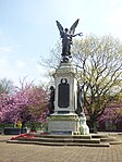
Burton upon Trent war memorial
Burton upon Trent War memorial
1922
22 June 1979
SK2497322594 52°48′01″N 1°37′52″W / 52.800331°N 1.6310395°W / 52.800331; -1.6310395 (Burton upon Trent war memorial)
1288788 Burton upon Trent war memorial More images


