Name
Location
Type
Completed Date designated
Grid ref. Entry number Image
41a Bridge Street
Hereford , County of Herefordshire Box Frame House
Late 14th century
23 December 1987
SO5079339758 52°03′14″N 2°43′09″W / 52.05401°N 2.719035°W / 52.05401; -2.719035 (41a Bridge Street)
1205588 Upload Photo
60 St Owen Street
Hereford
House
13th century
22 October 1973
SO5137139758 52°03′15″N 2°42′38″W / 52.054061°N 2.710606°W / 52.054061; -2.710606 (60 St Owen Street)
1196876 Upload Photo
29, 30 and 30a Castle Street
Hereford
House
Early 18th century
10 June 1952
SO5116639740 52°03′14″N 2°42′49″W / 52.053881°N 2.713593°W / 52.053881; -2.713593 (29, 30 and 30a Castle Street)
1205955 29, 30 and 30a Castle Street More images
31 Castle Street
Hereford
House
Mid 18th century
10 June 1952
SO5115039747 52°03′14″N 2°42′50″W / 52.053943°N 2.713827°W / 52.053943; -2.713827 (31 Castle Street)
1205978 31 Castle Street
20 Church Street
Hereford
House
18th century
10 June 1952
SO5101139882 52°03′19″N 2°42′57″W / 52.055144°N 2.715874°W / 52.055144; -2.715874 (20 Church Street)
1206265 Upload Photo
10 and 11 Castle Street
Hereford
House
Early 19th century
10 June 1952
SO5124039744 52°03′14″N 2°42′45″W / 52.053924°N 2.712515°W / 52.053924; -2.712515 (10 and 11 Castle Street)
1205907 Upload Photo
1a St Owen Street
Hereford
House
Early 19th century
22 October 1973
SO5121139966 52°03′21″N 2°42′47″W / 52.055917°N 2.712969°W / 52.055917; -2.712969 (1a St Owen Street)
1207400 Upload Photo
48 and 49 Broad Street
Hereford
House
Early 19th century
10 June 1952
SO5088039962 52°03′21″N 2°43′04″W / 52.055852°N 2.717796°W / 52.055852; -2.717796 (48 and 49 Broad Street)
1280611 Upload Photo
9 Castle Street
Hereford
House
Early 19th century
10 June 1952
SO5122939747 52°03′14″N 2°42′46″W / 52.05395°N 2.712675°W / 52.05395; -2.712675 (9 Castle Street)
1297429 Upload Photo
5 and 7 Widemarsh Street
Hereford
House
19th century
10 June 1952
SO5095840067 52°03′24″N 2°43′00″W / 52.056803°N 2.716673°W / 52.056803; -2.716673 (5 and 7 Widemarsh Street)
1196893 Upload Photo
1 and 1a Widemarsh Street
Hereford
House
1973
22 October 1973
SO5095940050 52°03′24″N 2°43′00″W / 52.05665°N 2.716656°W / 52.05665; -2.716656 (1 and 1a Widemarsh Street)
1297391 1 and 1a Widemarsh Street
3 Castle Hill
Hereford
House
17th century
22 October 1973
SO5113639699 52°03′13″N 2°42′50″W / 52.05351°N 2.714025°W / 52.05351; -2.714025 (3 Castle Hill)
1196801 Upload Photo
1 Bell Square
Weobley House
1987
20 February 1953
SO4013651694 52°09′37″N 2°52′36″W / 52.160258°N 2.876538°W / 52.160258; -2.876538 (1 Bell Square)
1081927 1 Bell Square
1 The Southend
Ledbury
Timber Framed House
c. 1600
18 September 1953
SO7111537565 52°02′09″N 2°25′21″W / 52.035731°N 2.42249°W / 52.035731; -2.42249 (1 The Southend)
1301682 1 The Southend More images
2 The Southend
Ledbury Timber Framed House
c. 1600
18 September 1953
SO7111737560 52°02′08″N 2°25′21″W / 52.035686°N 2.42246°W / 52.035686; -2.42246 (2 The Southend)
1082844 2 The Southend
2 New Street
Ledbury
Timber Framed House
c. 1600
18 September 1953
SO7111037561 52°02′08″N 2°25′21″W / 52.035694°N 2.422562°W / 52.035694; -2.422562 (2 New Street)
1082831 2 New Street
4 New Street
Ledbury
Timber Framed House
c. 1600
18 September 1953
SO7110537560 52°02′08″N 2°25′21″W / 52.035685°N 2.422635°W / 52.035685; -2.422635 (4 New Street)
1349411 Upload Photo
30 The Homend
Ledbury
House
18th century
18 September 1953
SO7101737823 52°02′17″N 2°25′26″W / 52.038045°N 2.42394°W / 52.038045; -2.42394 (30 The Homend)
1349388 Upload Photo
Magistrates' House and Nos 1, 2 and 3 Magistrates' Court
Ledbury
Timber Framed House
Early 18th century
18 September 1953
SO7118537736 52°02′14″N 2°25′17″W / 52.037272°N 2.421484°W / 52.037272; -2.421484 (Magistrates' House and Nos 1, 2 and 3 Magistrates' Court)
1082904 Magistrates' House and Nos 1, 2 and 3 Magistrates' Court More images
Mahollam Cottages
Mahollam, Kington Rural
House
15th century
19 August 1953
SO2702654355 52°10′57″N 3°04′07″W / 52.182597°N 3.068727°W / 52.182597; -3.068727 (Mahollam Cottages)
1301272 Upload Photo
47 New Street
Ross-on-Wye Prison
1820-30
22 October 1952
SO5987324247 51°54′55″N 2°35′05″W / 51.915296°N 2.584803°W / 51.915296; -2.584803 (47 New Street)
1349286 47 New Street More images
Man of Ross House
Ross-on-Wye
House
1689
22 October 1952
SO5991924109 51°54′51″N 2°35′03″W / 51.914059°N 2.584118°W / 51.914059; -2.584118 (Man of Ross House)
1098674 Man of Ross House More images
Market House
Ross-on-Wye
House
1660-1674
22 October 1952
SO5991924130 51°54′51″N 2°35′03″W / 51.914248°N 2.584121°W / 51.914248; -2.584121 (Market House)
1098680 Market House More images
Marlbrook House and attached Outbuilding
Weobley
House
16th century
20 February 1953
SO4020551500 52°09′31″N 2°52′32″W / 52.158521°N 2.875495°W / 52.158521; -2.875495 (Marlbrook House and attached Outbuilding)
1301256 Marlbrook House and attached Outbuilding More images
Michaelchurch Court, Steps and Terrace Walls to Entrance Front
Michaelchurch Escley House
Early 17th century
29 September 1952
SO3084634397 52°00′13″N 3°00′32″W / 52.003685°N 3.00881°W / 52.003685; -3.00881 (Michaelchurch Court, Steps and Terrace Walls to Entrance Front)
1224391 Upload Photo
Minaret, Boundary Walls and Gate Piers to North of Hope End Hotel
Hope End , near Colwall Gate Pier
1810-20
15 May 1975
SO7227841227 52°04′07″N 2°24′21″W / 52.068713°N 2.405835°W / 52.068713; -2.405835 (Minaret, Boundary Walls and Gate Piers to North of Hope End Hotel)
1082143 Upload Photo
Monnington Court
Monnington on Wye , Brobury with Monnington on WyeHouse
14th century
20 February 1953
SO3730543356 52°05′06″N 2°54′59″W / 52.08499°N 2.916378°W / 52.08499; -2.916378 (Monnington Court)
1157849 Monnington Court More images
Mordiford Bridge (that part on Mordiford)
Mordiford Road Bridge
14th century
26 January 1967
SO5699337454 52°02′02″N 2°37′42″W / 52.033814°N 2.628331°W / 52.033814; -2.628331 (Mordiford Bridge (that part on Mordiford))
1099818 Mordiford Bridge (that part on Mordiford) More images
Moreton Bridge (that part in Moreton CP)
Moreton on Lugg Road Bridge
16th century or 17th century
20 October 1952
SO5128545889 52°06′33″N 2°42′46″W / 52.109171°N 2.712738°W / 52.109171; -2.712738 (Moreton Bridge (that part in Moreton CP))
1099255 Moreton Bridge (that part in Moreton CP) More images
Moreton Bridge (that part in Marden CP)
Marden Road Bridge
16th century or 17th century
26 January 1967
SO5129245893 52°06′33″N 2°42′45″W / 52.109207°N 2.712637°W / 52.109207; -2.712637 (Moreton Bridge (that part in Marden CP))
1178835 Moreton Bridge (that part in Marden CP) More images
Nelson Column
Hereford Column
c. 1809
10 June 1952
SO5125139576 52°03′09″N 2°42′44″W / 52.052415°N 2.71233°W / 52.052415; -2.71233 (Nelson Column)
1297466 Nelson Column More images
New Court
Lugwardine Country House
18th century
11 October 1985
SO5422141180 52°04′02″N 2°40′09″W / 52.067088°N 2.669237°W / 52.067088; -2.669237 (New Court)
1099834 Upload Photo
New House
Goodrich Farmhouse
1953
18 May 1953
SO5633519528 51°52′21″N 2°38′08″W / 51.872604°N 2.635639°W / 51.872604; -2.635639 (New House)
1099457 New House More images
Northern half of Weobley Stores (4 Portland St)
Weobley House
17th century
20 February 1953
SO4025751579 52°09′33″N 2°52′29″W / 52.159237°N 2.874749°W / 52.159237; -2.874749 (Northern half of Weobley Stores (4 Portland St))
1301241 Northern half of Weobley Stores (4 Portland St)
Nun Upton
Nun Upton, Brimfield
House
Late 17th century
11 June 1959
SO5419466580 52°17′44″N 2°40′23″W / 52.295427°N 2.67307°W / 52.295427; -2.67307 (Nun Upton)
1081859 Upload Photo
Eastnor Castle Obelisk
Eastnor Park, Eastnor
Obelisk
1812
10 January 1986
SO7523237827 52°02′18″N 2°21′45″W / 52.038286°N 2.362494°W / 52.038286; -2.362494 (Eastnor Castle Obelisk)
1266786 Eastnor Castle Obelisk More images
Old Court
Bredwardine Farmhouse
2nd half 14th century
29 September 1952
SO3352144772 52°05′50″N 2°58′19″W / 52.097276°N 2.97187°W / 52.097276; -2.97187 (Old Court)
1099520 Old Court
Old Court
Longtown Farmhouse
14th century
14 March 1986
SO3375630272 51°58′01″N 2°57′56″W / 51.966959°N 2.965627°W / 51.966959; -2.965627 (Old Court)
1342121 Upload Photo
Old Court Hotel
Whitchurch Manor House
16th century
18 May 1963
SO5525417423 51°51′13″N 2°39′04″W / 51.853594°N 2.651066°W / 51.853594; -2.651066 (Old Court Hotel)
1225292 Old Court Hotel More images
Old Sufton
Mordiford
Country House
16th century
20 October 1952
SO5754138388 52°02′32″N 2°37′14″W / 52.042253°N 2.62046°W / 52.042253; -2.62046 (Old Sufton)
1301840 Upload Photo
Old Talbot Inn
Ledbury
Hotel
c. 1596
18 September 1953
SO7106437549 52°02′08″N 2°25′24″W / 52.035584°N 2.423232°W / 52.035584; -2.423232 (Old Talbot Inn)
1082833 Old Talbot Inn More images
Orleton Manor
Orleton Cross Passage House
late 16th century to early 17th century
11 June 1959
SO4908366964 52°17′54″N 2°44′53″W / 52.298428°N 2.748064°W / 52.298428; -2.748064 (Orleton Manor)
1081810 Upload Photo
Marstow Court Outbuilding
Marstow House
15th century
26 March 1987
SO5532319201 51°52′11″N 2°39′01″W / 51.869584°N 2.650295°W / 51.869584; -2.650295 (Marstow Court Outbuilding)
1214715 Upload Photo
Palace Chambers
Hereford House
1952
10 June 1952
SO5089339790 52°03′16″N 2°43′03″W / 52.054307°N 2.717581°W / 52.054307; -2.717581 (Palace Chambers)
1052295 Palace Chambers
Moreton Jeffries Church
Moreton Jeffries Parish Church
12th century
9 June 1967
SO6031148487 52°08′00″N 2°34′53″W / 52.13325°N 2.581255°W / 52.13325; -2.581255 (Moreton Jeffries Church)
1082237 Moreton Jeffries Church More images
Parish Hall (old Boys School)
Cradley
Parish Hall
1952
9 April 1952
SO7365447105 52°07′18″N 2°23′10″W / 52.121626°N 2.386218°W / 52.121626; -2.386218 (Parish Hall (old Boys School))
1082300 Parish Hall (old Boys School) More images
Park Farmhouse
Colwall
Farmhouse
C16-C17
18 November 1952
SO7384142372 52°04′45″N 2°22′59″W / 52.079083°N 2.383122°W / 52.079083; -2.383122 (Park Farmhouse)
1178575 Park Farmhouse More images
Peg's Farmhouse
Wellington Heath Farmhouse
14th century
18 November 1952
SO7029341140 52°04′04″N 2°26′05″W / 52.067827°N 2.434784°W / 52.067827; -2.434784 (Peg's Farmhouse)
1224884 Upload Photo
Pembridge Post Office and Stores
Pembridge House
14th century
16 June 1987
SO3901358084 52°13′03″N 2°53′39″W / 52.217576°N 2.894105°W / 52.217576; -2.894105 (Pembridge Post Office and Stores)
1081730 Upload Photo
Penrhos Court
Penrhos, Lyonshall
Farmhouse
Late 13th century or early 14th century
18 December 1974
SO3169956083 52°11′55″N 3°00′03″W / 52.198729°N 3.000741°W / 52.198729; -3.000741 (Penrhos Court)
1081753 Penrhos Court More images
Perrycroft
Colwall
House
1893-5
18 February 1970
SO7653641803 52°04′27″N 2°20′38″W / 52.074089°N 2.343758°W / 52.074089; -2.343758 (Perrycroft)
1178660 Perrycroft More images
Phillips House
Much Marcle House
1703
18 November 1952
SO6584632750 51°59′32″N 2°29′56″W / 51.992141°N 2.498815°W / 51.992141; -2.498815 (Phillips House)
1099029 Phillips House More images
Pontrilas Court
Pontrilas, Kentchurch
House
Mid- and Late 17th century
20 May 1987
SO3957327496 51°56′34″N 2°52′50″W / 51.942667°N 2.88048°W / 51.942667; -2.88048 (Pontrilas Court)
1099622 Pontrilas Court More images
Poston House
Vowchurch House
1984
12 November 1984
SO3598537924 52°02′10″N 2°56′05″W / 52.036008°N 2.93462°W / 52.036008; -2.93462 (Poston House)
1225155 Poston House More images
Preaching Cross in Grounds of Coningsby Hospital
Hereford
Preaching Cross
14th century
10 June 1952
SO5115240419 52°03′36″N 2°42′50″W / 52.059984°N 2.713895°W / 52.059984; -2.713895 (Preaching Cross in Grounds of Coningsby Hospital)
1279469 Preaching Cross in Grounds of Coningsby Hospital More images
Priory House
Clifford Farmhouse
17th century
29 September 1952
SO2543244670 52°05′43″N 3°05′24″W / 52.095327°N 3.089908°W / 52.095327; -3.089908 (Priory House)
1167739 Upload Photo
Putley Church
Putley Church
12th century
4 December 1985
SO6460737606 52°02′09″N 2°31′03″W / 52.035721°N 2.517362°W / 52.035721; -2.517362 (Putley Church)
1099008 Putley Church More images
Red Lion Hotel (Lal Bagh Restaurant)
Weobley
House
17th century
20 February 1953
SO4020951731 52°09′38″N 2°52′32″W / 52.160598°N 2.875478°W / 52.160598; -2.875478 (Red Lion Hotel (Lal Bagh Restaurant))
1349832 Red Lion Hotel (Lal Bagh Restaurant) More images
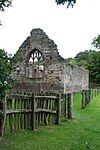
Blackfriars Priory Ruins
Hereford
Dominican Friary
c. 1276
10 June 1952
SO5119040419 52°03′36″N 2°42′48″W / 52.059988°N 2.71334°W / 52.059988; -2.71334 (Blackfriars Priory Ruins)
1293327 Blackfriars Priory Ruins More images
Lower Brockhampton Farmhouse Chapel Ruins
Brockhampton
Chapel
12th century
9 June 1967
SO6872056031 52°12′06″N 2°27′33″W / 52.201614°N 2.459106°W / 52.201614; -2.459106 (Lower Brockhampton Farmhouse Chapel Ruins)
1082377 Lower Brockhampton Farmhouse Chapel Ruins More images
Longworth Roman Catholic Chapel
Bartestree Chapel
c. 1400
11 October 1985
SO5684540595 52°03′43″N 2°37′51″W / 52.062041°N 2.630886°W / 52.062041; -2.630886 (Longworth Roman Catholic Chapel)
1099878 Longworth Roman Catholic Chapel More images
Rotherwas Chapel
Rotherwas, Dinedor
Roman Catholic Chapel
Earlier
26 January 1967
SO5361638333 52°02′29″N 2°40′40″W / 52.041444°N 2.677674°W / 52.041444; -2.677674 (Rotherwas Chapel)
1180032 Rotherwas Chapel More images
Rudhall Almshouses
Ross-on-Wye Almshouse
14th century
22 October 1952
SO5987124099 51°54′50″N 2°35′05″W / 51.913966°N 2.584815°W / 51.913966; -2.584815 (Rudhall Almshouses)
1098698 Rudhall Almshouses More images
Church of St Mary Ruins
Avenbury Church
Norman
12 April 1973
SO6615553153 52°10′32″N 2°29′47″W / 52.175588°N 2.496347°W / 52.175588; -2.496347 (Church of St Mary Ruins)
1349633 Church of St Mary Ruins More images
Ruxton Court
Llangarron Farmhouse
1963
18 May 1963
SO5409019471 51°52′19″N 2°40′06″W / 51.871911°N 2.668237°W / 51.871911; -2.668237 (Ruxton Court)
1099426 Ruxton Court More images
Serendipity
Ross-on-Wye
House
17th century
22 October 1952
SO5989224143 51°54′52″N 2°35′04″W / 51.914363°N 2.584515°W / 51.914363; -2.584515 (Serendipity)
1179457 Serendipity
Shell House
Ledbury
House
Early 18th century
18 September 1953
SO7100837848 52°02′18″N 2°25′27″W / 52.038269°N 2.424074°W / 52.038269; -2.424074 (Shell House)
1179949 Upload Photo
Shelwick Court
Shelwick , Holmer & ShelwickFarmhouse
15th century
13 October 1980
SO5272743023 52°05′01″N 2°41′29″W / 52.083531°N 2.691286°W / 52.083531; -2.691286 (Shelwick Court)
1099293 Shelwick Court More images
Shire Hall
Hereford Shire Hall
c1815-17
10 June 1952
SO5124139996 52°03′22″N 2°42′45″W / 52.05619°N 2.712536°W / 52.05619; -2.712536 (Shire Hall)
1297425 Shire Hall More images
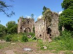
Snodhill Castle
Snodhill, Peterchurch
Bailey
12th century
17 January 1949
SO3224040354 52°03′27″N 2°59′23″W / 52.057406°N 2.989688°W / 52.057406; -2.989688 (Snodhill Castle)
1172756 Snodhill Castle More images
Snodhill Court Farmhouse
Snodhill, Peterchurch
Farmhouse
Early 17th century
17 January 1949
SO3192440342 52°03′26″N 2°59′39″W / 52.057259°N 2.994294°W / 52.057259; -2.994294 (Snodhill Court Farmhouse)
1099450 Upload Photo
St Katherine's Chapel, Hall and Stable
Ledbury
Hall House
1330-40
18 September 1953
SO7107737646 52°02′11″N 2°25′23″W / 52.036457°N 2.423051°W / 52.036457; -2.423051 (St Katherine's Chapel, Hall and Stable)
1179854 St Katherine's Chapel, Hall and Stable More images
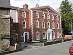
St Owen's Chambers and attached Railings
Hereford
House
Early 18th century
10 June 1952
SO5124939862 52°03′18″N 2°42′45″W / 52.054986°N 2.7124°W / 52.054986; -2.7124 (St Owen's Chambers and attached Railings)
1196871 St Owen's Chambers and attached Railings More images
Langstone Court Stables
Llangarron
Stable
c. 1700
18 May 1953
SO5345222043 51°53′42″N 2°40′40″W / 51.894981°N 2.677851°W / 51.894981; -2.677851 (Langstone Court Stables)
1099444 Upload Photo
Staick House
Eardisland
House
Late 16th century
20 February 1953
SO4204358743 52°13′26″N 2°51′00″W / 52.223828°N 2.849872°W / 52.223828; -2.849872 (Staick House)
1081908 Staick House More images
Street House
Weston under Penyard House
Early 18th century
18 May 1953
SO6321323596 51°54′35″N 2°32′10″W / 51.909675°N 2.536176°W / 51.909675; -2.536176 (Street House)
1099642 Upload Photo
Sufton Court
Mordiford
Country House
c. 1790
11 October 1985
SO5730537941 52°02′18″N 2°37′26″W / 52.038217°N 2.623845°W / 52.038217; -2.623845 (Sufton Court)
1179699 Sufton Court More images
Perrycroft Summerhouse, Gate and Boundary Walls
Colwall
Gate
c1893-1914
19 September 1984
SO7648141809 52°04′27″N 2°20′40″W / 52.074141°N 2.344561°W / 52.074141; -2.344561 (Perrycroft Summerhouse, Gate and Boundary Walls)
1349715 Upload Photo
Swan House and School View
Pembridge
House
Late 16th century or early 17th century
25 March 1987
SO3893358139 52°13′05″N 2°53′43″W / 52.218062°N 2.895285°W / 52.218062; -2.895285 (Swan House and School View)
1301065 Upload Photo
Swanstone Court and attached Outbuildings and Hop Kiln
Knapton Green, Dilwyn
House
17th century
20 February 1953
SO4415453001 52°10′21″N 2°49′05″W / 52.172429°N 2.818023°W / 52.172429; -2.818023 (Swanstone Court and attached Outbuildings and Hop Kiln)
1349817 Upload Photo
Bay Horse Inn
Bromyard , Bromyard and WinslowTimber Framed House
Early 17th century
25 October 1951
SO6541754651 52°11′20″N 2°30′26″W / 52.189009°N 2.507292°W / 52.189009; -2.507292 (Bay Horse Inn)
1349643 Bay Horse Inn More images
Church Cottage
Colwall
House
late C16-early 17th century
19 September 1984
SO7393442303 52°04′42″N 2°22′54″W / 52.078467°N 2.381759°W / 52.078467; -2.381759 (Church Cottage)
1302409 Upload Photo
Church House
Ledbury
Timber Framed House
c. 1600
18 September 1953
SO7119637721 52°02′14″N 2°25′17″W / 52.037137°N 2.421322°W / 52.037137; -2.421322 (Church House)
1301821 Church House More images
Dairy Farmhouse and attached Barn
Weobley
Farmhouse
15th century
20 February 1953
SO4001651810 52°09′41″N 2°52′42″W / 52.161287°N 2.878313°W / 52.161287; -2.878313 (Dairy Farmhouse and attached Barn)
1166641 Dairy Farmhouse and attached Barn
Feathers Hotel
Ledbury
House
Early 17th century
18 September 1953
SO7109837622 52°02′10″N 2°25′22″W / 52.036242°N 2.422742°W / 52.036242; -2.422742 (Feathers Hotel)
1301759 Feathers Hotel More images
Forbury
Leominster
House
Mid 18th century
24 July 1954
SO4973059176 52°13′43″N 2°44′15″W / 52.228477°N 2.737415°W / 52.228477; -2.737415 (Forbury)
1255417 Forbury More images
The Gables
Weobley
House
17th century
20 February 1953
SO4026451670 52°09′36″N 2°52′29″W / 52.160056°N 2.874663°W / 52.160056; -2.874663 (The Gables)
1081893 The Gables More images
The Green
Winslow , Bromyard and WinslowHouse
18th century
12 April 1973
SO6243754314 52°11′09″N 2°33′03″W / 52.185784°N 2.550843°W / 52.185784; -2.550843 (The Green)
1275549 Upload Photo
The Hall
Brampton Bryan House
17th century with earlier origins
11 June 1959
SO3699772589 52°20′52″N 2°55′35″W / 52.347736°N 2.926325°W / 52.347736; -2.926325 (The Hall)
1349754 The Hall More images
Market Hall
Pembridge
Market Hall
Later
16 October 1967
SO3902558101 52°13′04″N 2°53′38″W / 52.21773°N 2.893932°W / 52.21773; -2.893932 (Market Hall)
1081729 Market Hall More images
The Marsh
Eyton House
14th century
11 June 1959
SO4748961382 52°14′53″N 2°46′14″W / 52.248099°N 2.770565°W / 52.248099; -2.770565 (The Marsh)
1166720 Upload Photo
Master's House of St Katherines Hospital (Malvern Hills District Council Office)
Ledbury
House
Added/Altered each Century
5 November 1976
SO7104437658 52°02′12″N 2°25′25″W / 52.036563°N 2.423533°W / 52.036563; -2.423533 (Master's House of St Katherines Hospital (Malvern Hills District Council Office))
1301731 Upload Photo
Old Corner House
Weobley
House
1987
20 February 1953
SO4021851712 52°09′38″N 2°52′31″W / 52.160428°N 2.875343°W / 52.160428; -2.875343 (Old Corner House)
1166418 Old Corner House
Old Grammar School
Ledbury
Teachers House/Museum
Late 15th century
18 September 1953
SO7117137729 52°02′14″N 2°25′18″W / 52.037208°N 2.421687°W / 52.037208; -2.421687 (Old Grammar School)
1301848 Old Grammar School More images
Old Grammar School
Weobley
House
Mid 19th century
20 February 1953
SO4037151530 52°09′32″N 2°52′23″W / 52.158809°N 2.873074°W / 52.158809; -2.873074 (Old Grammar School)
1081901 Upload Photo
Old Manor
Weobley
Base Cruck House
14th century
20 February 1953
SO4014851699 52°09′37″N 2°52′35″W / 52.160304°N 2.876364°W / 52.160304; -2.876364 (Old Manor)
1349868 Old Manor More images
Pound Farmhouse
Kington Rural
Farmhouse
Late 19th century
19 August 1953
SO2894254175 52°10′52″N 3°02′26″W / 52.18123°N 3.040671°W / 52.18123; -3.040671 (Pound Farmhouse)
1166590 Upload Photo
The Rodd
Rodd, Nash and Little Brampton Country House
1629
19 August 1953
SO3222762607 52°15′27″N 2°59′40″W / 52.257439°N 2.994326°W / 52.257439; -2.994326 (The Rodd)
1081457 The Rodd More images
The Steppes
Ledbury
Timber Framed House
c. 1600
18 September 1953
SO7103937564 52°02′09″N 2°25′25″W / 52.035718°N 2.423598°W / 52.035718; -2.423598 (The Steppes)
1082838 The Steppes More images
The Throne
Weobley
Farmhouse
16th century
20 February 1953
SO4038051566 52°09′33″N 2°52′23″W / 52.159133°N 2.872949°W / 52.159133; -2.872949 (The Throne)
1081899 The Throne More images
Town Council Offices
Ledbury
House
c. 1600
18 September 1953
SO7112637731 52°02′14″N 2°25′20″W / 52.037223°N 2.422344°W / 52.037223; -2.422344 (Town Council Offices)
1082903 Town Council Offices More images
Vauld Farmhouse
The Vauld, Marden
Farmhouse
16th century
20 October 1952
SO5319249486 52°08′30″N 2°41′07″W / 52.141672°N 2.685391°W / 52.141672; -2.685391 (Vauld Farmhouse)
1179095 Vauld Farmhouse More images
Thinghill Grange
Withington Farmhouse
14th century
26 January 1967
SO5513145267 52°06′14″N 2°39′23″W / 52.103905°N 2.656502°W / 52.103905; -2.656502 (Thinghill Grange)
1348998 Upload Photo
Tower Hill House
Bromyard, Bromyard and Winslow
Timber Framed House
1630
25 October 1951
SO6547954455 52°11′14″N 2°30′23″W / 52.187251°N 2.506365°W / 52.187251; -2.506365 (Tower Hill House)
1349646 Tower Hill House More images
Town Hall
Hereford
Town Hall
c. 1904
22 October 1973
SO5119639918 52°03′20″N 2°42′47″W / 52.055484°N 2.713181°W / 52.055484; -2.713181 (Town Hall)
1279640 Town Hall More images
Tudor House Antiques
Ledbury
Timber Framed House
17th century
18 September 1953
SO7099237882 52°02′19″N 2°25′28″W / 52.038574°N 2.42431°W / 52.038574; -2.42431 (Tudor House Antiques)
1082864 Upload Photo
Ty Mawr
Longtown
Farmhouse
14th century
29 September 1952
SO3217226626 51°56′02″N 2°59′17″W / 51.933992°N 2.987959°W / 51.933992; -2.987959 (Ty Mawr)
1342122 Upload Photo
Unicorn House
Weobley House
Mid 19th century
20 February 1953
SO4031851572 52°09′33″N 2°52′26″W / 52.159181°N 2.873856°W / 52.159181; -2.873856 (Unicorn House)
1349837 Unicorn House More images
Upper Court
Clifford
Farmhouse
Mid 16th century
29 September 1952
SO2441745400 52°06′06″N 3°06′18″W / 52.10175°N 3.104884°W / 52.10175; -3.104884 (Upper Court)
1099497 Upload Photo
Upper House Farmhouse
Eardisley
Farmhouse
15th century
19 August 1953
SO3104849714 52°08′29″N 3°00′32″W / 52.141397°N 3.008968°W / 52.141397; -3.008968 (Upper House Farmhouse)
1157429 Upload Photo
Upper Limebrook Farmhouse
Limebrook, Wigmore
Farmhouse
15th century
11 June 1959
SO3749566567 52°17′37″N 2°55′04″W / 52.293661°N 2.917894°W / 52.293661; -2.917894 (Upper Limebrook Farmhouse)
1081743 Upload Photo
Upper Wyhall
Walford House
16th century
18 May 1953
SO5968920745 51°53′02″N 2°35′13″W / 51.883799°N 2.587067°W / 51.883799; -2.587067 (Upper Wyhall)
1167566 Upload Photo
Upton Court
Little Hereford
Farmhouse
late 16th century or early 17th century
11 June 1959
SO5513766027 52°17′26″N 2°39′33″W / 52.290534°N 2.65917°W / 52.290534; -2.65917 (Upton Court)
1167003 Upload Photo
Upton Court
Upton Bishop Farmhouse
14th century
18 May 1953
SO6578428155 51°57′03″N 2°29′57″W / 51.950827°N 2.499258°W / 51.950827; -2.499258 (Upton Court)
1166877 Upload Photo
Urishay Castle Chapel
Peterchurch
Private Chapel
Early 12th century
17 January 1949
SO3229637611 52°01′58″N 2°59′18″W / 52.032755°N 2.988327°W / 52.032755; -2.988327 (Urishay Castle Chapel)
1099487 Urishay Castle Chapel More images
Walsopthorne Farmhouse
Ashperton Farmhouse
c. 1600
26 March 1986
SO6502942320 52°04′41″N 2°30′42″W / 52.078127°N 2.511695°W / 52.078127; -2.511695 (Walsopthorne Farmhouse)
1302708 Walsopthorne Farmhouse
Walter Scott Charity School
Ross-on-Wye
Gate Pier
1717
22 October 1952
SO6005424030 51°54′48″N 2°34′56″W / 51.913358°N 2.582146°W / 51.913358; -2.582146 (Walter Scott Charity School)
1098685 Walter Scott Charity School
Weston Hall
Weston under Penyard
House
c. 1600
18 May 1953
SO6264323679 51°54′37″N 2°32′40″W / 51.910383°N 2.544471°W / 51.910383; -2.544471 (Weston Hall)
1099643 Weston Hall More images
Wharton Court
Wharton, Leominster
House
1603
24 July 1954
SO5111855862 52°11′56″N 2°43′00″W / 52.198811°N 2.716615°W / 52.198811; -2.716615 (Wharton Court)
1255348 Wharton Court
Whitbourne Hall
Meadow Green, Whitbourne
Country House
1860-2
9 April 1952
SO7042456768 52°12′30″N 2°26′03″W / 52.208334°N 2.434238°W / 52.208334; -2.434238 (Whitbourne Hall)
1275628 Whitbourne Hall More images
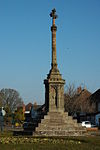
White Cross
Hereford
Cross
c. 1370
10 June 1952
SO4931140664 52°03′43″N 2°44′27″W / 52.062021°N 2.740781°W / 52.062021; -2.740781 (White Cross)
1196892 White Cross More images
White House and Attached Service Wing to Rear
St Margarets House
Early 19th century
29 September 1952
SO3494335639 52°00′55″N 2°56′58″W / 52.015345°N 2.949372°W / 52.015345; -2.949372 (White House and Attached Service Wing to Rear)
1266559 Upload Photo
White House Farmhouse
St Devereux Farmhouse
15th century
26 January 1967
SO4532232165 51°59′07″N 2°47′51″W / 51.985237°N 2.797599°W / 51.985237; -2.797599 (White House Farmhouse)
1099587 Upload Photo
Willersley Court
Willersley, Willersley and Winforton
Farmhouse
Early 16th century
19 August 1953
SO3117847429 52°07′15″N 3°00′24″W / 52.120873°N 3.006605°W / 52.120873; -3.006605 (Willersley Court)
1157569 Willersley Court More images
Woodhouse Farmhouse
Staplow , LedburyFarmhouse
14th century
18 November 1952
SO6899541212 52°04′06″N 2°27′13″W / 52.068403°N 2.453726°W / 52.068403; -2.453726 (Woodhouse Farmhouse)
1224740 Upload Photo
Wooding Farmhouse
Thornbury House
C16/17
9 April 1952
SO6174059618 52°14′00″N 2°33′42″W / 52.233419°N 2.561639°W / 52.233419; -2.561639 (Wooding Farmhouse)
1275938 Upload Photo
Worcester Lodge to Brockhampton Park
Brockhampton Park , BrockhamptonEstate Cottage
18th century
9 June 1967
SO6883354560 52°11′18″N 2°27′26″W / 52.188396°N 2.457317°W / 52.188396; -2.457317 (Worcester Lodge to Brockhampton Park)
1176667 Upload Photo

![]() Media related to Grade II* listed buildings in Herefordshire at Wikimedia Commons
Media related to Grade II* listed buildings in Herefordshire at Wikimedia Commons


