Name
Location
Type
Completed Date designated
Grid ref. Entry number Image
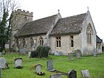
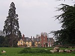
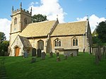
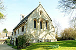
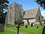
Church of St Margaret of Antioch
Alderton , Tewkesbury Church
Perpendicular
4 July 1960
SP0020533178 51°59′49″N 1°59′54″W / 51.997047°N 1.998424°W / 51.997047; -1.998424 (Church of St Margaret of Antioch)
1091731 Church of St Margaret of Antioch More images
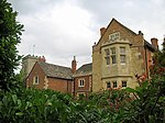
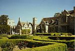
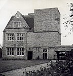
Dixton Manor
Dixton , AldertonManor House
16th century
4 July 1960
SO9845730485 51°58′22″N 2°01′26″W / 51.972832°N 2.023871°W / 51.972832; -2.023871 (Dixton Manor)
1091732 Dixton Manor More images
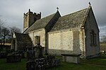
Church of St Nicholas
Ashchurch Village, Ashchurch Rural Anglican Church
12th century
4 July 1960
SO9275833414 51°59′57″N 2°06′25″W / 51.99912°N 2.106896°W / 51.99912; -2.106896 (Church of St Nicholas)
1153103 Church of St Nicholas More images
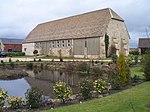
Dovecote circa 75 Metres South East of Manor Farm
Fiddington , Ashchurch RuralDovecote
1637
25 February 1987
SO9207630897 51°58′35″N 2°07′00″W / 51.976481°N 2.116771°W / 51.976481; -2.116771 (Dovecote circa 75 Metres South East of Manor Farm)
1091923 Upload Photo
Manor Farm
Fiddington , Ashchurch RuralFarmhouse
Late C18-early 19th century
25 February 1987
SO9205330957 51°58′37″N 2°07′02″W / 51.97702°N 2.117107°W / 51.97702; -2.117107 (Manor Farm)
1091922 Upload Photo
The Manor
Aston on Carrant , Ashchurch RuralHouse
1614
4 July 1960
SO9448934542 52°00′33″N 2°04′54″W / 52.009282°N 2.081701°W / 52.009282; -2.081701 (The Manor)
1340054 The Manor
Ashleworth Manor
White End, Ashleworth
Jettied House
c.1460 or later
10 January 1955
SO8189325734 51°55′47″N 2°15′53″W / 51.929821°N 2.264745°W / 51.929821; -2.264745 (Ashleworth Manor)
1091361 Ashleworth Manor More images
Foscombe
Ashleworth
Country House
c. 1860
26 November 1986
SO8009126722 51°56′19″N 2°17′28″W / 51.938642°N 2.291009°W / 51.938642; -2.291009 (Foscombe)
1340298 Foscombe More images
Tithe Barn, Ashleworth Court
Ashleworth
Cow House
19th century
10 January 1955
SO8178825205 51°55′30″N 2°15′58″W / 51.925062°N 2.266244°W / 51.925062; -2.266244 (Tithe Barn, Ashleworth Court)
1171121 Tithe Barn, Ashleworth Court More images
Dovecote 3m north of Bridge House
Bentham, Badgeworth
Dovecote
17th century
15 August 1973
SO9117716717 51°50′56″N 2°07′46″W / 51.848977°N 2.129491°W / 51.848977; -2.129491 (Dovecote 3m north of Bridge House)
1304753 Dovecote 3m north of Bridge House More images
Cleeve Hall
Bishop's Cleeve Bishops Palace
c. 1250
4 July 1960
SO9568827627 51°56′50″N 2°03′51″W / 51.947122°N 2.064144°W / 51.947122; -2.064144 (Cleeve Hall)
1303966 Cleeve Hall More images
Brockworth Court
Brockworth House
18th century
10 January 1955
SO8912117022 51°51′06″N 2°09′34″W / 51.851683°N 2.159348°W / 51.851683; -2.159348 (Brockworth Court)
1091764 Brockworth Court More images
Tithe Barn about 8m north-east of Brockworth Court
Brockworth
Barn
19th century
10 January 1955
SO8913917069 51°51′08″N 2°09′33″W / 51.852106°N 2.159088°W / 51.852106; -2.159088 (Tithe Barn about 8m north-east of Brockworth Court)
1152564 Tithe Barn about 8m north-east of Brockworth Court
Buckland Manor Hotel
Buckland Village, Buckland
Country House
17th century
4 July 1960
SP0814135964 52°01′19″N 1°52′58″W / 52.022037°N 1.88277°W / 52.022037; -1.88277 (Buckland Manor Hotel)
1091842 Buckland Manor Hotel More images
Unidentified Monuments in the Churchyard, about 1.5m north of West End of North Aisle, Church of St Michael
Buckland Village, Buckland
Chest Tomb
15th century
7 September 1987
SP0816736015 52°01′21″N 1°52′57″W / 52.022495°N 1.88239°W / 52.022495; -1.88239 (Unidentified Monuments in the Churchyard, about 1.5m north of West End of North Aisle, Church of St Michael)
1091843 Upload Photo
Chaceley Hall
Chaceley Kitchen
Late 19th century
10 January 1955
SO8421430577 51°58′24″N 2°13′52″W / 51.973434°N 2.231214°W / 51.973434; -2.231214 (Chaceley Hall)
1304298 Chaceley Hall More images
Church of St John the Baptist
Chaceley Village, Chaceley
Anglican Church
early-mid 19th century
10 January 1955
SO8551130670 51°58′28″N 2°12′44″W / 51.974306°N 2.212337°W / 51.974306; -2.212337 (Church of St John the Baptist)
1091455 Church of St John the Baptist More images
Grain House Farmhouse
Chaceley Village, Chaceley
Farmhouse
18th century
12 August 1985
SO8545630730 51°58′29″N 2°12′47″W / 51.974844°N 2.21314°W / 51.974844; -2.21314 (Grain House Farmhouse)
1153559 Upload Photo
Caledonia Manor House
Churchdown House
late C17-C18
29 October 1986
SO8840519898 51°52′39″N 2°10′11″W / 51.877526°N 2.169841°W / 51.877526; -2.169841 (Caledonia Manor House)
1305066 Upload Photo
Wightfield Manor
Deerhurst Farmhouse
1987
4 July 1960
SO8694228724 51°57′25″N 2°11′29″W / 51.956846°N 2.19143°W / 51.956846; -2.19143 (Wightfield Manor)
1088690 Wightfield Manor
Church of St Mary and Corpus Christi
Down Hatherley Village, Down Hatherley
Anglican Church
c. 1860
10 January 1955
SO8678722484 51°54′03″N 2°11′36″W / 51.90074°N 2.193444°W / 51.90074; -2.193444 (Church of St Mary and Corpus Christi)
1153578 Church of St Mary and Corpus Christi More images
Church of St Catherine
Wormington Village, Dumbleton Church
Anglo-Saxon
4 July 1960
SP0389136431 52°01′35″N 1°56′41″W / 52.026281°N 1.944702°W / 52.026281; -1.944702 (Church of St Catherine)
1091676 Church of St Catherine More images
Church of St Mary
Little Washbourne , DumbletonFormer Church
12th century
4 July 1960
SO9891433437 51°59′58″N 2°01′02″W / 51.999374°N 2.017229°W / 51.999374; -2.017229 (Church of St Mary)
1091716 Church of St Mary More images
Dumbleton Hall
Dumbleton Village, Dumbleton
Country House
c. 1830
28 August 1987
SP0132635626 52°01′09″N 1°58′56″W / 52.019055°N 1.982088°W / 52.019055; -1.982088 (Dumbleton Hall)
1091709 Dumbleton Hall More images
Church of St Mary the Virgin
Forthampton Village, Forthampton
Anglican Church
1788
10 January 1955
SO8588432573 51°59′29″N 2°12′25″W / 51.991425°N 2.206986°W / 51.991425; -2.206986 (Church of St Mary the Virgin)
1340277 Church of St Mary the Virgin More images
Forthampton Court
Forthampton
Country House
C12-mid 16th century
12 August 1985
SO8701231777 51°59′03″N 2°11′26″W / 51.984296°N 2.190528°W / 51.984296; -2.190528 (Forthampton Court)
1153626 Forthampton Court More images
Beach Hall (the Summer House) circa 5m south of Witcombe Park
Witcombe Park, Great Witcombe
Walled Garden
1697
4 July 1960
SO9115214434 51°49′42″N 2°07′47″W / 51.828451°N 2.129795°W / 51.828451; -2.129795 (Beach Hall (the Summer House) circa 5m south of Witcombe Park)
1304582 Upload Photo
Gretton Farmhouse
Gretton Farmhouse
16th century
4 July 1960
SP0097030291 51°58′16″N 1°59′14″W / 51.97109°N 1.987289°W / 51.97109; -1.987289 (Gretton Farmhouse)
1305102 Upload Photo
Hasfield Court
Hasfield Country House
Late 17th century
12 August 1985
SO8251627470 51°56′44″N 2°15′21″W / 51.945449°N 2.255773°W / 51.945449; -2.255773 (Hasfield Court)
1091444 Hasfield Court More images
Church of St Edward
Hawling Village, Hawling
Parish Church
Early 13th century
4 July 1960
SP0629322939 51°54′18″N 1°54′36″W / 51.904956°N 1.909936°W / 51.904956; -1.909936 (Church of St Edward)
1091850 Church of St Edward More images
Church of St Oswald's Tower
Lassington , Highnam Tower
Late 11th century
10 January 1955
SO7960321172 51°53′19″N 2°17′52″W / 51.888726°N 2.297777°W / 51.888726; -2.297777 (Church of St Oswald's Tower)
1091372 Church of St Oswald's Tower More images
Church of St Giles
Maisemore Parish Church
15th century
10 January 1955
SO8138021655 51°53′35″N 2°16′19″W / 51.893131°N 2.271984°W / 51.893131; -2.271984 (Church of St Giles)
1171533 Church of St Giles More images
Maisemore Court, Old Court, New Court
Maisemore Farmhouse
Early 17th century
26 November 1986
SO8139321582 51°53′33″N 2°16′18″W / 51.892475°N 2.271791°W / 51.892475; -2.271791 (Maisemore Court, Old Court, New Court)
1091377 Upload Photo
Church of St Peter
Minsterworth Parish Church
1869-70
26 November 1986
SO7731417005 51°51′04″N 2°19′51″W / 51.851173°N 2.330761°W / 51.851173; -2.330761 (Church of St Peter)
1340317 Church of St Peter More images
Church of St Mary
Prior's Norton, Norton
Anglican Church
1875-76
10 January 1955
SO8655424379 51°55′04″N 2°11′49″W / 51.917772°N 2.196905°W / 51.917772; -2.196905 (Church of St Mary)
1340308 Church of St Mary More images
Church of St Martin de Tours
Woolstone , Oxenton Church
14th century
4 December 1987
SO9611230244 51°58′14″N 2°03′29″W / 51.970654°N 2.058005°W / 51.970654; -2.058005 (Church of St Martin de Tours)
1091692 Church of St Martin de Tours More images
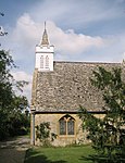
Chapel of Ease (St Michael)
Stanley Pontlarge , Prescott Church
12th century
4 July 1960
SO9992430202 51°58′13″N 2°00′09″W / 51.97029°N 2.002516°W / 51.97029; -2.002516 (Chapel of Ease (St Michael))
1340193 Chapel of Ease (St Michael) More images
The Cottage
Stanley Pontlarge, Prescott
House
Late C15-early 16th century
4 July 1960
SO9989830214 51°58′13″N 2°00′10″W / 51.970398°N 2.002894°W / 51.970398; -2.002894 (The Cottage)
1091663 Upload Photo
Church of St Lawrence
Sandhurst Village, Sandhurst
Anglican Church
1858
10 January 1955
SO8279423332 51°54′30″N 2°15′05″W / 51.908254°N 2.251521°W / 51.908254; -2.251521 (Church of St Lawrence)
1154346 Church of St Lawrence More images
Gate Piers in front of Wallsworth Hall
Sandhurst
Gate Pier
18th century
12 August 1985
SO8417122971 51°54′18″N 2°13′53″W / 51.90505°N 2.231487°W / 51.90505; -2.231487 (Gate Piers in front of Wallsworth Hall)
1091414 Gate Piers in front of Wallsworth Hall
Wallsworth Hall
Sandhurst
Country House
1753
12 August 1985
SO8411523003 51°54′19″N 2°13′56″W / 51.905336°N 2.232303°W / 51.905336; -2.232303 (Wallsworth Hall)
1340310 Wallsworth Hall More images
Church of St Paul
Shurdington Church
1655
4 July 1960
SO9211118825 51°52′05″N 2°06′58″W / 51.867944°N 2.115981°W / 51.867944; -2.115981 (Church of St Paul)
1091720 Church of St Paul More images
Snowshill Manor
Snowshill Village, Snowshill
Country House
17th century
4 July 1960
SP0967533841 52°00′11″N 1°51′38″W / 52.002925°N 1.860474°W / 52.002925; -1.860474 (Snowshill Manor)
1340081 Snowshill Manor More images
Church of the Ascension
Southam Church
12th century
4 December 1987
SO9698125557 51°55′43″N 2°02′43″W / 51.928519°N 2.045313°W / 51.928519; -2.045313 (Church of the Ascension)
1303115 Church of the Ascension More images
Manor Farmhouse
Southam
Farmhouse
1631
4 July 1960
SO9677325660 51°55′46″N 2°02′54″W / 51.929444°N 2.048339°W / 51.929444; -2.048339 (Manor Farmhouse)
1091667 Upload Photo
Southam Tithe Barn and Shelter Shed
Southam
Barn
C20
4 July 1960
SO9697625598 51°55′44″N 2°02′43″W / 51.928888°N 2.045386°W / 51.928888; -2.045386 (Southam Tithe Barn and Shelter Shed)
1091668 Southam Tithe Barn and Shelter Shed More images
The De La Bere Hotel
Southam
Country House
c. 1500
4 July 1960
SO9722925350 51°55′36″N 2°02′30″W / 51.92666°N 2.041705°W / 51.92666; -2.041705 (The De La Bere Hotel)
1155737 The De La Bere Hotel More images
Old Manor Farmhouse
Stanton Farmhouse
Late 16th century
4 July 1960
SP0682434241 52°00′24″N 1°54′07″W / 52.006563°N 1.901997°W / 52.006563; -1.901997 (Old Manor Farmhouse)
1154068 Upload Photo
Stables, Wormington Grange
Stanton
Dwelling
Late 19th century
4 July 1960
SP0461934646 52°00′37″N 1°56′03″W / 52.010227°N 1.934115°W / 52.010227; -1.934115 (Stables, Wormington Grange)
1091824 Upload Photo
The Manor and Warne Cottage
Stanton
House
Early 16th century
4 July 1960
SP0677034191 52°00′22″N 1°54′10″W / 52.006114°N 1.902785°W / 52.006114; -1.902785 (The Manor and Warne Cottage)
1091838 The Manor and Warne Cottage More images
Wormington Grange
Stanton
Country House
1770s
4 July 1960
SP0467534570 52°00′34″N 1°56′00″W / 52.009543°N 1.9333°W / 52.009543; -1.9333 (Wormington Grange)
1340084 Wormington Grange More images
Church of St Peter
Stanway Village, Stanway
Church
1797
4 July 1960
SP0607432364 51°59′23″N 1°54′47″W / 51.989696°N 1.912956°W / 51.989696; -1.912956 (Church of St Peter)
1154342 Church of St Peter More images
Papermill Farmhouse
Stanway
Farmhouse
13th century
7 September 1987
SP0714732375 51°59′23″N 1°53′50″W / 51.989783°N 1.89733°W / 51.989783; -1.89733 (Papermill Farmhouse)
1091800 Upload Photo
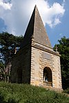
Pyramid in Grounds of Stanway House, about 300m to the East
Stanway Village, Stanway
Garden Building
1750
7 September 1987
SP0644632422 51°59′25″N 1°54′27″W / 51.990214°N 1.907537°W / 51.990214; -1.907537 (Pyramid in Grounds of Stanway House, about 300m to the East)
1303832 Pyramid in Grounds of Stanway House, about 300m to the East More images
Church of St Catherine
Staverton church
late C20
4 July 1960
SO8900323598 51°54′39″N 2°09′41″W / 51.910804°N 2.161273°W / 51.910804; -2.161273 (Church of St Catherine)
1304748 Church of St Catherine More images
Unidentified Monument in the Churchyard of the Church of St John the Baptist, circa 2.5m south of the Porch
Tredington , Stoke Orchard Chest Tomb
late C17-early 18th century
25 February 1987
SO9049729481 51°57′49″N 2°08′23″W / 51.963725°N 2.139719°W / 51.963725; -2.139719 (Unidentified Monument in the Churchyard of the Church of St John the Baptist, circa 2.5m south of the Porch)
1091884 Upload Photo
Wadfield House and Side Walls to Forecourt
Sudeley House
c. 1705
4 July 1960
SP0255826394 51°56′10″N 1°57′51″W / 51.936048°N 1.964201°W / 51.936048; -1.964201 (Wadfield House and Side Walls to Forecourt)
1091780 Upload Photo
Church of St Margaret
Alstone Village, Teddington Church
Late 12th century
4 July 1960
SO9826232459 51°59′26″N 2°01′36″W / 51.990579°N 2.026721°W / 51.990579; -2.026721 (Church of St Margaret)
1340159 Church of St Margaret More images
Manor Farmhouse
Alstone Village, Teddington
Farmhouse
C20
4 December 1987
SO9827132511 51°59′28″N 2°01′36″W / 51.991047°N 2.02659°W / 51.991047; -2.02659 (Manor Farmhouse)
1091671 Upload Photo
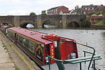
Abbey Mill
River Avon, Tewkesbury
Banqueting House
1952
4 March 1952
SO8891732544 51°59′28″N 2°09′46″W / 51.991234°N 2.162815°W / 51.991234; -2.162815 (Abbey Mill)
1201285 Abbey Mill More images
Avonside
Tewkesbury
Row House
Mid 18th century
4 March 1952
SO8939033121 51°59′47″N 2°09′21″W / 51.996431°N 2.155944°W / 51.996431; -2.155944 (Avonside)
1201256 Upload Photo
Bell Hotel
Tewkesbury
Inn
1696
4 March 1952
SO8898632499 51°59′27″N 2°09′43″W / 51.990831°N 2.161808°W / 51.990831; -2.161808 (Bell Hotel)
1201210 Bell Hotel More images
Berkeley Arms and Outbuilding
Tewkesbury
Hotel
C20
4 March 1952
SO8926832631 51°59′31″N 2°09′28″W / 51.992023°N 2.157706°W / 51.992023; -2.157706 (Berkeley Arms and Outbuilding)
1201203 Berkeley Arms and Outbuilding More images
Black Bear Inn
Tewkesbury
Steps
Early 16th century
4 March 1952
SO8940733177 51°59′49″N 2°09′21″W / 51.996935°N 2.155699°W / 51.996935; -2.155699 (Black Bear Inn)
1207382 Black Bear Inn More images
Churchyard Gates
Abbey Precincts, Tewkesbury
Gate
1750
4 March 1952
SO8900832486 51°59′27″N 2°09′41″W / 51.990714°N 2.161488°W / 51.990714; -2.161488 (Churchyard Gates)
1206025 Churchyard Gates
Clarence House
Tewkesbury
Cruck House
Early 16th century
4 March 1952
SO8931032762 51°59′36″N 2°09′26″W / 51.993202°N 2.157098°W / 51.993202; -2.157098 (Clarence House)
1052276 Clarence House More images
Craik House
Tewkesbury
Jettied House
LATE 15th century or early 16th century
4 March 1952
SO8915832589 51°59′30″N 2°09′34″W / 51.991643°N 2.159306°W / 51.991643; -2.159306 (Craik House)
1205867 Craik House More images
Cross House
Tewkesbury
Apartment
1994
4 March 1952
SO8926432698 51°59′33″N 2°09′28″W / 51.992625°N 2.157766°W / 51.992625; -2.157766 (Cross House)
1201228 Cross House More images
Golden Key House
Tewkesbury
Jettied House
16th century
4 March 1952
SO8927532760 51°59′35″N 2°09′27″W / 51.993183°N 2.157608°W / 51.993183; -2.157608 (Golden Key House)
1206326 Golden Key House More images
Jessop House Hotel
Tewkesbury
Row House
Early 18th century
4 March 1952
SO8904732543 51°59′28″N 2°09′39″W / 51.991227°N 2.160921°W / 51.991227; -2.160921 (Jessop House Hotel)
1205712 Jessop House Hotel More images
King John's Bridge
Tewkesbury
Steps
c. 1190
4 March 1952
SO8937133231 51°59′51″N 2°09′22″W / 51.997419°N 2.156225°W / 51.997419; -2.156225 (King John's Bridge)
1201287 King John's Bridge More images
King John's Castle
The Mythe, Tewkesbury
House
Mid 16th century
4 March 1952
SO8890634119 52°00′19″N 2°09′47″W / 52.005394°N 2.163026°W / 52.005394; -2.163026 (King John's Castle)
1201162 King John's Castle More images
Malthouse to rear of No 23, Barton Street
Tewkesbury
Malt House
17th century
4 March 1952
SO8941532738 51°59′35″N 2°09′20″W / 51.992988°N 2.155568°W / 51.992988; -2.155568 (Malthouse to rear of No 23, Barton Street)
1281018 Upload Photo
Mythe Bridge
The Mythe, Tewkesbury
Road Bridge
1825
4 March 1952
SO8887333737 52°00′07″N 2°09′49″W / 52.001959°N 2.163495°W / 52.001959; -2.163495 (Mythe Bridge)
1282810 Mythe Bridge More images
Newton House
Tewkesbury
Open Hall House
late 14th century or 15th century
4 March 1952
SO8917532569 51°59′29″N 2°09′33″W / 51.991464°N 2.159058°W / 51.991464; -2.159058 (Newton House)
1280642 Upload Photo
Nottingham Arms
Tewkesbury
Jettied House
Early 16th century
4 March 1952
SO8931932823 51°59′38″N 2°09′25″W / 51.99375°N 2.156969°W / 51.99375; -2.156969 (Nottingham Arms)
1201269 Nottingham Arms More images
Old Baptist Chapel
Tewkesbury
House
1720
4 March 1952
SO8902832562 51°59′29″N 2°09′40″W / 51.991398°N 2.161199°W / 51.991398; -2.161199 (Old Baptist Chapel)
1207425 Old Baptist Chapel More images
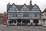
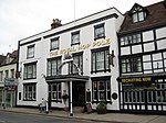
Royal Hop Pole Hotel
Tewkesbury
Jettied House
Late 15th century
4 March 1952
SO8920532630 51°59′31″N 2°09′31″W / 51.992013°N 2.158623°W / 51.992013; -2.158623 (Royal Hop Pole Hotel)
1205936 Royal Hop Pole Hotel More images
Tewkesbury Museum and attached Railings
Tewkesbury
Jettied House
early to mid 17th century
4 March 1952
SO8943432702 51°59′34″N 2°09′19″W / 51.992665°N 2.15529°W / 51.992665; -2.15529 (Tewkesbury Museum and attached Railings)
1204935 Tewkesbury Museum and attached RailingsMore images
12 High Street (The Old Fleece)
Tewkesbury
Jettied House
Early 17th century
4 March 1952
SO8929032798 51°59′37″N 2°09′27″W / 51.993525°N 2.157391°W / 51.993525; -2.157391 (12 High Street (The Old Fleece))
1201243 12 High Street (The Old Fleece) More images
Town Hall
Tewkesbury
Town Hall
1788
4 March 1952
SO8929232835 51°59′38″N 2°09′27″W / 51.993858°N 2.157363°W / 51.993858; -2.157363 (Town Hall)
1206399 Town Hall More images
Tudor Hotel
Tewkesbury
House
Early 17th century
4 March 1952
SO8936533048 51°59′45″N 2°09′23″W / 51.995774°N 2.156306°W / 51.995774; -2.156306 (Tudor Hotel)
1280099 Tudor Hotel More images
Young Mens Christian Association
Tewkesbury
Row House
17th century or earlier
4 March 1952
SO8922032641 51°59′32″N 2°09′30″W / 51.992112°N 2.158405°W / 51.992112; -2.158405 (Young Mens Christian Association)
1201226 Young Mens Christian Association More images
No 9, Church Street including Yard Wall
Tewkesbury
Jettied House
14th century or early 15th century
4 March 1952
SO8925632635 51°59′31″N 2°09′28″W / 51.992059°N 2.157881°W / 51.992059; -2.157881 (No 9, Church Street including Yard Wall)
1280735 No 9, Church Street including Yard Wall More images
10, Church Street
Tewkesbury
House
mid/late 18th century
4 March 1952
SO8925332631 51°59′31″N 2°09′29″W / 51.992023°N 2.157924°W / 51.992023; -2.157924 (10, Church Street)
1282789 10, Church Street More images
15 and 16, Church Street
Tewkesbury
Jettied House
Late 15th century
4 March 1952
SO8922932613 51°59′31″N 2°09′30″W / 51.99186°N 2.158273°W / 51.99186; -2.158273 (15 and 16, Church Street)
1280681 15 and 16, Church Street More images
No 77, Church St including Gate Piers
Tewkesbury
Row House
Early 18th century
4 March 1952
SO8913532573 51°59′29″N 2°09′35″W / 51.991499°N 2.159641°W / 51.991499; -2.159641 (No 77, Church St including Gate Piers)
1280534 Upload Photo
88 and 88a, Church Street
Tewkesbury
House
16th century
4 March 1952
SO8917732603 51°59′30″N 2°09′33″W / 51.991769°N 2.15903°W / 51.991769; -2.15903 (88 and 88a, Church Street)
1205905 Upload Photo
89 and 90, Church Street
Tewkesbury
Jettied House
15th century or early 16th century
4 March 1952
SO8918032606 51°59′30″N 2°09′32″W / 51.991796°N 2.158987°W / 51.991796; -2.158987 (89 and 90, Church Street)
1201225 89 and 90, Church Street More images
91 and 92, Church Street
Tewkesbury
Jettied House
1564
4 March 1952
SO8919232615 51°59′31″N 2°09′32″W / 51.991878°N 2.158812°W / 51.991878; -2.158812 (91 and 92, Church Street)
1205919 91 and 92, Church Street More images
100 Church Street
Tewkesbury
Jettied House
1664
4 March 1952
SO8924032661 51°59′32″N 2°09′29″W / 51.992292°N 2.158115°W / 51.992292; -2.158115 (100 Church Street)
1280450 100 Church Street More images
1, High Street
Tewkesbury
Row House
Early 18th century
4 March 1952
SO8926632710 51°59′34″N 2°09′28″W / 51.992733°N 2.157737°W / 51.992733; -2.157737 (1, High Street)
1201239 Upload Photo
2, High Street
Tewkesbury
Row House
Early 18th century
4 March 1952
SO8926532720 51°59′34″N 2°09′28″W / 51.992823°N 2.157752°W / 51.992823; -2.157752 (2, High Street)
1280304 Upload Photo
15, High Street
Tewkesbury
House
Late 16th century
4 March 1952
SO8929232812 51°59′37″N 2°09′27″W / 51.993651°N 2.157362°W / 51.993651; -2.157362 (15, High Street)
1206372 15, High Street More images
39 and 40 High Street
Tewkesbury
Row House
c. 1730
4 March 1952
SO8933332961 51°59′42″N 2°09′24″W / 51.994991°N 2.15677°W / 51.994991; -2.15677 (39 and 40 High Street)
1282770 39 and 40 High Street More images
132, High Street
Tewkesbury
Jettied House
Early 16th century
4 March 1952
SO8932032803 51°59′37″N 2°09′25″W / 51.99357°N 2.156954°W / 51.99357; -2.156954 (132, High Street)
1282779 132, High Street More images
135 High Street
Tewkesbury
Jettied House
16th century
4 March 1952
SO8930932789 51°59′36″N 2°09′26″W / 51.993444°N 2.157114°W / 51.993444; -2.157114 (135 High Street)
1372300 135 High Street More images
137 High Street
Tewkesbury
Row House
15th century
4 March 1952
SO8930732780 51°59′36″N 2°09′26″W / 51.993363°N 2.157143°W / 51.993363; -2.157143 (137 High Street)
1052263 137 High Street
154, High Street
Tewkesbury
Jettied House
Late 15th century
4 March 1952
SO8928632702 51°59′34″N 2°09′27″W / 51.992662°N 2.157446°W / 51.992662; -2.157446 (154, High Street)
1201274 154, High Street More images
155, High Street
Tewkesbury
Jettied House
late 15th century or early 16th century
4 March 1952
SO8928532698 51°59′33″N 2°09′27″W / 51.992626°N 2.15746°W / 51.992626; -2.15746 (155, High Street)
1282742 155, High Street More images
22 Barton Street
Tewkesbury
Jettied House
16th century
4 March 1952
SO8940932718 51°59′34″N 2°09′20″W / 51.992808°N 2.155655°W / 51.992808; -2.155655 (22 Barton Street)
1204795 Upload Photo
81 and 82, Barton Street
Tewkesbury
Cruck House
14th century
4 March 1952
SO8932932678 51°59′33″N 2°09′25″W / 51.992447°N 2.156819°W / 51.992447; -2.156819 (81 and 82, Barton Street)
1205058 Upload Photo
1 and 2, Mill Bank
Tewkesbury
Jettied House
late 15th century or early 16th century
4 March 1952
SO8894632556 51°59′29″N 2°09′45″W / 51.991342°N 2.162393°W / 51.991342; -2.162393 (1 and 2, Mill Bank)
1201278 1 and 2, Mill Bank
Toddington House
Toddington House
Early 17th century
4 July 1960
SP0345633079 51°59′46″N 1°57′04″W / 51.996147°N 1.951074°W / 51.996147; -1.951074 (Toddington House)
1303593 Toddington House More images
Church of St Mary Magdalene
Twyning Village, Twyning
Anglican Church
12th century
4 July 1960
SO8937336084 52°01′23″N 2°09′23″W / 52.02307°N 2.156285°W / 52.02307; -2.156285 (Church of St Mary Magdalene)
1303825 Church of St Mary Magdalene More images
Church of St Mary Magdalene
Elmstone Hardwicke , Uckington Church
12th century
4 July 1960
SO9203226065 51°55′59″N 2°07′02″W / 51.933037°N 2.117298°W / 51.933037; -2.117298 (Church of St Mary Magdalene)
1340067 Church of St Mary Magdalene More images
Abbey Old House
Winchcombe Abbey
Founded 972
4 July 1960
SP0234028362 51°57′13″N 1°58′02″W / 51.953743°N 1.967359°W / 51.953743; -1.967359 (Abbey Old House)
1305465 Upload Photo
Corndean Hall
Winchcombe
Villa
Early 19th century
31 October 1984
SP0160426192 51°56′03″N 1°58′41″W / 51.934235°N 1.978078°W / 51.934235; -1.978078 (Corndean Hall)
1171711 Corndean Hall
The Follies
Winchcombe
Row House
17th century
4 July 1960
SP0266628524 51°57′19″N 1°57′45″W / 51.955198°N 1.962614°W / 51.955198; -1.962614 (The Follies)
1172038 Upload Photo
Tithe Barn 60 Metres South of Postlip Hall
Postlip, Winchcombe
Assembly Hall
1960
4 July 1960
SO9989326784 51°56′22″N 2°00′11″W / 51.93956°N 2.002965°W / 51.93956; -2.002965 (Tithe Barn 60 Metres South of Postlip Hall)
1091478 Tithe Barn 60 Metres South of Postlip Hall
Ye Old Corner Cupboard
Winchcombe
Inn (formerly farmhouse)
16th century
4 July 1960
SP0203228138 51°57′06″N 1°58′19″W / 51.95173°N 1.971842°W / 51.95173; -1.971842 (Ye Old Corner Cupboard)
1091517 Ye Old Corner Cupboard More images
The Manor Farmhouse (two occupations)
Woodmancote Farmhouse
C16-early 17th century
4 July 1960
SO9748227255 51°56′38″N 2°02′17″W / 51.943788°N 2.03804°W / 51.943788; -2.03804 (The Manor Farmhouse (two occupations))
1091637 Upload Photo

