Name
Location
Type
Completed Date designated
Grid ref. Entry number Image
Aylmer
Higher Brixham, Brixham , Torbay
House
Early 19th century
18 October 1949
SX9162554857 50°23′01″N 3°31′33″W / 50.383586°N 3.525706°W / 50.383586; -3.525706 (Aylmer)
1218018 Upload Photo
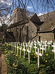
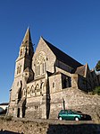
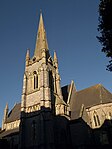
Church of St Mary the Virgin
Higher Brixham, Brixham
Parish Church
possibly Medieval
18 October 1949
SX9212055119 50°23′10″N 3°31′08″W / 50.386033°N 3.518821°W / 50.386033; -3.518821 (Church of St Mary the Virgin)
1195156 Church of St Mary the Virgin More images
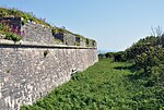
Ramparts, Counterscarp Revetment, Glacis, Musketry Wall of Southern Fort
Berry Head, Brixham
Wall
1794-1804
18 October 1949
SX9411256123 50°23′44″N 3°29′28″W / 50.395421°N 3.491094°W / 50.395421; -3.491094 (Ramparts, Counterscarp Revetment, Glacis, Musketry Wall of Southern Fort)
1293272 Upload Photo
Ramparts, Revetments, North Battery Platform, North and South Musketry Walls of Northern Fort
Berry Head, Brixham
Gate
1795-1807
18 October 1949
SX9427856521 50°23′57″N 3°29′20″W / 50.399029°N 3.488872°W / 50.399029; -3.488872 (Ramparts, Revetments, North Battery Platform, North and South Musketry Walls of Northern Fort)
1208194 Ramparts, Revetments, North Battery Platform, North and South Musketry Walls of Northern Fort
Beacon Terrace
Torbay
Terrace
1833
20 November 1952
SX9189163180 50°27′30″N 3°31′28″W / 50.458458°N 3.524366°W / 50.458458; -3.524366 (Beacon Terrace)
1293347 Upload Photo
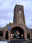
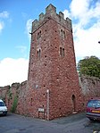
Bishops Palace Walls and Tower
Torbay
Bishops Palace
14th century
13 January 1951
SX8863060750 50°26′10″N 3°34′10″W / 50.436003°N 3.569565°W / 50.436003; -3.569565 (Bishops Palace Walls and Tower)
1208109 Bishops Palace Walls and TowerMore images
Blagdon Manor
Torbay
Hall House
15th century
13 May 1951
SX8558860203 50°25′50″N 3°36′44″W / 50.4305°N 3.612215°W / 50.4305; -3.612215 (Blagdon Manor)
1298262 Upload Photo
Church of Our Lady, Help of Christians and St Denis
Torbay
Church
1865
14 February 1972
SX9191265878 50°28′58″N 3°31′29″W / 50.482717°N 3.524851°W / 50.482717; -3.524851 (Church of Our Lady, Help of Christians and St Denis)
1206830 Church of Our Lady, Help of Christians and St Denis More images
Church of St Andrew
Torbay
Greek Orthodox Church
13th century
20 November 1952
SX9095264308 50°28′06″N 3°32′17″W / 50.468425°N 3.537918°W / 50.468425; -3.537918 (Church of St Andrew)
1206837 Church of St Andrew More images
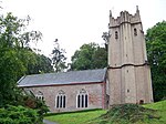
Church of St George and St Mary
Cockington , TorbayParish Church
Early 13th century
20 November 1952
SX8907563784 50°27′48″N 3°33′51″W / 50.463362°N 3.564201°W / 50.463362; -3.564201 (Church of St George and St Mary)
1208547 Church of St George and St Mary More images
Church of St Matthew
Chelston Parish Church
1895-1904
14 February 1972
SX9004563720 50°27′47″N 3°33′02″W / 50.462969°N 3.550521°W / 50.462969; -3.550521 (Church of St Matthew)
1218480 Church of St Matthew More images
Church of St Mary the Virgin
Churston Ferrers Parish Church
Probably 15th century
9 February 1961
SX9042756419 50°23′51″N 3°32′35″W / 50.397406°N 3.543005°W / 50.397406; -3.543005 (Church of St Mary the Virgin)
1293060 Church of St Mary the Virgin More images
Churston Court
Churston Ferrers House
Late medieval
11 November 1952
SX9039356414 50°23′50″N 3°32′37″W / 50.397355°N 3.543482°W / 50.397355; -3.543482 (Churston Court)
1208761 Churston Court More images
Lupton House
Churston Ferrers
House
Rebuilt circa 1772
18 October 1949
SX9026355002 50°23′05″N 3°32′42″W / 50.384637°N 3.544898°W / 50.384637; -3.544898 (Lupton House)
1195173 Lupton House More images
Cockington Court
Cockington, Torbay
Country House
16th century
20 November 1952
SX8907663845 50°27′50″N 3°33′51″W / 50.46391°N 3.564205°W / 50.46391; -3.564205 (Cockington Court)
1206759 Cockington Court More images
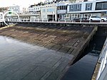
D-day Embarkation Slipways and adjoining Section of Quay Wall
Torbay
Wall
1943
6 June 2000
SX9181363205 50°27′31″N 3°31′32″W / 50.458669°N 3.525472°W / 50.458669; -3.525472 (D-day Embarkation Slipways and adjoining Section of Quay Wall)
1382072 D-day Embarkation Slipways and adjoining Section of Quay Wall
Hatley St George
Torbay
Villa
1846
10 January 1975
SX9298863362 50°27′37″N 3°30′32″W / 50.460296°N 3.50897°W / 50.460296; -3.50897 (Hatley St George)
1209844 Upload Photo
Hesketh Crescent and attached Railings & No 1-15 and attached Railings
Torbay
Apartment
1952
20 November 1952
SX9301063138 50°27′30″N 3°30′31″W / 50.458286°N 3.508596°W / 50.458286; -3.508596 (Hesketh Crescent and attached Railings & No 1-15 and attached Railings)
1206808 Upload Photo
Parish Church of St Matthias
Ilsham Church Hall
C20
10 January 1975
SX9319164173 50°28′03″N 3°30′23″W / 50.467624°N 3.506342°W / 50.467624; -3.506342 (Parish Church of St Matthias)
1206840 Parish Church of St Matthias More images
Ilsham Manor Oratory
Ilsham Oratory
15th century or earlier
20 November 1952
SX9380664125 50°28′02″N 3°29′52″W / 50.467304°N 3.497666°W / 50.467304; -3.497666 (Ilsham Manor Oratory)
1206789 Upload Photo
Kirkham House
Paignton , TorbayHouse
1520-1560
13 March 1951
SX8858560991 50°26′17″N 3°34′13″W / 50.438161°N 3.57027°W / 50.438161; -3.57027 (Kirkham House)
1207782 Kirkham House More images
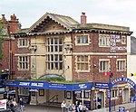
Little Theatre
Torquay, Torbay
Booking Office
1856-1857
10 January 1975
SX9255163076 50°27′28″N 3°30′54″W / 50.457645°N 3.515042°W / 50.457645; -3.515042 (Little Theatre)
1218459 Little Theatre More images
Manor Farmhouse including Remains of Linhay at Rear
Barton, Torbay
Farmhouse
Early 16th century
10 January 1975
SX9092567189 50°29′40″N 3°32′21″W / 50.49432°N 3.53914°W / 50.49432; -3.53914 (Manor Farmhouse including Remains of Linhay at Rear)
1206772 Upload Photo
Oldway Mansion
Paignton, Torbay
House
1870s
13 May 1951
SX8878461532 50°26′35″N 3°34′03″W / 50.443062°N 3.56763°W / 50.443062; -3.56763 (Oldway Mansion)
1195207 Oldway Mansion More images
Parish Church of St Luke
Torbay
Church
1863
14 February 1972
SX9130363948 50°27′55″N 3°31′58″W / 50.465254°N 3.53287°W / 50.465254; -3.53287 (Parish Church of St Luke)
1218424 Parish Church of St Luke More images
Parish Church of St Mary
Collaton St Mary Parish Church
1864-1866
13 March 1951
SX8642760176 50°25′50″N 3°36′01″W / 50.43042°N 3.600399°W / 50.43042; -3.600399 (Parish Church of St Mary)
1207472 Parish Church of St Mary More images
Parish Church of St Mary Magdalene
Torbay
Church
1843-1849
10 January 1975
SX9128964366 50°28′08″N 3°31′59″W / 50.469009°N 3.533189°W / 50.469009; -3.533189 (Parish Church of St Mary Magdalene)
1219197 Parish Church of St Mary Magdalene More images
Torbay Cinema
Torbay
Cinema
1912
20 February 1991
SX8899860650 50°26′07″N 3°33′52″W / 50.435173°N 3.564356°W / 50.435173; -3.564356 (Torbay Cinema)
1208209 Torbay Cinema More images
1–15 Wellswood Park Road
Torbay
Terrace
1853
20 November 1952
SX9295864064 50°28′00″N 3°30′35″W / 50.466602°N 3.509593°W / 50.466602; -3.509593 (1–15 Wellswood Park Road)
1206876 Upload Photo
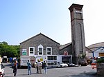
163 Newton Road
Torquay , TorbayAtmospheric Railway Engine House
1847-1848
10 January 1975
SX8990166204 50°29′07″N 3°33′12″W / 50.485273°N 3.553281°W / 50.485273; -3.553281 (163 Newton Road)
1217986 163 Newton Road More images

