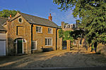
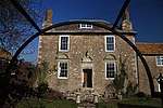
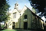
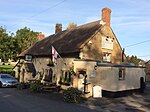
Name
Location
Type
Completed Date designated
Grid ref. Entry number Image
Abbotsbury Abbey Abbott's Walk
Abbotsbury Abbey building14th century
26 January 1956
SY5780485177 50°39′53″N 2°35′54″W / 50.664725°N 2.598398°W / 50.664725; -2.598398 (Abbotsbury Abbey Abbott's Walk)
1118746 Abbotsbury Abbey Abbott's Walk
Abbotsbury Abbey Gatehouse
Abbotsbury
Abbey gatehouse
14th century
26 January 1956
SY5769685208 50°39′54″N 2°36′00″W / 50.664996°N 2.599929°W / 50.664996; -2.599929 (Abbotsbury Abbey Gatehouse)
1118741 Upload Photo
Abbotsbury Abbey Pigeon House
Abbotsbury
Dovecote 15th century
26 January 1956
SY5787085035 50°39′48″N 2°35′51″W / 50.663453°N 2.597448°W / 50.663453; -2.597448 (Abbotsbury Abbey Pigeon House)
1172244 Upload Photo
Abbotsbury Abbey Pynion End Gable
Abbotsbury
Abbey gable end
Late 14th century
26 January 1956
SY5778385146 50°39′52″N 2°35′55″W / 50.664445°N 2.598691°W / 50.664445; -2.598691 (Abbotsbury Abbey Pynion End Gable)
1172220 Abbotsbury Abbey Pynion End Gable More images
Rodden House
Rodden, Abbotsbury
House
Early 18th century
26 January 1956
SY6111984215 50°39′23″N 2°33′05″W / 50.656306°N 2.551394°W / 50.656306; -2.551394 (Rodden House)
1324196 Rodden House More images
The Manor House
Abbotsbury
Manor house Late 16th century
26 January 1956
SY5771285245 50°39′55″N 2°35′59″W / 50.66533°N 2.599707°W / 50.66533; -2.599707 (The Manor House)
1324227 The Manor House
Parish Church of St Pancras
Alton Pancras Anglican parish church 15th-century tower
26 January 1956
ST6988002403 50°49′13″N 2°25′44″W / 50.82038°N 2.428953°W / 50.82038; -2.428953 (Parish Church of St Pancras)
1118915 Parish Church of St Pancras More images
The Manor House
Alton Pancras
House
c. 1730–44
26 January 1956
ST6991902384 50°49′13″N 2°25′42″W / 50.820211°N 2.428398°W / 50.820211; -2.428398 (The Manor House)
1118879 The Manor House
Parish Church of St Michael
Askerswell Anglican parish church
15th-century tower
5 September 1960
SY5299492588 50°43′52″N 2°40′03″W / 50.730996°N 2.667396°W / 50.730996; -2.667396 (Parish Church of St Michael)
1213455 Parish Church of St Michael More images
South Eggardon Farmhouse
South Eggardon Farm, Askerswell
Farmhouse
16th century or earlier
7 August 1952
SY5358093749 50°44′29″N 2°39′33″W / 50.741483°N 2.65924°W / 50.741483; -2.65924 (South Eggardon Farmhouse)
1118792 South Eggardon Farmhouse
Dovecote 15 Metres North West of Athelhampton Hall
Athelhampton Dovecote
Early 16th century
26 January 1956
SY7701594289 50°44′52″N 2°19′38″W / 50.747744°N 2.327156°W / 50.747744; -2.327156 (Dovecote 15 Metres North West of Athelhampton Hall)
1119127 Dovecote 15 Metres North West of Athelhampton Hall More images
Garden Pavilions, Walls and Terraces Immediately South and South West of Athelhampton Hall, Including Wall and Archway Linking Gardens to Stables
Athelhampton
Pavilions c. 1891
10 March 1987
SY7703394188 50°44′49″N 2°19′37″W / 50.746837°N 2.326895°W / 50.746837; -2.326895 (Garden Pavilions, Walls and Terraces Immediately South and South West of Athelhampton Hall, Including Wall and Archway Linking Gardens to Stables)
1323996 Garden Pavilions, Walls and Terraces Immediately South and South West of Athelhampton Hall, Including Wall and Archway Linking Gardens to Stables
Stables 50 Metres South West of Athelhampton Hall
Athelhampton
Stables Early 17th century
10 March 1987
SY7699694250 50°44′51″N 2°19′39″W / 50.747393°N 2.327423°W / 50.747393; -2.327423 (Stables 50 Metres South West of Athelhampton Hall)
1119128 Stables 50 Metres South West of Athelhampton Hall
Barton End, and Attached Walls at Rear
Beaminster House
Early 18th century
22 December 1983
ST4811901566 50°48′41″N 2°44′16″W / 50.811309°N 2.737733°W / 50.811309; -2.737733 (Barton End, and Attached Walls at Rear)
1291242 Barton End, and Attached Walls at Rear More images
Champions with Front Wall 30 Metres to South
Beaminster
Town house
Late 17th century
12 June 1953
ST4797301402 50°48′35″N 2°44′23″W / 50.809821°N 2.739782°W / 50.809821; -2.739782 (Champions with Front Wall 30 Metres to South)
1220584 Champions with Front Wall 30 Metres to South More images
Devonia
Beaminster
Detached house
Late 18th century
12 June 1953
ST4792301370 50°48′34″N 2°44′26″W / 50.809529°N 2.740487°W / 50.809529; -2.740487 (Devonia)
1220022 Upload Photo
Farrs
Beaminster
Detached house
Early 18th century
12 June 1953
ST4819401162 50°48′28″N 2°44′12″W / 50.807683°N 2.736612°W / 50.807683; -2.736612 (Farrs)
1290324 Upload Photo
Front Courtyard and South Terrace Walls and Gazebos, at Parnham
Parnham, Beaminster
Courtyard
c. 1910
22 December 1983
ST4746400279 50°47′59″N 2°44′49″W / 50.799677°N 2.746844°W / 50.799677; -2.746844 (Front Courtyard and South Terrace Walls and Gazebos, at Parnham)
1221181 Upload Photo
Hitts House and Front Walls, Wagon Stones and Continuations to East and West
Beaminster
Detached house
Late 17th century
12 June 1953
ST4825701078 50°48′25″N 2°44′09″W / 50.806933°N 2.735706°W / 50.806933; -2.735706 (Hitts House and Front Walls, Wagon Stones and Continuations to East and West)
1210734 Upload Photo
Meerhay Manor
Meerhay, Beaminster
Manor farmhousec. 1610
12 June 1953
ST4851402642 50°49′16″N 2°43′56″W / 50.821019°N 2.732279°W / 50.821019; -2.732279 (Meerhay Manor)
1290899 Meerhay Manor
Midland Bank
Beaminster
Town house
17th century
12 June 1953
ST4803801327 50°48′33″N 2°44′20″W / 50.809153°N 2.738849°W / 50.809153; -2.738849 (Midland Bank)
1290452 Upload Photo
Pines
Beaminster
House
Late 18th century
12 June 1953
ST4804601365 50°48′34″N 2°44′19″W / 50.809495°N 2.738741°W / 50.809495; -2.738741 (Pines)
1118732 Pines More images
Stable Block 25 Metres East of the Manor House
Beaminster
Stables
c. 1670
22 December 1983
ST4828801405 50°48′36″N 2°44′07″W / 50.809876°N 2.735312°W / 50.809876; -2.735312 (Stable Block 25 Metres East of the Manor House)
1220908 Upload Photo
Stable Block North of Parnham House (Workshops and Offices)
Parnham, Beaminster
Stable
c. 1910
22 December 1983
ST4752000330 50°48′01″N 2°44′46″W / 50.800141°N 2.746057°W / 50.800141; -2.746057 (Stable Block North of Parnham House (Workshops and Offices))
1221179 Upload Photo
The Manor House and Stable Block
Beaminster
Manor house
Late 18th century
12 June 1953
ST4824401409 50°48′36″N 2°44′09″W / 50.809908°N 2.735937°W / 50.809908; -2.735937 (The Manor House and Stable Block)
1220906 Upload Photo
The Yews
Beaminster
Detached house
Late 17th century
22 December 1983
ST4821401113 50°48′26″N 2°44′11″W / 50.807244°N 2.736321°W / 50.807244; -2.736321 (The Yews)
1290326 Upload Photo
Attached Service Ranges, West of Manor House, and Brick Wall at Front
Bettiscombe Service buildings18th century
8 April 1983
ST4011800322 50°47′58″N 2°51′04″W / 50.79935°N 2.851078°W / 50.79935; -2.851078 (Attached Service Ranges, West of Manor House, and Brick Wall at Front)
1324079 Upload Photo
Bettiscombe Manor House with Attached South Front Area Wall and Gate-Piers
Bettiscombe
Manor house
Early 18th century
4 December 1951
ST4014100322 50°47′58″N 2°51′03″W / 50.799352°N 2.850752°W / 50.799352; -2.850752 (Bettiscombe Manor House with Attached South Front Area Wall and Gate-Piers)
1118973 Upload Photo
Garden Walls Attached on North Side of Manor House
Bettiscombe
Garden walls
8 April 1983
ST4012000352 50°47′59″N 2°51′04″W / 50.79962°N 2.851055°W / 50.79962; -2.851055 (Garden Walls Attached on North Side of Manor House)
1324081 Upload Photo
Pillar Box at Barnes Cross at ST 693 118
Cornford Hill, Bishop's Caundle
Pillar box 1853
16 September 1987
ST6930811775 50°54′17″N 2°26′16″W / 50.904625°N 2.437862°W / 50.904625; -2.437862 (Pillar Box at Barnes Cross at ST 693 118)
1237251 Pillar Box at Barnes Cross at ST 693 118 More images
New Holy Trinity Church
Bothenhampton Anglican parish church
1887–89
19 December 1984
SY4703591943 50°43′29″N 2°45′06″W / 50.724682°N 2.751729°W / 50.724682; -2.751729 (New Holy Trinity Church)
1213728 New Holy Trinity Church More images
Smith's Bridge
Bradford Abbas Road bridge
16th century
11 July 1951
ST5896314032 50°55′27″N 2°35′07″W / 50.924275°N 2.585233°W / 50.924275; -2.585233 (Smith's Bridge)
1119407 Smith's Bridge More images
Church of St Mary
Bradford Peverell Anglican parish church
1849–50
26 January 1956
SY6580293030 50°44′09″N 2°29′09″W / 50.735869°N 2.485968°W / 50.735869; -2.485968 (Church of St Mary)
1324204 Church of St Mary More images
Church of St Swithun
North Allington , Bridport
Anglican parish church
1826–27
28 November 1950
SY4613793094 50°44′06″N 2°45′53″W / 50.734949°N 2.764618°W / 50.734949; -2.764618 (Church of St Swithun)
1216300 Church of St Swithun More images
Daniel Taylor's Almshouses and Wall of Friends' Burial Place
Bridport
Almshouses 15th and 16th century
28 November 1950
SY4662292577 50°43′49″N 2°45′28″W / 50.730345°N 2.757671°W / 50.730345; -2.757671 (Daniel Taylor's Almshouses and Wall of Friends' Burial Place)
1287414 Daniel Taylor's Almshouses and Wall of Friends' Burial Place
Downe Hall
Bridport
House
18th century
28 November 1950
SY4674493207 50°44′10″N 2°45′22″W / 50.736021°N 2.756034°W / 50.736021; -2.756034 (Downe Hall)
1215760 Upload Photo
Former Literary and Scientific Institute
Bridport
Public library
19th century
28 November 1950
SY4678692918 50°44′00″N 2°45′19″W / 50.733427°N 2.755397°W / 50.733427; -2.755397 (Former Literary and Scientific Institute)
1118999 Former Literary and Scientific Institute More images
Granby House Masonic Hall
Bridport
Houses
1769
28 November 1950
SY4703592840 50°43′58″N 2°45′07″W / 50.732748°N 2.751858°W / 50.732748; -2.751858 (Granby House Masonic Hall)
1118972 Upload Photo
Granville House
Bridport
House
Mid 18th century
28 November 1950
SY4649992986 50°44′02″N 2°45′34″W / 50.734012°N 2.759473°W / 50.734012; -2.759473 (Granville House)
1279223 Granville House More images
Messrs Norman Goods Warehouse
West Bay , BridportWarehouse
18th century
19 September 1975
SY4636090350 50°42′37″N 2°45′40″W / 50.710296°N 2.761059°W / 50.710296; -2.761059 (Messrs Norman Goods Warehouse)
1228722 Messrs Norman Goods Warehouse
The Castle (Museum and Art Gallery)
Bridport
House
Early 16th century
28 November 1950
SY4660692823 50°43′57″N 2°45′29″W / 50.732556°N 2.757934°W / 50.732556; -2.757934 (The Castle (Museum and Art Gallery))
1227857 The Castle (Museum and Art Gallery) More images
The Chantry
Bridport
House
Probably 14th or 15th century
28 November 1950
SY4658592424 50°43′44″N 2°45′29″W / 50.728966°N 2.758173°W / 50.728966; -2.758173 (The Chantry)
1287219 Upload Photo
The Walls to Garden Behind No 74, East Street
Bridport
House wall
Late 18th century
28 November 1950
SY4690092871 50°43′59″N 2°45′14″W / 50.733014°N 2.753775°W / 50.733014; -2.753775 (The Walls to Garden Behind No 74, East Street)
1118969 Upload Photo
Unitarian Chapel
Bridport
Unitarian chapel 1794
28 November 1950
SY4678992961 50°44′02″N 2°45′19″W / 50.733813°N 2.755361°W / 50.733813; -2.755361 (Unitarian Chapel)
1324052 Unitarian Chapel More images
133–139, North Allington
Allington, Bridport
Houses
16th or 17th century
28 November 1950
SY4609793543 50°44′20″N 2°45′55″W / 50.738983°N 2.765251°W / 50.738983; -2.765251 (133–139, North Allington)
1216318 Upload Photo
34 West Street
Bridport
House
Mid 18th century
28 November 1950
SY4645692954 50°44′01″N 2°45′36″W / 50.73372°N 2.760078°W / 50.73372; -2.760078 (34 West Street)
1229114 Upload Photo
27 and 29, West Allington
Allington, Bridport
Houses
Late 18th or early 19th century
28 November 1950
SY4614893015 50°44′03″N 2°45′52″W / 50.73424°N 2.764451°W / 50.73424; -2.764451 (27 and 29, West Allington)
1228694 Upload Photo
9 East Street
Bridport
House
16th or 17th century
28 November 1950
SY4661692948 50°44′01″N 2°45′28″W / 50.733681°N 2.75781°W / 50.733681; -2.75781 (9 East Street)
1118996 9 East Street More images
3 Monuments Immediately East of South Tower of Church of St Martin
Broadmayne Table tombs 17th century
27 October 1986
SY7284386636 50°40′43″N 2°23′09″W / 50.678744°N 2.385724°W / 50.678744; -2.385724 (3 Monuments Immediately East of South Tower of Church of St Martin)
1323943 Upload Photo
Parish Church of St Martin
Broadmayne
Anglican parish church
Late 13th century
26 January 1956
SY7284486645 50°40′44″N 2°23′09″W / 50.678825°N 2.38571°W / 50.678825; -2.38571 (Parish Church of St Martin)
1119258 Parish Church of St Martin More images
Barn 20 Metres East of Childhay Manor Farmhouse
Childhay, Broadwindsor
Cruck barn16th century or possibly later
4 December 1951
ST4096504047 50°49′59″N 2°50′23″W / 50.832931°N 2.839662°W / 50.832931; -2.839662 (Barn 20 Metres East of Childhay Manor Farmhouse)
1118783 Upload Photo
Bere Chapel Farmhouse
Broadwindsor
Farmhouse
16th century
8 October 1973
ST3917305751 50°50′53″N 2°51′55″W / 50.848066°N 2.865388°W / 50.848066; -2.865388 (Bere Chapel Farmhouse)
1118770 Upload Photo
Childhay Manor Farmhouse
Childhay, Broadwindsor
Farmhouse
Late 15th century
4 December 1951
ST4095504011 50°49′57″N 2°50′23″W / 50.832606°N 2.839798°W / 50.832606; -2.839798 (Childhay Manor Farmhouse)
1291153 Childhay Manor Farmhouse
Old Sandpitts
Sandpit, Broadwindsor
Farmhouse
15th century
31 July 1984
ST4251004524 50°50′15″N 2°49′04″W / 50.837375°N 2.8178°W / 50.837375; -2.8178 (Old Sandpitts)
1210321 Upload Photo
Parish Church of St John the Baptist
Broadwindsor
Anglican parish church
Late 12th or early 13th century
11 November 1966
ST4377702651 50°49′14″N 2°47′58″W / 50.820659°N 2.799521°W / 50.820659; -2.799521 (Parish Church of St John the Baptist)
1118784 Parish Church of St John the Baptist More images
Park
Broadwindsor
Farmhouse
16th century
4 December 1951
ST4437203330 50°49′37″N 2°47′28″W / 50.826822°N 2.791178°W / 50.826822; -2.791178 (Park)
1118777 Upload Photo
Racedown House with Attached Rear Garden Walls, and Gate Pier to North
Birdsmoorgate, Broadwindsor
House
Mid and late 18th century
4 December 1951
ST3969401654 50°48′41″N 2°51′26″W / 50.811283°N 2.857313°W / 50.811283; -2.857313 (Racedown House with Attached Rear Garden Walls, and Gate Pier to North)
1118781 Upload Photo
South Dibberford Farmhouse
Broadwindsor
Farmhouse
17th century
4 December 1951
ST4642503733 50°49′50″N 2°45′44″W / 50.830639°N 2.762092°W / 50.830639; -2.762092 (South Dibberford Farmhouse)
1118771 South Dibberford Farmhouse More images
Church of St Nicholas
Buckland Ripers Anglican parish church
15th century
20 May 1985
SY6513482538 50°38′29″N 2°29′40″W / 50.641481°N 2.49444°W / 50.641481; -2.49444 (Church of St Nicholas)
1151971 Church of St Nicholas More images
Burstock Grange
Burstock Farmhouse
c. 15th century
4 December 1951
ST4246202428 50°49′07″N 2°49′05″W / 50.818524°N 2.818152°W / 50.818524; -2.818152 (Burstock Grange)
1215390 Upload Photo
Parish Church of St Andrew
Burstock
Anglican parish church
Possibly 12th century
11 November 1966
ST4222602914 50°49′22″N 2°49′18″W / 50.822871°N 2.821579°W / 50.822871; -2.821579 (Parish Church of St Andrew)
1210375 Parish Church of St Andrew More images


