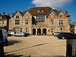
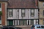
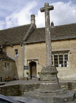
Name
Location
Type
Completed Date designated
Grid ref. Entry number Image
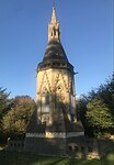
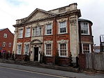
Parish Church
Easton Grey , WiltshireAnglican Church
1836
28 October 1959
ST8808487642 51°35′15″N 2°10′24″W / 51.587504°N 2.173389°W / 51.587504; -2.173389 (Parish Church)
1023199 Parish Church More images
Parish Church of St Denys (the Minster Church)
Warminster , WiltshireParish Church
11th century
28 April 1952
ST8692445494 51°12′31″N 2°11′19″W / 51.208501°N 2.188565°W / 51.208501; -2.188565 (Parish Church of St Denys (the Minster Church))
1364460 Parish Church of St Denys (the Minster Church) More images
Parks Court
Upton Scudamore , WiltshireFarmhouse
15th century
24 July 1969
ST8655847759 51°13′44″N 2°11′38″W / 51.228859°N 2.19389°W / 51.228859; -2.19389 (Parks Court)
1021515 Upload Photo
Parliament Piece
Ramsbury , WiltshireHouse
c. 1620
22 August 1966
SU2734471707 51°26′37″N 1°36′29″W / 51.443699°N 1.607952°W / 51.443699; -1.607952 (Parliament Piece)
1183680 Upload Photo
Parnella House
Devizes , WiltshireHouse
18th century
9 April 1954
SU0033861579 51°21′12″N 1°59′48″W / 51.353286°N 1.996533°W / 51.353286; -1.996533 (Parnella House)
1250833 Parnella House More images
Parsonage Farmhouse
Salisbury , WiltshireFarmhouse
16th century ORIGIN
12 October 1972
SU1325232260 51°05′22″N 1°48′44″W / 51.089503°N 1.812162°W / 51.089503; -1.812162 (Parsonage Farmhouse)
1243246 Upload Photo
Part of King's Arms Hotel
Salisbury, Wiltshire
Public House
1952
28 February 1952
SU1457329657 51°03′58″N 1°47′36″W / 51.066064°N 1.793404°W / 51.066064; -1.793404 (Part of King's Arms Hotel)
1259028 Part of King's Arms Hotel
Peacock Cottages
Winterbourne Dauntsey , Winterbourne, WiltshireHouse
15th century
29 May 1987
SU1759134829 51°06′45″N 1°45′00″W / 51.112487°N 1.750085°W / 51.112487; -1.750085 (Peacock Cottages)
1184635 Peacock Cottages More images
Philipps House
Dinton Park, Dinton , Wiltshire
Apartment
1960
23 March 1960
SU0041631910 51°05′11″N 1°59′44″W / 51.086506°N 1.995438°W / 51.086506; -1.995438 (Philipps House)
1318756 Philipps House More images
Phipps Mausoleum in Westbury Cemetery
Westbury , WiltshireMausoleum
1871-1886 (on the OS map)
31 March 1978
ST8811351448 51°15′43″N 2°10′18″W / 51.262064°N 2.171744°W / 51.262064; -2.171744 (Phipps Mausoleum in Westbury Cemetery)
1364424 Phipps Mausoleum in Westbury Cemetery More images
Pickwick Manor
Corsham , WiltshireHouse
14th-century to 15th-century origins
20 December 1960
ST8626170527 51°26′01″N 2°11′57″W / 51.433574°N 2.199029°W / 51.433574; -2.199029 (Pickwick Manor)
1363977 Upload Photo
Polebarn House with Brick Boundary Wall, Gatepiers and Gates
Trowbridge , WiltshireHouse/Hotel
1789
29 December 1950
ST8589458055 51°19′17″N 2°12′14″W / 51.321422°N 2.203809°W / 51.321422; -2.203809 (Polebarn House with Brick Boundary Wall, Gatepiers and Gates)
1021632 Polebarn House with Brick Boundary Wall, Gatepiers and GatesMore images
Pond Farmhouse
Purton Stoke , Purton, WiltshireFarmhouse
17th century
17 January 1985
SU0877690033 51°36′33″N 1°52′29″W / 51.609064°N 1.874665°W / 51.609064; -1.874665 (Pond Farmhouse)
1356025 Upload Photo
Pound Farmhouse
Purton , WiltshireFarmhouse
Mid 15th century
17 January 1955
SU0934588976 51°35′58″N 1°51′59″W / 51.599551°N 1.866476°W / 51.599551; -1.866476 (Pound Farmhouse)
1023175 Upload Photo
Pound Street Malthouse
Warminster, Wiltshire
Malt House
18th century
28 April 1952
ST8665944907 51°12′12″N 2°11′32″W / 51.203216°N 2.192336°W / 51.203216; -2.192336 (Pound Street Malthouse)
1036240 Upload Photo
Premises on East Corner of New Street
Devizes, Wiltshire
Snuff factory
Modern
9 April 1954
SU0043661647 51°21′14″N 1°59′42″W / 51.353898°N 1.995126°W / 51.353898; -1.995126 (Premises on East Corner of New Street)
1251673 Premises on East Corner of New Street More images
Priestley's House
The Green, Calne , Wiltshire
House
16th century
19 May 1950
ST9996470725 51°26′08″N 2°00′07″W / 51.435524°N 2.001908°W / 51.435524; -2.001908 (Priestley's House)
1270902 Upload Photo
Priory Manor
The Priory, Kington St Michael , Wiltshire
House
15th century
20 December 1960
ST8951277796 51°29′56″N 2°09′09″W / 51.499003°N 2.152481°W / 51.499003; -2.152481 (Priory Manor)
1022340 Upload Photo
Pythouse
Pythouse Park, West Tisbury, Wiltshire
Apartment
1987
6 January 1966
ST9063528564 51°03′23″N 2°08′06″W / 51.05634°N 2.134997°W / 51.05634; -2.134997 (Pythouse)
1318819 Pythouse More images
RAF Club
Calne , WiltshireCross Passage House
Early 17th century
19 May 1950
ST9985970826 51°26′11″N 2°00′12″W / 51.436432°N 2.003418°W / 51.436432; -2.003418 (RAF Club)
1247102 Upload Photo
Railway Viaduct
Chippenham , WiltshireRailway Viaduct
1841
22 June 1978
ST9181573588 51°27′40″N 2°07′09″W / 51.461206°N 2.119205°W / 51.461206; -2.119205 (Railway Viaduct)
1267956 Railway Viaduct More images
Rectory Farmhouse
Britford , WiltshireDetached House
Mid 17th century
23 March 1960
SU1627128499 51°03′20″N 1°46′09″W / 51.055606°N 1.769224°W / 51.055606; -1.769224 (Rectory Farmhouse)
1023790 Upload Photo
Remains of Old Fonthill Abbey
Fonthill Abbey Wood, Fonthill Gifford, Wiltshire
Country House
1796-c1818
6 January 1966
ST9182230997 51°04′42″N 2°07′05″W / 51.078236°N 2.118116°W / 51.078236; -2.118116 (Remains of Old Fonthill Abbey)
1146090 Remains of Old Fonthill Abbey More images
Restrop House
Purton, Wiltshire
House
Late C16-Early 17th century
17 April 1986
SU0811486884 51°34′51″N 1°53′03″W / 51.58076°N 1.884296°W / 51.58076; -1.884296 (Restrop House)
1356028 Upload Photo
Retaining Wall, Rails, Gates and Stable Yard Wall of No 17, Market Place
Devizes, Wiltshire
Gate
19 September 1972
SU0030361562 51°21′11″N 1°59′49″W / 51.353133°N 1.997036°W / 51.353133; -1.997036 (Retaining Wall, Rails, Gates and Stable Yard Wall of No 17, Market Place)
1263273 Upload Photo
Riverside House
Axford , WiltshireHouse
17th century
22 August 1966
SU2388370076 51°25′45″N 1°39′28″W / 51.42919°N 1.657859°W / 51.42919; -1.657859 (Riverside House)
1365448 Upload Photo
Roche Court
Winterslow , WiltshireHouse
1804-5
29 May 1987
SU2501134064 51°06′19″N 1°38′39″W / 51.105334°N 1.644142°W / 51.105334; -1.644142 (Roche Court)
1300004 Roche Court More images
Roche Old Court
Winterslow, Wiltshire
House
c1600-1625
23 March 1960
SU2465934115 51°06′21″N 1°38′57″W / 51.105808°N 1.649166°W / 51.105808; -1.649166 (Roche Old Court)
1300012 Roche Old Court More images
Rockley Manor
Rockley, Ogbourne St. Andrew , Wiltshire
House
18th century
27 February 1958
SU1624871897 51°26′45″N 1°46′03″W / 51.445832°N 1.767596°W / 51.445832; -1.767596 (Rockley Manor)
1033851 Upload Photo
Rose and Crown Public House and attached Stable Block
Chippenham , WiltshireHall House
C14/C15
25 April 1950
ST9221073141 51°27′26″N 2°06′49″W / 51.457192°N 2.113509°W / 51.457192; -2.113509 (Rose and Crown Public House and attached Stable Block)
1268032 Rose and Crown Public House and attached Stable Block More images
Rosefield and Homefield with Gatepiers, Gate Standards and Gate
Trowbridge, Wiltshire
House
late C18/early 19th century
29 December 1950
ST8600757909 51°19′12″N 2°12′08″W / 51.320112°N 2.202181°W / 51.320112; -2.202181 (Rosefield and Homefield with Gatepiers, Gate Standards and Gate)
1021633 Upload Photo
Rowden Farmhouse with Barn, Outbuildings and Gatepiers attached
Chippenham, Lacock , Wiltshire
Farmhouse
Possibly earlier core-Pre 16th century
16 June 1986
ST9182572091 51°26′52″N 2°07′08″W / 51.447746°N 2.119026°W / 51.447746; -2.119026 (Rowden Farmhouse with Barn, Outbuildings and Gatepiers attached)
1022194 Upload Photo
Rudloe Manor
Rudloe, Box, Wiltshire
Manor House
Late Medieval
24 July 1985
ST8422870667 51°26′05″N 2°13′42″W / 51.434779°N 2.22828°W / 51.434779; -2.22828 (Rudloe Manor)
1022808 Rudloe Manor More images
Former Salisbury and South Wiltshire Museum, 40 and 42 St Anns St
Salisbury, Wiltshire
House
18th century
28 February 1952
SU1474329612 51°03′56″N 1°47′28″W / 51.065655°N 1.79098°W / 51.065655; -1.79098 (Former Salisbury and South Wiltshire Museum, 40 and 42 St Anns St)
1258828 Former Salisbury and South Wiltshire Museum, 40 and 42 St Anns St
Sandcliffe
Devizes, Wiltshire
House
Early 18th century
9 April 1954
SU0015961632 51°21′14″N 1°59′57″W / 51.353763°N 1.999103°W / 51.353763; -1.999103 (Sandcliffe)
1251683 Sandcliffe More images
Screen to Road in front of Portway House
Warminster, Wiltshire
Gate
1760
26 May 1954
ST8737745360 51°12′26″N 2°10′55″W / 51.207306°N 2.182075°W / 51.207306; -2.182075 (Screen to Road in front of Portway House)
1285678 Screen to Road in front of Portway House
Seend House
Seend, Wiltshire
House
c1805-1810
19 March 1962
ST9432760917 51°20′50″N 2°04′58″W / 51.347304°N 2.082841°W / 51.347304; -2.082841 (Seend House)
1243855 Upload Photo
Shalbourne Manor Farmhouse
Shalbourne , WiltshireFarmhouse
16th century
22 August 1966
SU3143462912 51°21′52″N 1°33′00″W / 51.364409°N 1.549882°W / 51.364409; -1.549882 (Shalbourne Manor Farmhouse)
1184699 Shalbourne Manor Farmhouse More images
Silver Street House
Bradford-on-Avon, Wiltshire
House
Early 18th century
18 April 1952
ST8273461034 51°20′53″N 2°14′57″W / 51.34812°N 2.2493°W / 51.34812; -2.2493 (Silver Street House)
1036125 Upload Photo
Somerset Hospital
Froxfield, Wiltshire
Almshouses
1694
22 August 1966
SU3000668090 51°24′40″N 1°34′12″W / 51.411043°N 1.569956°W / 51.411043; -1.569956 (Somerset Hospital)
1034076 Somerset Hospital More images
Southwick Court Farmhouse
Southwick , WiltshireFarmhouse
Late 16th century
11 September 1968
ST8451155808 51°18′04″N 2°13′25″W / 51.301181°N 2.223557°W / 51.301181; -2.223557 (Southwick Court Farmhouse)
1194818 Southwick Court Farmhouse More images
Spye Arch Lodge
Bowden Hill, Bromham , Wiltshire
Gate Lodge
16th century
19 March 1962
ST9417067938 51°24′38″N 2°05′07″W / 51.410433°N 2.085213°W / 51.410433; -2.085213 (Spye Arch Lodge)
1033912 Spye Arch Lodge More images
St Cecilia's
Calne , WiltshireHouse
Early 19th century
19 May 1950
ST9966671170 51°26′22″N 2°00′22″W / 51.439525°N 2.006195°W / 51.439525; -2.006195 (St Cecilia's)
1247117 Upload Photo
St Edmund's School
Salisbury , WiltshireSchool
1860
12 October 1972
SU1458430349 51°04′20″N 1°47′36″W / 51.072287°N 1.79322°W / 51.072287; -1.79322 (St Edmund's School)
1273059 St Edmund's School More images
St Elizabeth's Convent and St Osmund's Roman Catholic Primary School
Salisbury , WiltshireChurch School
c. 1890
28 February 1952
SU1450929217 51°03′44″N 1°47′40″W / 51.062109°N 1.794335°W / 51.062109; -1.794335 (St Elizabeth's Convent and St Osmund's Roman Catholic Primary School)
1023664 St Elizabeth's Convent and St Osmund's Roman Catholic Primary School More images
St Johns Court
Malmesbury, Wiltshire
Terrace
1966
18 January 1949
ST9351686945 51°34′53″N 2°05′42″W / 51.581326°N 2.094971°W / 51.581326; -2.094971 (St Johns Court)
1269276 Upload Photo
St John's Hospital Chapel
Wilton, Wiltshire
House
18th century
4 August 1951
SU0941331440 51°04′56″N 1°52′01″W / 51.082204°N 1.866997°W / 51.082204; -1.866997 (St John's Hospital Chapel)
1198954 St John's Hospital Chapel More images
St Martin's House
Salisbury, Wiltshire
House
18th century
28 February 1952
SU1476829681 51°03′59″N 1°47′26″W / 51.066275°N 1.790621°W / 51.066275; -1.790621 (St Martin's House)
1258755 Upload Photo
St Mary House
Chippenham , WiltshireHouse
Late 16th century
25 April 1950
ST9231473168 51°27′27″N 2°06′43″W / 51.457436°N 2.112013°W / 51.457436; -2.112013 (St Mary House)
1267937 Upload Photo
St Nicholas's Hospital
Salisbury, Wiltshire
Hospital
Founded in 13th century
28 February 1952
SU1439629143 51°03′41″N 1°47′45″W / 51.061447°N 1.795951°W / 51.061447; -1.795951 (St Nicholas's Hospital)
1259077 St Nicholas's Hospital More images
St Olaves
Bradford-on-Avon, Wiltshire
House
18th century
18 April 1952
ST8286460975 51°20′51″N 2°14′51″W / 51.347593°N 2.247431°W / 51.347593; -2.247431 (St Olaves)
1185137 St Olaves More images
Stable Block to Tottenham House
Great Bedwyn, Wiltshire
Stable
1818
22 August 1966
SU2490364129 51°22′32″N 1°38′37″W / 51.375674°N 1.643603°W / 51.375674; -1.643603 (Stable Block to Tottenham House)
1365488 Upload Photo
Stables, Riding School and Entrance Archway to Corsham Court
Corsham Court , Corsham , WiltshireStables
c1700-20
20 December 1960
ST8737770579 51°26′03″N 2°10′59″W / 51.434068°N 2.182977°W / 51.434068; -2.182977 (Stables, Riding School and Entrance Archway to Corsham Court)
1182308 Stables, Riding School and Entrance Archway to Corsham Court
Statue of Fame in Cupola, at South End of Parterre
Longford Park, Odstock, Wiltshire
Statue
1767
28 March 1985
SU1713626567 51°02′18″N 1°45′25″W / 51.038209°N 1.756973°W / 51.038209; -1.756973 (Statue of Fame in Cupola, at South End of Parterre)
1023842 Upload Photo
Staynings
Salisbury, Wiltshire
House
Early 18th century
28 February 1952
SU1421329799 51°04′02″N 1°47′55″W / 51.06735°N 1.798536°W / 51.06735; -1.798536 (Staynings)
1023636 Upload Photo
Sticke Tennis Court to West of Hartham House
Hartham, Corsham, Wiltshire
Cricket Pavilion
Built 1890s
1 August 1986
ST8590772091 51°26′51″N 2°12′15″W / 51.447628°N 2.204184°W / 51.447628; -2.204184 (Sticke Tennis Court to West of Hartham House)
1284355 Upload Photo
Store House and Animal House to the South East of Manor Farmhouse
Hankerton, Wiltshire
Animal House
1706
2 May 1977
ST9774690857 51°37′00″N 2°02′02″W / 51.616534°N 2.033951°W / 51.616534; -2.033951 (Store House and Animal House to the South East of Manor Farmhouse)
1022244 Upload Photo
Stowford Manor
Wingfield, Wiltshire
Farmhouse
Late 15th century
13 November 1962
ST8110157672 51°19′04″N 2°16′21″W / 51.317838°N 2.272568°W / 51.317838; -2.272568 (Stowford Manor)
1180800 Upload Photo
Summer House at Milford Manor
Salisbury, Wiltshire
Summerhouse
Early 18th century
12 March 1984
SU1559629682 51°03′59″N 1°46′44″W / 51.066263°N 1.778804°W / 51.066263; -1.778804 (Summer House at Milford Manor)
1272838 Upload Photo
Summer House at Wilbury House
Newton Tony , WiltshireSummerhouse
c. 1710
29 May 1987
SU2227441610 51°10′24″N 1°40′58″W / 51.173299°N 1.68277°W / 51.173299; -1.68277 (Summer House at Wilbury House)
1313163 Upload Photo
Summer House in Garden of No 15, The Close
Salisbury, Wiltshire
Summerhouse
Late C17/Early 18th century
12 October 1972
SU1453929713 51°04′00″N 1°47′38″W / 51.066569°N 1.793887°W / 51.066569; -1.793887 (Summer House in Garden of No 15, The Close)
1023590 Upload Photo
Sundial House
Bradford-on-Avon, Wiltshire
House
18th century
18 April 1952
ST8275461043 51°20′54″N 2°14′56″W / 51.348202°N 2.249014°W / 51.348202; -2.249014 (Sundial House)
1364480 Upload Photo
Sunton House
Sunton, Collingbourne Ducis , Wiltshire
House
c. 1710
4 June 1952
SU2428054768 51°17′30″N 1°39′11″W / 51.291531°N 1.653189°W / 51.291531; -1.653189 (Sunton House)
1285379 Upload Photo
Tedworth House
Tidworth , WiltshireCountry House
c. 1860
24 October 1984
SU2327247545 51°13′36″N 1°40′05″W / 51.226626°N 1.668112°W / 51.226626; -1.668112 (Tedworth House)
1339397 Tedworth House More images
Temple about 32m west of Belcombe Court
Bradford-on-Avon, Wiltshire
Garden Temple
1740s
18 April 1952
ST8170060621 51°20′40″N 2°15′51″W / 51.344374°N 2.264125°W / 51.344374; -2.264125 (Temple about 32m west of Belcombe Court)
1036019 Upload Photo
Terraces with Ornamental Balustrades and Steps to South of the Hall, including retaining Walls running to East and West and Garden Wall
Bradford-on-Avon, Wiltshire
Terraces
18th century
23 August 1974
ST8285560886 51°20′48″N 2°14′51″W / 51.346793°N 2.247556°W / 51.346793; -2.247556 (Terraces with Ornamental Balustrades and Steps to South of the Hall, including retaining Walls running to East and West and Garden Wall)
1036053 Terraces with Ornamental Balustrades and Steps to South of the Hall, including retaining Walls running to East and West and Garden Wall
The Ark
Devizes, Wiltshire
House
Early 19th century
9 April 1954
SU0047061191 51°20′59″N 1°59′41″W / 51.349797°N 1.994638°W / 51.349797; -1.994638 (The Ark)
1250355 Upload Photo
The Bear Hotel
Devizes, Wiltshire
Wall
Early 19th century
9 April 1954
SU0035861448 51°21′08″N 1°59′46″W / 51.352108°N 1.996246°W / 51.352108; -1.996246 (The Bear Hotel)
1250363 The Bear Hotel More images
The Black Swan Inn
Devizes, Wiltshire
Hotel
18th century
9 April 1954
SU0034961565 51°21′11″N 1°59′47″W / 51.35316°N 1.996375°W / 51.35316; -1.996375 (The Black Swan Inn)
1263051 The Black Swan Inn More images
The Cedars
Devizes, Wiltshire
House
Late 18th century
9 April 1954
ST9982561772 51°21′18″N 2°00′14″W / 51.355022°N 2.0039°W / 51.355022; -2.0039 (The Cedars)
1263761 Upload Photo
The Chantry
Mere , WiltshireHouse
1989
6 January 1966
ST8112932217 51°05′20″N 2°16′15″W / 51.088952°N 2.270819°W / 51.088952; -2.270819 (The Chantry)
1130724 Upload Photo
The Chantry
Warminster , WiltshireHouse
circa 1750-1760
28 April 1952
ST8731945154 51°12′20″N 2°10′58″W / 51.205453°N 2.182898°W / 51.205453; -2.182898 (The Chantry)
1036217 The Chantry More images
The Chantry and Little Chantry
Bradford-on-Avon , WiltshireHouse
16th century
18 April 1952
ST8232060845 51°20′47″N 2°15′19″W / 51.346408°N 2.255235°W / 51.346408; -2.255235 (The Chantry and Little Chantry)
1364531 The Chantry and Little Chantry
The Cloisters
Salisbury, Wiltshire
Timber Framed House
C15/C16
28 February 1952
SU1457429685 51°03′59″N 1°47′36″W / 51.066316°N 1.793389°W / 51.066316; -1.793389 (The Cloisters)
1273188 The Cloisters
The Cloisters, Iford Manor
Iford, Westwood , Wiltshire
Garden
1914
13 November 1962
ST8016158878 51°19′43″N 2°17′10″W / 51.32865°N 2.286123°W / 51.32865; -2.286123 (The Cloisters, Iford Manor)
1021878 The Cloisters, Iford Manor More images
The Conduit House
Bowden Hill , Lacock, WiltshireConduit House
Mid 16th century
7 January 1987
ST9376667981 51°24′39″N 2°05′28″W / 51.410815°N 2.091022°W / 51.410815; -2.091022 (The Conduit House)
1363959 Upload Photo
The Corner House
Lacock , WiltshireCruck House
Early 17th century
20 December 1960
ST9155468557 51°24′57″N 2°07′22″W / 51.415965°N 2.12284°W / 51.415965; -2.12284 (The Corner House)
1363927 The Corner House More images
The Court House
Bratton , WiltshireCross Passage House
Late 15th century
11 September 1968
ST9106152616 51°16′21″N 2°07′46″W / 51.272621°N 2.129524°W / 51.272621; -2.129524 (The Court House)
1193662 The Court House More images
The Courthouse
Downton , WiltshireDetached House
Late 17th century
23 March 1960
SU1748421419 50°59′31″N 1°45′08″W / 50.991907°N 1.752257°W / 50.991907; -1.752257 (The Courthouse)
1023905 Upload Photo
The Courts
Holt , WiltshireCountry House
Early 18th century
13 November 1962
ST8611461803 51°21′18″N 2°12′03″W / 51.355128°N 2.200799°W / 51.355128; -2.200799 (The Courts)
1364103 The Courts More images
The Deanery
Salisbury , WiltshireHouse
17th century
28 February 1952
SU1442729592 51°03′56″N 1°47′44″W / 51.065484°N 1.795491°W / 51.065484; -1.795491 (The Deanery)
1252023 The Deanery
The Dower House
Castle Combe , WiltshireHouse
Late 17th century
20 December 1960
ST8421777248 51°29′38″N 2°13′43″W / 51.493952°N 2.228734°W / 51.493952; -2.228734 (The Dower House)
1199036 The Dower House More images
The Downton Press and The White Horse
Downton , WiltshireHouse
Early 16th century
23 March 1960
SU1750521490 50°59′33″N 1°45′07″W / 50.992545°N 1.751954°W / 50.992545; -1.751954 (The Downton Press and The White Horse)
1300702 The Downton Press and The White Horse More images
The Gatehouse and attached Front Wall on South Side
Chitterne , WiltshireDetached House
Late 16th century
11 September 1968
ST9916544222 51°11′50″N 2°00′48″W / 51.197215°N 2.013331°W / 51.197215; -2.013331 (The Gatehouse and attached Front Wall on South Side)
1364348 Upload Photo
The Georgian Boathouse
Fonthill Park, Fonthill Bishop , Wiltshire
Boat House
Mid 18th century
6 January 1966
ST9342032686 51°05′36″N 2°05′43″W / 51.093445°N 2.095336°W / 51.093445; -2.095336 (The Georgian Boathouse)
1146058 Upload Photo
The Golden Gates, Bowood House
Derry Hill, Calne Without , Wiltshire
Gate Lodge
C20
15 December 1972
ST9569070495 51°26′00″N 2°03′48″W / 51.433438°N 2.06339°W / 51.433438; -2.06339 (The Golden Gates, Bowood House)
1253792 The Golden Gates, Bowood House More images
The Greathouse
Kington Langley , WiltshireHouse
Late 17th century
20 December 1960
ST9295677077 51°29′33″N 2°06′10″W / 51.492593°N 2.102852°W / 51.492593; -2.102852 (The Greathouse)
1022321 The Greathouse More images
The Grotto at Bowden Park
Bowden Park , Lacock, WiltshireGrotto
c. 1800
7 January 1987
ST9380368096 51°24′43″N 2°05′26″W / 51.41185°N 2.090492°W / 51.41185; -2.090492 (The Grotto at Bowden Park)
1022134 Upload Photo
The Grove
Corsham , WiltshireHouse
1737
20 December 1960
ST8716370233 51°25′51″N 2°11′10″W / 51.430952°N 2.186043°W / 51.430952; -2.186043 (The Grove)
1198550 Upload Photo
The Guildhall
Salisbury , WiltshireGuildhall
1788-1795
28 February 1952
SU1449729985 51°04′08″N 1°47′40″W / 51.069016°N 1.794476°W / 51.069016; -1.794476 (The Guildhall)
1242739 The Guildhall More images
The Haunch of Venison
Salisbury, Wiltshire
House
Established 1320
28 February 1952
SU1436029960 51°04′08″N 1°47′47″W / 51.068794°N 1.796432°W / 51.068794; -1.796432 (The Haunch of Venison)
1273531 The Haunch of Venison More images
The Ivy Longhouse and the Ivy Stables
Chippenham , WiltshireHouse
1996
25 April 1950
ST9169773201 51°27′28″N 2°07′15″W / 51.457724°N 2.120894°W / 51.457724; -2.120894 (The Ivy Longhouse and the Ivy Stables)
1268174 Upload Photo
The Lansdowne Monument
Cherhill Down, Calne Without, Wiltshire
Obelisk
1845
31 July 1986
SU0477469309 51°25′22″N 1°55′58″W / 51.422773°N 1.93273°W / 51.422773; -1.93273 (The Lansdowne Monument)
1253569 The Lansdowne Monument More images
The Manor House
Ansty , WiltshireFarmhouse
16th century
6 January 1966
ST9560526357 51°02′12″N 2°03′51″W / 51.036555°N 2.064057°W / 51.036555; -2.064057 (The Manor House)
1300354 The Manor House More images
The Manor House
Milton Lilbourne , WiltshireHouse
c1710-30
4 June 1952
SU1896760537 51°20′37″N 1°43′45″W / 51.343604°N 1.729076°W / 51.343604; -1.729076 (The Manor House)
1035694 The Manor House More images
The Manor House
Seend , WiltshireHouse
Before 1701
19 March 1962
ST9447161044 51°20′54″N 2°04′51″W / 51.348448°N 2.080775°W / 51.348448; -2.080775 (The Manor House)
1243854 The Manor House More images
The Manor House
Steeple Ashton , WiltshireHouse
c. 1900
11 September 1968
ST9070057170 51°18′49″N 2°08′05″W / 51.313564°N 2.134819°W / 51.313564; -2.134819 (The Manor House)
1252488 Upload Photo
The Manor House
Yatton Keynell , WiltshireManor House
Possibly earlier-Pre 1659
20 December 1960
ST8644576279 51°29′07″N 2°11′48″W / 51.485297°N 2.196604°W / 51.485297; -2.196604 (The Manor House)
1300423 Upload Photo
The Manor House and Barn
Biddestone , WiltshireCross Passage House
Possibly earlier-Pre 17th century
20 December 1960
ST8668073355 51°27′32″N 2°11′35″W / 51.459012°N 2.193109°W / 51.459012; -2.193109 (The Manor House and Barn)
1363596 The Manor House and Barn More images
The Market Cross
Devizes, Wiltshire
Market Cross
1814
9 April 1954
SU0040661486 51°21′09″N 1°59′44″W / 51.35245°N 1.995557°W / 51.35245; -1.995557 (The Market Cross)
1250362 The Market Cross More images
The Mechanics' Institute
Swindon
Market Hall
1855
17 February 1970
SU1458084781 51°33′42″N 1°47′28″W / 51.561722°N 1.791068°W / 51.561722; -1.791068 (The Mechanics' Institute)
1198947 The Mechanics' Institute More images
The Milford Arms
Salisbury, Wiltshire
House
C15/C16
12 October 1972
SU1464629958 51°04′08″N 1°47′32″W / 51.068769°N 1.792351°W / 51.068769; -1.792351 (The Milford Arms)
1258053 Upload Photo
The Mount House
Great Somerford , WiltshireHouse
16th century
12 December 1951
ST9639783035 51°32′46″N 2°03′12″W / 51.546197°N 2.053352°W / 51.546197; -2.053352 (The Mount House)
1022515 The Mount House More images
The New Inn
Salisbury, Wiltshire
Cruck House
C15/C16
28 February 1952
SU1437629776 51°04′02″N 1°47′46″W / 51.067139°N 1.796211°W / 51.067139; -1.796211 (The New Inn)
1258368 The New Inn More images
The Obelisk
Warminster , WiltshireObelisk
1783
28 April 1952
ST8695445133 51°12′19″N 2°11′17″W / 51.205255°N 2.188122°W / 51.205255; -2.188122 (The Obelisk)
1194575 The Obelisk More images
The Old Court House
Castle Combe , WiltshireJettied House
Early 16th century
20 December 1960
ST8421277154 51°29′35″N 2°13′44″W / 51.493107°N 2.228802°W / 51.493107; -2.228802 (The Old Court House)
1022862 The Old Court House More images
The Old Manor House
Highworth , SwindonHouse
Dated 1656
26 January 1955
SU2025092453 51°37′50″N 1°42′32″W / 51.630529°N 1.708835°W / 51.630529; -1.708835 (The Old Manor House)
1355951 The Old Manor House More images
The Old Manor House
Milston , WiltshireManor House
1613
10 January 1953
SU1622845234 51°12′22″N 1°46′09″W / 51.206088°N 1.769089°W / 51.206088; -1.769089 (The Old Manor House)
1318536 Upload Photo
The Old Parsonage
Steeple Ashton , WiltshireHouse
Early 15th century
11 September 1968
ST9078456956 51°18′42″N 2°08′01″W / 51.311641°N 2.133608°W / 51.311641; -2.133608 (The Old Parsonage)
1252695 Upload Photo
The Old Town Hall
Devizes , WiltshireTown Hall
During erection of present
9 April 1954
SU0043861416 51°21′07″N 1°59′42″W / 51.351821°N 1.995097°W / 51.351821; -1.995097 (The Old Town Hall)
1252446 The Old Town Hall More images
The Old Vicarage and attached Railings
Chippenham , WiltshireVicarage
Late C17/Early 18th century
25 April 1950
ST9232673227 51°27′29″N 2°06′43″W / 51.457967°N 2.111842°W / 51.457967; -2.111842 (The Old Vicarage and attached Railings)
1267908 The Old Vicarage and attached Railings More images
The Pheasant Inn and Crewe's Hall
Salisbury , WiltshireInn
15th century
28 February 1952
SU1455930177 51°04′15″N 1°47′37″W / 51.070741°N 1.793584°W / 51.070741; -1.793584 (The Pheasant Inn and Crewe's Hall)
1243120 The Pheasant Inn and Crewe's Hall More images
The Priory Barn
Bradford-on-Avon , WiltshireTithe Barn
late medieval
18 April 1952
ST8247361065 51°20′54″N 2°15′11″W / 51.348391°N 2.253049°W / 51.348391; -2.253049 (The Priory Barn)
1364527 The Priory Barn More images
The former Queen's Head Inn
Dunkirk, Devizes , Wiltshire
Terrace
18th century
9 April 1954
ST9940861924 51°21′23″N 2°00′36″W / 51.356388°N 2.009889°W / 51.356388; -2.009889 (The former Queen's Head Inn)
1249469 The former Queen's Head Inn More images
The Red House at Eastwell House
Potterne , WiltshireGarden Building
c. 1700
19 March 1962
ST9935858004 51°19′16″N 2°00′38″W / 51.32114°N 2.010598°W / 51.32114; -2.010598 (The Red House at Eastwell House)
1258775 Upload Photo
The Rose and Crown Inn
East Harnham , Salisbury, WiltshireTimber Framed House
16th century
28 February 1952
SU1428428983 51°03′36″N 1°47′51″W / 51.060011°N 1.797555°W / 51.060011; -1.797555 (The Rose and Crown Inn)
1242271 The Rose and Crown Inn More images
The Royal George Public House including Part of former No 19
Salisbury , WiltshireHouse
18th century
12 October 1972
SU1452630267 51°04′18″N 1°47′39″W / 51.071551°N 1.794051°W / 51.071551; -1.794051 (The Royal George Public House including Part of former No 19)
1248750 The Royal George Public House including Part of former No 19 More images
The Sanctuary
Steeple Ashton , WiltshireHouse
Early 16th century
29 January 1988
ST9084356954 51°18′42″N 2°07′58″W / 51.311624°N 2.132762°W / 51.311624; -2.132762 (The Sanctuary)
1252506 The Sanctuary
The Sham Ruin
Corsham Court , Corsham, WiltshireGrotto
c. 1797
1 August 1986
ST8734070575 51°26′03″N 2°11′01″W / 51.434031°N 2.183509°W / 51.434031; -2.183509 (The Sham Ruin)
1284571 The Sham Ruin
The Sign of the Angel
Lacock , WiltshireHouse
Early C20
20 December 1960
ST9158968574 51°24′58″N 2°07′20″W / 51.416119°N 2.122337°W / 51.416119; -2.122337 (The Sign of the Angel)
1198180 The Sign of the Angel More images
The Spectrum Building (formerly the Renault Distribution Centre )
Swindon
1981-2
18 September 2013
SU1227285351 51°34′01″N 1°49′28″W / 51.566902°N 1.824343°W / 51.566902; -1.824343 (The Spectrum Building (formerly the Renault Distribution Centre))
1416061 The Spectrum Building (formerly the Renault Distribution Centre ) More images
The Tounson Almshouses
Calne , WiltshireCross Passage House
1950
19 May 1950
ST9990670868 51°26′13″N 2°00′10″W / 51.436809°N 2.002742°W / 51.436809; -2.002742 (The Tounson Almshouses)
1270992 The Tounson Almshouses More images
The Town Hall
Devizes , WiltshireTown Hall
1806-08
9 April 1954
SU0046861335 51°21′04″N 1°59′41″W / 51.351092°N 1.994666°W / 51.351092; -1.994666 (The Town Hall)
1262331 The Town Hall More images
The Town Hall
Westbury , WiltshireTown Hall
Early 19th century
29 December 1950
ST8739251524 51°15′46″N 2°10′55″W / 51.262732°N 2.18208°W / 51.262732; -2.18208 (The Town Hall)
1036308 The Town Hall More images
The Wardrobe
Salisbury , WiltshireHouse
1254
28 February 1952
SU1413429668 51°03′58″N 1°47′59″W / 51.066174°N 1.799669°W / 51.066174; -1.799669 (The Wardrobe)
1254383 The Wardrobe More images
The White House
Highworth, Swindon
House
Late 17th century
26 January 1955
SU2001692469 51°37′50″N 1°42′44″W / 51.630681°N 1.712215°W / 51.630681; -1.712215 (The White House)
1023387 Upload Photo
The Woodhouse
Chippenham , WiltshireHouse
Late C16-Early 17th century
25 April 1950
ST9233973199 51°27′28″N 2°06′42″W / 51.457715°N 2.111654°W / 51.457715; -2.111654 (The Woodhouse)
1267949 The Woodhouse More images
Tidcombe Manor
Tidcombe , Tidcombe and Fosbury, WiltshireHouse
Mid-Late 18th century
22 August 1966
SU2898858380 51°19′26″N 1°35′07″W / 51.323789°N 1.585382°W / 51.323789; -1.585382 (Tidcombe Manor)
1365508 Tidcombe Manor More images
Tower House
Malmesbury , WiltshireHouse
Mid 16th century
18 January 1949
ST9342687256 51°35′03″N 2°05′47″W / 51.584122°N 2.096276°W / 51.584122; -2.096276 (Tower House)
1269271 Tower House More images
Trowle Manor Farmhouse
Trowle Common, Trowbridge , Wiltshire
Farmhouse
Older
26 November 1976
ST8417458660 51°19′37″N 2°13′43″W / 51.326816°N 2.228518°W / 51.326816; -2.228518 (Trowle Manor Farmhouse)
1021662 Upload Photo
Turleigh Manor
Turleigh , Winsley, WiltshireHouse
Late 17th century to early 18th century
13 November 1962
ST8049060747 51°20′44″N 2°16′53″W / 51.345466°N 2.281504°W / 51.345466; -2.281504 (Turleigh Manor)
1021905 Upload Photo
Turner Memorial in the Churchyard about 45m south of Lady Chapel of the Church of St Michael
Melksham , WiltshireChest Tomb
Early 19th century
13 February 1985
ST9026563678 51°22′19″N 2°08′28″W / 51.372074°N 2.14124°W / 51.372074; -2.14124 (Turner Memorial in the Churchyard about 45m south of Lady Chapel of the Church of St Michael)
1021708 Upload Photo
Two former Hangars on North Side of former Airfield
Yatesbury , Cherhill, WiltshireAircraft Hangar
1916
25 November 1987
SU0520771296 51°26′26″N 1°55′35″W / 51.440635°N 1.926474°W / 51.440635; -1.926474 (Two former Hangars on North Side of former Airfield)
1283146 Two former Hangars on North Side of former Airfield
Two Monuments in the Churchyard between 11m and 13m north of Tower of Church of St Mary the Virgin
Steeple Ashton , WiltshireChest Tomb
Early to Mid 18th century
11 September 1968
ST9062557135 51°18′48″N 2°08′09″W / 51.313248°N 2.135894°W / 51.313248; -2.135894 (Two Monuments in the Churchyard between 11m and 13m north of Tower of Church of St Mary the Virgin)
1252398 Upload Photo
Unidentified Monument in Churchyard, 3m south of Lady Chapel, Church of St Mary
Bishops Cannings , WiltshireChest Tomb
15th century
29 April 1987
SU0378864166 51°22′36″N 1°56′49″W / 51.376536°N 1.946964°W / 51.376536; -1.946964 (Unidentified Monument in Churchyard, 3m south of Lady Chapel, Church of St Mary)
1365975 Upload Photo
Upavon Camp (Officers' Mess), Building 21
Trenchard Lines , Upavon, WiltshireOfficers Mess
1914-1915
3 June 1986
SU1550654878 51°17′34″N 1°46′44″W / 51.292825°N 1.779009°W / 51.292825; -1.779009 (Upavon Camp (Officers' Mess), Building 21)
1365554 Upload Photo
Upham House
Upper Upham , Aldbourne, WiltshireCountry House
possibly earlier work
22 August 1966
SU2292777136 51°29′34″N 1°40′16″W / 51.492708°N 1.671154°W / 51.492708; -1.671154 (Upham House)
1200440 Upham House More images
Urchfont Manor
Urchfont, Wiltshire
House
15th century
19 March 1962
SU0358356962 51°18′42″N 1°57′00″W / 51.311761°N 1.949979°W / 51.311761; -1.949979 (Urchfont Manor)
1035857 Urchfont Manor More images
Vale House
Salisbury, Wiltshire
House
18th century
28 February 1952
SU1476129648 51°03′58″N 1°47′27″W / 51.065979°N 1.790722°W / 51.065979; -1.790722 (Vale House)
1273247 Upload Photo
Vastern House
Vastern, Wootton Bassett , Wiltshire
House
15th century core
15 August 1985
SU0495381421 51°31′54″N 1°55′48″W / 51.531676°N 1.92999°W / 51.531676; -1.92999 (Vastern House)
1300114 Vastern House
Vernleaze and attached Service Range and Garden Wall
Calne , WiltshireHouse
Early 19th century
19 May 1950
ST9959070122 51°25′48″N 2°00′26″W / 51.430102°N 2.007287°W / 51.430102; -2.007287 (Vernleaze and attached Service Range and Garden Wall)
1247357 Upload Photo
Victoria Hall
Salisbury, Wiltshire
House
1716
28 February 1952
SU1460230096 51°04′12″N 1°47′35″W / 51.070011°N 1.792973°W / 51.070011; -1.792973 (Victoria Hall)
1273287 Upload Photo
Village Cross in Schoolyard
Lacock , WiltshireVillage Cross
Late Medieval
20 December 1960
ST9157868436 51°24′54″N 2°07′21″W / 51.414878°N 2.122492°W / 51.414878; -2.122492 (Village Cross in Schoolyard)
1363937 Village Cross in Schoolyard More images
Village Farmhouse
Charlton , WiltshireFarmhouse
Late 17th century
12 December 1951
ST9643388956 51°35′58″N 2°03′10″W / 51.599435°N 2.052895°W / 51.599435; -2.052895 (Village Farmhouse)
1022224 Upload Photo
Villetts House
Swindon House
1729
2 October 1951
SU1574683807 51°33′11″N 1°46′27″W / 51.552934°N 1.774291°W / 51.552934; -1.774291 (Villetts House)
1355900 Villetts House More images
Wall along Street to north of No 5, St Margaret's Place
Bradford-on-Avon, Wiltshire
House
18th century
18 April 1952
ST8263160727 51°20′43″N 2°15′03″W / 51.345356°N 2.250764°W / 51.345356; -2.250764 (Wall along Street to north of No 5, St Margaret's Place)
1364496 Upload Photo
Walls of Bailey to Old Wardour Castle
Wardour Park, Tisbury, Wiltshire
Wall
1570s
6 July 1987
ST9383826396 51°02′13″N 2°05′21″W / 51.036889°N 2.089258°W / 51.036889; -2.089258 (Walls of Bailey to Old Wardour Castle)
1318789 Upload Photo
Warminster School
Warminster , WiltshireSchool
Mid 19th century
28 April 1952
ST8695345367 51°12′26″N 2°11′17″W / 51.20736°N 2.188145°W / 51.20736; -2.188145 (Warminster School)
1193680 Warminster School More images
Well Close House
Bradford-on-Avon , WiltshireHouse
17th century
23 August 1974
ST8209360720 51°20′43″N 2°15′31″W / 51.345277°N 2.258488°W / 51.345277; -2.258488 (Well Close House)
1036017 Upload Photo
West Court Farmhouse
Shalbourne , WiltshireFarmhouse
C15-C17
30 July 1986
SU3138962669 51°21′44″N 1°33′02″W / 51.362226°N 1.550549°W / 51.362226; -1.550549 (West Court Farmhouse)
1033981 Upload Photo
West Hill House
Calne , WiltshireApartment
1950
19 May 1950
ST9967271058 51°26′19″N 2°00′22″W / 51.438518°N 2.006109°W / 51.438518; -2.006109 (West Hill House)
1247319 Upload Photo
West Portal of Box Tunnel
Box, Wiltshire
Railway Tunnel Portal
c. 1840
24 July 1985
ST8292768905 51°25′08″N 2°14′49″W / 51.418898°N 2.24691°W / 51.418898; -2.24691 (West Portal of Box Tunnel)
1284962 West Portal of Box Tunnel
West Portal of Middlehill Tunnel
Middlehill, Box , Wiltshire
Railway Tunnel Portal
1840
27 July 1985
ST8194068730 51°25′02″N 2°15′40″W / 51.417294°N 2.261095°W / 51.417294; -2.261095 (West Portal of Middlehill Tunnel)
1022803 Upload Photo
Westbury Conservative Club (Ferndale House)
Westbury, Wiltshire
Wall
Early 18th century
29 December 1950
ST8741751566 51°15′47″N 2°10′54″W / 51.26311°N 2.181723°W / 51.26311; -2.181723 (Westbury Conservative Club (Ferndale House))
1194765 Westbury Conservative Club (Ferndale House) More images
Westbury House. Railings along east Side and walled Forecourt to south of Westbury House
Bradford-on-Avon, Wiltshire
House
Early 18th century
18 April 1952
ST8254060864 51°20′48″N 2°15′07″W / 51.346585°N 2.252077°W / 51.346585; -2.252077 (Westbury House. Railings along east Side and walled Forecourt to south of Westbury House)
1036119 Westbury House. Railings along east Side and walled Forecourt to south of Westbury House More images
Westcroft
Trowbridge , WiltshireHouse
1784
29 December 1950
ST8541358261 51°19′24″N 2°12′39″W / 51.323262°N 2.21072°W / 51.323262; -2.21072 (Westcroft)
1182520 Westcroft More images
Whistley House
Potterne , WiltshireCountry House
18th century
19 March 1962
ST9879959244 51°19′56″N 2°01′07″W / 51.332289°N 2.018625°W / 51.332289; -2.018625 (Whistley House)
1243109 Upload Photo
White Hart Hotel
Calne , WiltshireInn
Late 16th century
19 May 1950
ST9993670696 51°26′07″N 2°00′08″W / 51.435263°N 2.00231°W / 51.435263; -2.00231 (White Hart Hotel)
1247314 White Hart Hotel More images
White Hart Hotel
Salisbury , WiltshireHotel
Late 18th century
28 February 1952
SU1457129722 51°04′00″N 1°47′36″W / 51.066649°N 1.79343°W / 51.066649; -1.79343 (White Hart Hotel)
1258980 White Hart Hotel More images
Wilcot Manor House
Wilcot , WiltshireManor House
Early 17th century
4 June 1952
SU1397660790 51°20′46″N 1°48′03″W / 51.346023°N 1.800721°W / 51.346023; -1.800721 (Wilcot Manor House)
1364664 Upload Photo
William IV Public House
Salisbury , WiltshireHouse
17th century
12 October 1972
SU1465829924 51°04′06″N 1°47′32″W / 51.068463°N 1.792181°W / 51.068463; -1.792181 (William IV Public House)
1259805 Upload Photo
Wilsford House
Wilsford, Wilsford cum Lake , Wiltshire
House
1904-6
15 April 1987
SU1340139731 51°09′24″N 1°48′35″W / 51.156678°N 1.809759°W / 51.156678; -1.809759 (Wilsford House)
1131008 Upload Photo
Wilton Windmill
Wilton, Grafton, Wiltshire
Tower Mill
1821
30 July 1986
SU2756561620 51°21′11″N 1°36′20″W / 51.352992°N 1.605553°W / 51.352992; -1.605553 (Wilton Windmill)
1034034 Wilton Windmill More images
Woolley Grange
Woolley Green, Bradford-on-Avon , Wiltshire
Manor House
17th century
23 August 1974
ST8367461553 51°21′10″N 2°14′09″W / 51.352815°N 2.235827°W / 51.352815; -2.235827 (Woolley Grange)
1036151 Woolley Grange More images
Woolmore Farmhouse
Bowerhill, Melksham Without , Wiltshire
Farmhouse
1631
13 February 1985
ST9163062493 51°21′41″N 2°07′18″W / 51.361441°N 2.121602°W / 51.361441; -2.121602 (Woolmore Farmhouse)
1021762 Upload Photo
Workshop 25m north-east of Church of St James
Ansty Village, Ansty , Wiltshire
Banqueting House
1570-80
6 January 1966
ST9567726342 51°02′11″N 2°03′47″W / 51.03642°N 2.06303°W / 51.03642; -2.06303 (Workshop 25m north-east of Church of St James)
1318675 Workshop 25m north-east of Church of St James More images
Wroughton House
Wroughton , SwindonCross Passage House
Early 18th century
26 January 1955
SU1381880256 51°31′16″N 1°48′08″W / 51.521055°N 1.802237°W / 51.521055; -1.802237 (Wroughton House)
1185607 Upload Photo
Zealys House
Chippenham , WiltshireTown House
Early 18th century
25 April 1950
ST9233573208 51°27′28″N 2°06′42″W / 51.457796°N 2.111712°W / 51.457796; -2.111712 (Zealys House)
1267907 Zealys House More images

![]() Media related to Grade II listed buildings in Wiltshire at Wikimedia Commons
Media related to Grade II listed buildings in Wiltshire at Wikimedia Commons


