Name
Location
Type
Completed Date designated
Grid ref. Entry number Image
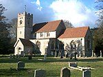
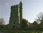
Church of St Mary
Saunderton , Bledlow-cum-Saunderton , Wycombe Parish Church
14th century
21 June 1955
SP7955501890 51°42′36″N 0°51′00″W / 51.710114°N 0.849998°W / 51.710114; -0.849998 (Church of St Mary)
1332059 Church of St Mary More images
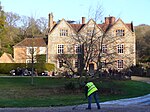
Forty Green Farmhouse
Forty Green, Bledlow-cum-Saunderton
Farmhouse
1718
21 June 1955
SP7662803312 51°43′24″N 0°53′31″W / 51.723304°N 0.89204°W / 51.723304; -0.89204 (Forty Green Farmhouse)
1332060 Upload Photo
Manor House
Bledlow , Bledlow-cum-SaundertonHouse
c. 1670
21 June 1955
SP7796402132 51°42′45″N 0°52′23″W / 51.712512°N 0.872966°W / 51.712512; -0.872966 (Manor House)
1125803 Upload Photo
The Old House Farmhouse
Bledlow-cum-Saunderton
Farmhouse
Late 15th century
21 June 1955
SP7905701896 51°42′37″N 0°51′26″W / 51.710238°N 0.857203°W / 51.710238; -0.857203 (The Old House Farmhouse)
1310782 Upload Photo
Bradenham Manor
Bradenham House
16th century
21 June 1955
SU8287797081 51°39′59″N 0°48′11″W / 51.666405°N 0.80307°W / 51.666405; -0.80307 (Bradenham Manor)
1332048 Bradenham Manor More images
Church of St Botolph
Bradenham
Parish Church
c. 1100
21 June 1955
SU8283497126 51°40′01″N 0°48′13″W / 51.666815°N 0.803681°W / 51.666815; -0.803681 (Church of St Botolph)
1125779 Church of St Botolph More images
The White House
Bradenham
House
c. 1800
21 June 1955
SU8269597132 51°40′01″N 0°48′20″W / 51.66689°N 0.805689°W / 51.66689; -0.805689 (The White House)
1310723 The White House More images
Church of St Peter and St Paul
Ellesborough Parish Church
late C14-C15
21 June 1955
SP8363706739 51°45′11″N 0°47′23″W / 51.753109°N 0.78977°W / 51.753109; -0.78977 (Church of St Peter and St Paul)
1125881 Church of St Peter and St Paul More images
Wellwick Manor
Ellesborough
House
17th century
25 October 1951
SP8523807884 51°45′47″N 0°45′59″W / 51.763161°N 0.766302°W / 51.763161; -0.766302 (Wellwick Manor)
1118401 Wellwick Manor More images
Wellwick Manor
Wendover House
17th century
25 October 1951
SP8523707886 51°45′47″N 0°45′59″W / 51.763179°N 0.766316°W / 51.763179; -0.766316 (Wellwick Manor)
1332019 Wellwick Manor More images
Church of St Mary the Virgin
Fawley Parish Church
12th century
21 June 1955
SU7535486716 51°34′27″N 0°54′51″W / 51.574285°N 0.91405°W / 51.574285; -0.91405 (Church of St Mary the Virgin)
1125702 Church of St Mary the Virgin More images
Freeman Mausoleum
Fawley
Mausoleum
1750
7 February 1980
SU7531686718 51°34′28″N 0°54′53″W / 51.574308°N 0.914598°W / 51.574308; -0.914598 (Freeman Mausoleum)
1125703 Freeman Mausoleum More images
Church of St Mary Magdalene
Great and Little Hampden Parish Church
13th century
21 June 1955
SP8484502369 51°42′49″N 0°46′24″W / 51.713646°N 0.773338°W / 51.713646; -0.773338 (Church of St Mary Magdalene)
1158762 Church of St Mary Magdalene More images
Widmere Farmhouse
Widmere, Great Marlow
Farmhouse
late C17-early 18th century
21 June 1955
SU8319889195 51°35′44″N 0°48′01″W / 51.595468°N 0.800301°W / 51.595468; -0.800301 (Widmere Farmhouse)
1332119 Upload Photo
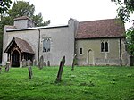
Church of St Mary
Hambleden Parish Church
12th century
21 June 1955
SU7839986604 51°34′22″N 0°52′13″W / 51.572863°N 0.870145°W / 51.572863; -0.870145 (Church of St Mary)
1160018 Church of St Mary More images
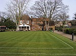
Greenlands (part of Henley Business School)
Greenlands, Hambleden
Country House
c. 1810
4 December 1992
SU7757085483 51°33′46″N 0°52′56″W / 51.5629°N 0.882352°W / 51.5629; -0.882352 (Greenlands (part of Henley Business School))
1125682 Greenlands (part of Henley Business School)More images
Hambleden Manor House
Hambleden
House
Early 17th century
21 June 1955
SU7851086651 51°34′24″N 0°52′07″W / 51.57327°N 0.868533°W / 51.57327; -0.868533 (Hambleden Manor House)
1125692 Hambleden Manor House More images
Kenricks
Hambleden
House
C19-C20
21 June 1955
SU7867886515 51°34′19″N 0°51′58″W / 51.572024°N 0.86614°W / 51.572024; -0.86614 (Kenricks)
1160069 Kenricks More images
Church of St Michael and All Angels
Hughenden Park, Hughenden
Parish Church
14th century
21 June 1955
SU8642195526 51°39′07″N 0°45′08″W / 51.651893°N 0.752224°W / 51.651893; -0.752224 (Church of St Michael and All Angels)
1125743 Church of St Michael and All Angels More images
Church of St Nicholas
Ibstone Parish Church
12th century
21 June 1955
SU7560292336 51°37′29″N 0°54′33″W / 51.624773°N 0.909263°W / 51.624773; -0.909263 (Church of St Nicholas)
1160705 Church of St Nicholas More images
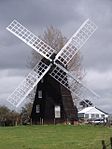
Windmill
Lacey Green Smock Mill
mid-late 17th century
26 April 1985
SP8191600781 51°41′59″N 0°48′58″W / 51.699806°N 0.816095°W / 51.699806; -0.816095 (Windmill)
1159021 Windmill More images
Church of St John the Baptist
Little Marlow Parish Church
Late 12th century
21 June 1955
SU8740787826 51°34′57″N 0°44′24″W / 51.582525°N 0.739894°W / 51.582525; -0.739894 (Church of St John the Baptist)
1311079 Church of St John the Baptist More images
Bank Farmhouse
Meadle , Longwick-cum-Ilmer House
15th century
26 April 1985
SP8068005980 51°44′48″N 0°49′58″W / 51.74672°N 0.832773°W / 51.74672; -0.832773 (Bank Farmhouse)
1159190 Upload Photo
Church of St Michael and All Angels
Horsenden , Longwick-cum-IlmerParish Church
15th century
21 June 1955
SP7935502922 51°43′10″N 0°51′10″W / 51.719419°N 0.852657°W / 51.719419; -0.852657 (Church of St Michael and All Angels)
1332032 Church of St Michael and All Angels More images
Church of St Peter
Ilmer , Longwick-cum-IlmerParish Church
12th century
21 June 1955
SP7692205487 51°44′34″N 0°53′14″W / 51.742816°N 0.887304°W / 51.742816; -0.887304 (Church of St Peter)
1332033 Church of St Peter More images
Sir William Borlase's Grammar School
Marlow School
1624
16 July 1949
SU8454286412 51°34′13″N 0°46′54″W / 51.570251°N 0.781572°W / 51.570251; -0.781572 (Sir William Borlase's Grammar School)
1217598 Sir William Borlase's Grammar School More images
Brampton House
Marlow
House
18th century
16 July 1949
SU8502686320 51°34′10″N 0°46′29″W / 51.569351°N 0.774613°W / 51.569351; -0.774613 (Brampton House)
1332409 Brampton House More images
Church of All Saints
Marlow Parish Church
1832-1835
16 July 1949
SU8513886173 51°34′05″N 0°46′23″W / 51.568013°N 0.773033°W / 51.568013; -0.773033 (Church of All Saints)
1332380 Church of All Saints More images
Court Garden
Marlow
Country House
18th century
31 January 1974
SU8488386148 51°34′04″N 0°46′36″W / 51.567826°N 0.776717°W / 51.567826; -0.776717 (Court Garden)
1125078 Court Garden More images
Crown Hotel
Marlow
Town Hall/Hotel/Shops
1807
16 July 1949
SU8483786614 51°34′19″N 0°46′38″W / 51.572022°N 0.777268°W / 51.572022; -0.777268 (Crown Hotel)
1159570 Crown Hotel More images
Old Parsonage
Marlow
House
14th century
16 July 1949
SU8515386368 51°34′11″N 0°46′22″W / 51.569763°N 0.772769°W / 51.569763; -0.772769 (Old Parsonage)
1125080 Old Parsonage More images
Remnantz
Marlow
House
1799-1811
16 July 1949
SU8462686402 51°34′13″N 0°46′49″W / 51.570148°N 0.780363°W / 51.570148; -0.780363 (Remnantz)
1275651 Remnantz More images
The Stables at Remnantz
Marlow
Gate Pier
16 July 1949
SU8466386382 51°34′12″N 0°46′47″W / 51.569963°N 0.779834°W / 51.569963; -0.779834 (The Stables at Remnantz)
1275653 The Stables at Remnantz
The End House
Marlow
House
Late 18th century
16 July 1949
SU8503286310 51°34′09″N 0°46′28″W / 51.56926°N 0.774529°W / 51.56926; -0.774529 (The End House)
1125072 The End House More images
The Old House
Marlow
House
18th century
16 July 1949
SU8479586509 51°34′16″N 0°46′40″W / 51.571085°N 0.7779°W / 51.571085; -0.7779 (The Old House)
1235001 The Old House More images
The Old Malt House
Marlow
House
Late 18th century
16 July 1949
SU8518386234 51°34′07″N 0°46′21″W / 51.568554°N 0.772369°W / 51.568554; -0.772369 (The Old Malt House)
1275958 Upload Photo
The White House
Marlow
House
c. 1730
16 July 1949
SU8496886411 51°34′13″N 0°46′32″W / 51.570178°N 0.775428°W / 51.570178; -0.775428 (The White House)
1159481 The White House More images
Western House
Marlow
House
1699
16 July 1949
SU8447786355 51°34′11″N 0°46′57″W / 51.569748°N 0.782524°W / 51.569748; -0.782524 (Western House)
1216983 Upload Photo
29 and 31 West Street
Marlow
House
18th century
16 July 1949
SU8478686501 51°34′16″N 0°46′41″W / 51.571014°N 0.778031°W / 51.571014; -0.778031 (29 and 31 West Street)
1235047 29 and 31 West Street
33 West Street
Marlow
House
18th century
16 July 1949
SU8478186487 51°34′15″N 0°46′41″W / 51.570889°N 0.778107°W / 51.570889; -0.778107 (33 West Street)
1275805 Upload Photo
47 West Street
Marlow
House
18th century
16 July 1949
SU8473986462 51°34′14″N 0°46′43″W / 51.570671°N 0.778719°W / 51.570671; -0.778719 (47 West Street)
1216789 Upload Photo
41 and 41a High Street
Marlow
House
18th century
17 August 1970
SU8496686471 51°34′15″N 0°46′32″W / 51.570717°N 0.775442°W / 51.570717; -0.775442 (41 and 41a High Street)
1332404 41 and 41a High Street More images
74 and 76 High Street
Marlow
House
Mid 18th century
16 July 1949
SU8498086393 51°34′12″N 0°46′31″W / 51.570014°N 0.775259°W / 51.570014; -0.775259 (74 and 76 High Street)
1332408 74 and 76 High Street More images
Church of St Peter and St Paul
Medmenham Parish Church
Mid 12th century
21 June 1955
SU8047484472 51°33′12″N 0°50′27″W / 51.553405°N 0.840698°W / 51.553405; -0.840698 (Church of St Peter and St Paul)
1310930 Church of St Peter and St Paul More images
Danesfield House
Danesfield, Medmenham
Country House
1899-1901
9 August 1977
SU8163084394 51°33′09″N 0°49′27″W / 51.552538°N 0.824047°W / 51.552538; -0.824047 (Danesfield House)
1310810 Danesfield House More images
Lodge Farmhouse
Medmenham Farmhouse
17th century
21 June 1955
SU8042384622 51°33′17″N 0°50′29″W / 51.554761°N 0.841399°W / 51.554761; -0.841399 (Lodge Farmhouse)
1125591 Upload Photo
Medmenham Abbey , Abbey House and Wall with Arch to Forecourt
Medmenham
Abbey
1987
21 June 1955
SU8068183826 51°32′51″N 0°50′16″W / 51.547569°N 0.837861°W / 51.547569; -0.837861 (Medmenham Abbey, Abbey House and Wall with Arch to Forecourt)
1310928 Upload Photo
Wittingdon
Wittington, Medmenham
Country House
1898
24 November 1976
SU8209584414 51°33′10″N 0°49′02″W / 51.552651°N 0.817337°W / 51.552651; -0.817337 (Wittingdon)
1125557 Wittingdon More images
Chipps Manor
Wheeler End , Piddington and Wheeler End Farmhouse
1733
21 June 1955
SU8032293738 51°38′12″N 0°50′27″W / 51.636724°N 0.840772°W / 51.636724; -0.840772 (Chipps Manor)
1332101 Upload Photo
Church of St Mary
Princes Risborough Parish Church
13th century
21 June 1955
SP8059703492 51°43′28″N 0°50′04″W / 51.724366°N 0.834551°W / 51.724366; -0.834551 (Church of St Mary)
1125815 Church of St Mary More images
Dovecote West of St Dunstan's Church
Monks Risborough , Princes RisboroughDovecote
16th century
21 June 1955
SP8119204442 51°43′58″N 0°49′33″W / 51.73282°N 0.825717°W / 51.73282; -0.825717 (Dovecote West of St Dunstan's Church)
1125788 Dovecote West of St Dunstan's Church More images
Manor House and attached Garden Walls (north West Wall incorporated into the Forge and the Coach House)
Princes Risborough, Wycombe
House
1955
21 June 1955
SP8061603536 51°43′29″N 0°50′03″W / 51.724759°N 0.834265°W / 51.724759; -0.834265 (Manor House and attached Garden Walls (north West Wall incorporated into the Forge and the Coach House))
1311048 Manor House and attached Garden Walls (north West Wall incorporated into the Forge and the Coach House) More images
Market House
Princes Risborough
Market House
1824
21 June 1955
SP8074203502 51°43′28″N 0°49′57″W / 51.724435°N 0.832449°W / 51.724435; -0.832449 (Market House)
1159718 Market House More images
Church of St Peter and St Paul
Stokenchurch Parish Church
12th century
21 June 1955
SU7602996436 51°39′42″N 0°54′08″W / 51.661573°N 0.902206°W / 51.661573; -0.902206 (Church of St Peter and St Paul)
1310455 Church of St Peter and St Paul More images
Church of St Mary
Turville Parish Church
12th century
21 June 1955
SU7670191153 51°36′50″N 0°53′37″W / 51.61399°N 0.893649°W / 51.61399; -0.893649 (Church of St Mary)
1125644 Church of St Mary More images
Northend Farmhouse
Turville
Farmhouse
c. 1700
21 June 1955
SU7344792744 51°37′43″N 0°56′25″W / 51.628726°N 0.940302°W / 51.628726; -0.940302 (Northend Farmhouse)
1125674 Upload Photo
The Old Vicarage
Turville
House
c. 1967
21 June 1955
SU7665491165 51°36′51″N 0°53′40″W / 51.614104°N 0.894325°W / 51.614104; -0.894325 (The Old Vicarage)
1125643 The Old Vicarage More images
Daphne's Temple, West Wycombe Park
West Wycombe Temple
18th century
9 January 1954
SU8329994644 51°38′40″N 0°47′51″W / 51.644435°N 0.79755°W / 51.644435; -0.79755 (Daphne's Temple, West Wycombe Park)
1160546 Daphne's Temple, West Wycombe Park More images
Flora's Temple, West Wycombe Park
West Wycombe
Loggia
Late 18th century
9 January 1954
SU8380494329 51°38′30″N 0°47′25″W / 51.641529°N 0.790329°W / 51.641529; -0.790329 (Flora's Temple, West Wycombe Park)
1125121 Upload Photo
Island Temple, West Wycombe Park
West Wycombe
Loggia
1778-1780
9 January 1954
SU8316294451 51°38′34″N 0°47′58″W / 51.642721°N 0.799575°W / 51.642721; -0.799575 (Island Temple, West Wycombe Park)
1125125 Island Temple, West Wycombe Park More images
North Lodge, West Wycombe Park
West Wycombe
Lodge
18th century
9 January 1954
SU8333894641 51°38′40″N 0°47′49″W / 51.644403°N 0.796987°W / 51.644403; -0.796987 (North Lodge, West Wycombe Park)
1125126 North Lodge, West Wycombe Park
North West Lodge and Gatepiers, West Wycombe Park
West Wycombe
Gate Pier
18th century
9 January 1954
SU8277294647 51°38′40″N 0°48′19″W / 51.64454°N 0.805164°W / 51.64454; -0.805164 (North West Lodge and Gatepiers, West Wycombe Park)
1125127 Upload Photo
Sawmill House
West Wycombe
House
Late 18th century
9 January 1954
SU8373694141 51°38′23″N 0°47′29″W / 51.639849°N 0.791356°W / 51.639849; -0.791356 (Sawmill House)
1332394 Upload Photo
Small Temple, West Wycombe Park
West Wycombe
Dovecote
Later
9 January 1954
SU8284494261 51°38′28″N 0°48′15″W / 51.64106°N 0.804215°W / 51.64106; -0.804215 (Small Temple, West Wycombe Park)
1125124 Small Temple, West Wycombe Park More images
Temple of Bacchus, West Wycombe Park
West Wycombe
Statue
18th century
28 June 1973
SU8288594302 51°38′29″N 0°48′13″W / 51.641422°N 0.803613°W / 51.641422; -0.803613 (Temple of Bacchus, West Wycombe Park)
1125084 Upload Photo
Temple of the Four Winds, West Wycombe Park
West Wycombe
Temple
18th century
9 January 1954
SU8318894170 51°38′25″N 0°47′57″W / 51.640191°N 0.799266°W / 51.640191; -0.799266 (Temple of the Four Winds, West Wycombe Park)
1160544 Temple of the Four Winds, West Wycombe Park More images
The Exedra, West Wycombe Park
West Wycombe
Wall
Late 18th century
28 June 1973
SU8289294288 51°38′29″N 0°48′13″W / 51.641295°N 0.803515°W / 51.641295; -0.803515 (The Exedra, West Wycombe Park)
1125083 The Exedra, West Wycombe Park More images
Triumphal (Cockpit) Arch, West Wycombe Park
West Wycombe
Arch
Late 18th century
28 June 1973
SU8290094288 51°38′29″N 0°48′12″W / 51.641294°N 0.803399°W / 51.641294; -0.803399 (Triumphal (Cockpit) Arch, West Wycombe Park)
1160549 Triumphal (Cockpit) Arch, West Wycombe Park
The (Hellfire) Cave
West Wycombe
Cave
1750-1752
9 January 1954
SU8294294812 51°38′46″N 0°48′10″W / 51.645998°N 0.802668°W / 51.645998; -0.802668 (The (Hellfire) Cave)
1332393 The (Hellfire) Cave More images
The Church Loft
West Wycombe
Guest House
Early 18th century
9 January 1954
SU8301594675 51°38′41″N 0°48′06″W / 51.644756°N 0.801646°W / 51.644756; -0.801646 (The Church Loft)
1125134 The Church Loft More images
The Dower House
West Wycombe
House
c. 1763
9 January 1954
SU8302794698 51°38′42″N 0°48′05″W / 51.644961°N 0.801467°W / 51.644961; -0.801467 (The Dower House)
1160483 Upload Photo
The Manor House
West Wycombe
House
Early 18th century
9 January 1954
SU8298794675 51°38′41″N 0°48′07″W / 51.64476°N 0.802051°W / 51.64476; -0.802051 (The Manor House)
1125135 Upload Photo
Workshop (furniture Factory) adjoining No 37 High Street on North and occupied by EMF Brown
West Wycombe
Furniture Factory
Late 18th century or early 19th century
9 January 1954
SU8302194686 51°38′41″N 0°48′06″W / 51.644854°N 0.801557°W / 51.644854; -0.801557 (Workshop (furniture Factory) adjoining No 37 High Street on North and occupied by EMF Brown)
1125174 Upload Photo
Church of St Paul
Wooburn Parish Church
Late 12th century
21 June 1955
SU9095387795 51°34′54″N 0°41′19″W / 51.581686°N 0.688738°W / 51.581686; -0.688738 (Church of St Paul)
1125542 Church of St Paul More images
Clapton Revel
Wooburn
House
c1700-1710
17 October 1969
SU9100290035 51°36′07″N 0°41′15″W / 51.601813°N 0.687451°W / 51.601813; -0.687451 (Clapton Revel)
1125541 Upload Photo
Cores End Cottage, Cores End House
Wooburn
House
c. 1730
21 June 1955
SU9041987249 51°34′37″N 0°41′48″W / 51.576864°N 0.696583°W / 51.576864; -0.696583 (Cores End Cottage, Cores End House)
1160086 Upload Photo
Bassetsbury Manor
Wycombe Manor House
Late 17th century or early 18th century
9 January 1954
SU8765492378 51°37′24″N 0°44′07″W / 51.623405°N 0.735194°W / 51.623405; -0.735194 (Bassetsbury Manor)
1310947 Bassetsbury Manor More images
Church of Saint Francis
Wycombe
Church
1929-1930
28 June 1973
SU8771994485 51°38′32″N 0°44′01″W / 51.642335°N 0.733728°W / 51.642335; -0.733728 (Church of Saint Francis)
1125114 Church of Saint Francis More images
Disraeli Monument
Wycombe
Wall
1862
28 June 1973
SU8565594619 51°38′38″N 0°45′49″W / 51.643857°N 0.763515°W / 51.643857; -0.763515 (Disraeli Monument)
1125201 Disraeli Monument More images
Hughenden Manor Farmhouse
Wycombe
Farmhouse
Late 17th century or early 18th century
9 January 1954
SU8575395117 51°38′54″N 0°45′43″W / 51.648319°N 0.761977°W / 51.648319; -0.761977 (Hughenden Manor Farmhouse)
1125184 Upload Photo
Premises occupied by Midland Bank
Wycombe
Bank (financial)
18th century
9 January 1954
SU8653992996 51°37′45″N 0°45′04″W / 51.629133°N 0.751144°W / 51.629133; -0.751144 (Premises occupied by Midland Bank)
1125187 Upload Photo
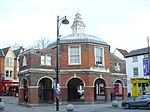
The Little Market House
Wycombe
Market House
c. 1604
9 January 1954
SU8655693031 51°37′46″N 0°45′03″W / 51.629445°N 0.750889°W / 51.629445; -0.750889 (The Little Market House)
1310836 The Little Market House More images
Wycombe Abbey (parts of Wycombe Abbey School)
Wycombe
Manor House
17th century
9 January 1954
SU8658192627 51°37′33″N 0°45′02″W / 51.625809°N 0.750628°W / 51.625809; -0.750628 (Wycombe Abbey (parts of Wycombe Abbey School))
1310649 Upload Photo
7 Castle Street
Wycombe
House
18th century
28 June 1973
SU8656293129 51°37′49″N 0°45′03″W / 51.630325°N 0.750779°W / 51.630325; -0.750779 (7 Castle Street)
1159695 Upload Photo
30 High Street
Wycombe
House
18th century
9 January 1954
SU8666792924 51°37′42″N 0°44′58″W / 51.628466°N 0.749313°W / 51.628466; -0.749313 (30 High Street)
1159966 Upload Photo
33 High Street
Wycombe
House
18th century
9 January 1954
SU8664292942 51°37′43″N 0°44′59″W / 51.628632°N 0.749669°W / 51.628632; -0.749669 (33 High Street)
1332337 Upload Photo
34 High Street
Wycombe
House
18th century or earlier
28 June 1973
SU8662492942 51°37′43″N 0°45′00″W / 51.628634°N 0.749929°W / 51.628634; -0.749929 (34 High Street)
1125162 Upload Photo
39 High Street
Wycombe
Town House
1st half of 18th century
9 January 1954
SU8657192981 51°37′44″N 0°45′02″W / 51.628993°N 0.750685°W / 51.628993; -0.750685 (39 High Street)
1125163 Upload Photo


