There are over 9,000 Grade I listed buildings and 20,000 Grade II* listed buildings in England. This page is a list of these buildings in the unitary authority of Warrington in Cheshire, including the town of Warrington and 18 other civil parishes.
Map all coordinates using OpenStreetMapDownload coordinates as:
Grade I
| Name | Location | Type | Completed | Date designated | Grid ref. Geo-coordinates | Notes | Entry number | Image |
|---|---|---|---|---|---|---|---|---|
| Sankey Viaduct | Burtonwood and Westbrook, Warrington | Railway Viaduct | 1830 | 21 February 1977 | SJ5687094711 53°26′51″N 2°39′01″W / 53.44759°N 2.65018°W / 53.44759; -2.65018 (Sankey Viaduct) |
The first railway viaduct to be built in the world, it was designed by George Stephenson for the Liverpool and Manchester Railway Company to carry the railway across the Sankey Valley. It is constructed in brick faced with sandstone ashlar. The viaduct is carried on nine semicircular arches. | 1075927 |  |
| St Wilfrid's Church, Grappenhall | Grappenhall and Thelwall, Warrington | Church | 12th century | 8 January 1970 | SJ6394386300 53°22′20″N 2°32′36″W / 53.3723°N 2.5434°W / 53.3723; -2.5434 (St Wilfrid's Church, Grappenhall) |
There is some Norman fabric in the south wall of the nave, the south chapel was built as a chantry in about 1334, and the tower and most of the rest of the church date from 1525–39. The clerestory was added in 1833, and the north vestry in 1851. In 1873–74 Paley and Austin carried out a restoration. | 1139320 |  |
| Lymm Cross | Lymm, Warrington | Cross | Early to mid-17th century | 24 January 1950 | SJ6833787244 53°22′52″N 2°28′39″W / 53.3811°N 2.4776°W / 53.3811; -2.4776 (Lymm Cross) |
This is a sandstone structure standing on an artificially stepped sandstone outcrop. The shaft of the cross is contained in a square pavilion with square corner pillars, which has a roof with pedimented gables and a ball finial. | 1227014 |  |
| St Oswald's Church | Winwick, Warrington | Church | Early 13th century | 9 August 1966 | SJ6037592833 53°25′51″N 2°35′52″W / 53.4308°N 2.5979°W / 53.4308; -2.5979 (St Oswald's Church) |
Additions and alterations have been made over the centuries, including the rebuilding of the chancel, sanctuary and vestry by A. W. N. Pugin in 1847–49, and the rebuilding of the spire and restoration of the church in 1869 by Paley and Austin. The church is constructed in sandstone, and has a west tower. Many of the furnishings were designed by Pugin. Inside the church is the cross-arm of an Anglo-Saxon preaching cross dating from around 750. | 1278428 |  |
| Eastern Outbuilding, Town Hall |
Warrington | House | 1750 | 4 April 1975 | SJ6026088267 53°23′23″N 2°35′56″W / 53.3898°N 2.5990°W / 53.3898; -2.5990 (Eastern Outbuilding, Town Hall) |
This was built as offices for Bank Hall, and were later used by the local authority. The building has a three-bay rusticated and pedimented centre, and five brick bays on each side. | 1329748 |  Upload Photo |
| Town Hall | Warrington | Town Hall | 1750 | 6 December 1949 | SJ6021888266 53°23′23″N 2°35′59″W / 53.3897°N 2.5997°W / 53.3897; -2.5997 (Town Hall) |
Designed by James Gibbs as a country house, named Bank House, for Thomas Patten, this in Palladian style. It has three storeys and a hipped slate roof. The house is constructed in red brick and rusticated stone. In the centre is full-height portico with Composite columns carrying a pediment bearing the arms of the Patten family. The entrance is in the middle storey and is approached by a double staircase. | 1329725 |  |
| Western Outbuilding, Town Hall |
Warrington | House | 1750 | 6 December 1949 | SJ6017688259 53°23′23″N 2°36′01″W / 53.3897°N 2.6003°W / 53.3897; -2.6003 (Western Outbuilding, Town Hall) |
This was built as stables for Bank Hall, and were later used as offices by the local authority. The building has a three-bay rusticated and pedimented centre, and three brick bays on each side. | 1261276 |  Upload Photo |
Grade II*
| Name | Location | Type | Completed | Date designated | Grid ref. Geo-coordinates | Notes | Entry number | Image |
|---|---|---|---|---|---|---|---|---|
| Tanyard Farm Farmbuilding | Appleton, Warrington | Barn | Late 16th century | 23 December 1983 | SJ6573783844 53°21′01″N 2°30′58″W / 53.3504°N 2.5162°W / 53.3504; -2.5162 (Tanyard Farm Farmbuilding) |
This originated as a threshing barn, cartshed and stable, which form an L-shaped plan. It is timber-framed, with brick nogging, and stands on a sandstone plinth. It is roofed with blue tiles. The timber framing includes four crucks, two of which are complete, the other two are sawn off near the top. | 1139363 |  Upload Photo |
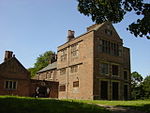
| Bewsey Old Hall | Bewsey, Burtonwood and Westbrook, Warrington | House | Late 16th century | 4 December 1951 | SJ5907089572 53°24′05″N 2°37′01″W / 53.4013°N 2.6170°W / 53.4013; -2.6170 (Bewsey Old Hall) |
The hall underwent alterations during the 17th to the 19th centuries, and was restored and partly rebuilt in the 20th century, but only a fragment of the original hall has survived. What does survive has an L-shaped plan, and is in three storeys. It is constructed in brick with stone dressings and slate roofs, and has mullioned or mullioned and transomed windows. The moated site on which the hall stands is a scheduled monument. | 1230619 |  |
| Gatehouse to Bradley (or Bradlegh) Old Hall |
Burtonwood and Westbrook, Warrington | Gatehouse | c. 1460 | 4 December 1951 | SJ5717293902 53°26′24″N 2°38′46″W / 53.44013°N 2.64622°W / 53.44013; -2.64622 (Gatehouse to Bradley (or Bradlegh) Old Hall) |
The gatehouse to the hall, now partly in ruins. It is constructed in sandstone, forming an archway above the entrance to the drive. The surviving features include the arch, which is four-centred with colonnettes (small columns), the springers of the fallen vault, and octagonal canted mock turrets supported by buttresses at the four corners. | 1278505 |  (or Bradlegh) Old Hall |
| Holcroft Hall | Culcheth, Culcheth and Glazebury, Warrington | Farmhouse | Late 15th to early 16th century | 15 November 1966 | SJ6797995162 53°27′08″N 2°29′01″W / 53.4522°N 2.4837°W / 53.4522; -2.4837 (Holcroft Hall) |
A farmhouse that has been altered and extended. It is constructed in rendered brick with a slate roof. It is in two storeys with an attic, and has four bays, including an added wing. The windows are mullioned. Inside the house is another mullioned window, moulded beams, and a priest hole. | 1159651 |  |
| North Barn at Hurst Hall | Glazebury, Culcheth and Glazebury, Warrington | Hall House | Late 15th century or earlier | 22 August 1983 | SJ6685496903 53°28′04″N 2°30′03″W / 53.4678°N 2.5008°W / 53.4678; -2.5008 (North Barn at Hurst Hall) |
This is part of what was originally on old hall, later converted into a barn. It is basically timber framed with brick cladding and a stone slate roof. It is in two bays, with an extra half-bay at each end. The timber roof is open, of unusual construction for the region, and said to be "spectacular". | 1139388 |  Upload Photo |
| Lymm Hall | Lymm, Warrington | House | Late 16th century | 24 January 1950 | SJ6843987041 53°22′45″N 2°28′33″W / 53.3792°N 2.4759°W / 53.3792; -2.4759 (Lymm Hall) |
Constructed in sandstone and brick, it was originally an E-shaped Elizabethan moated house. Since then, the hall has been altered and restored, particularly in the 19th century. | 1265849 |  Upload Photo |
| St John the Evangelist's Church | Walton, Warrington | Church | 1882–83 | 23 December 1983 | SJ5984685254 53°21′45″N 2°36′18″W / 53.3626°N 2.6049°W / 53.3626; -2.6049 (St John the Evangelist's Church) |
The church was designed by Paley and Austin, and paid for by Sir Gilbert Greenall. It is in Decorated style, and constructed in sandstone with Westmorland green slate roofs. The church has a cruciform plan, with a large central tower decorated with chequerwork and surmounted by an octagonal spire. | 1139352 |  |
| Myddleton Hall | Houghton Green, Winwick, Warrington | Hall House | 1658 | 9 August 1966 | SJ6199592973 53°25′56″N 2°34′24″W / 53.4321°N 2.5734°W / 53.4321; -2.5734 (Myddleton Hall) |
A brick country house standing on a sandstone plinth with sandstone dressings. It is in two storeys and consists of a hall with two cross wings, and another right wing. The windows are mullioned and/or transomed. Some of the 19th-century additions have been demolished. | 1231049 |  Upload Photo |
| St Ann's Church | Warrington | Church | 1866–68 | 24 October 1974 | SJ6054889042 53°23′48″N 2°35′41″W / 53.3967°N 2.5948°W / 53.3967; -2.5948 (St Ann's Church) |
Designed by John Douglas in High Victorian Gothic style. It is constructed in red brick with dressings in blue brick. The church has a tower and an apsidal chancel. It is now redundant, and was converted into an indoor climbing centre in 1996. | 1161591 |  |
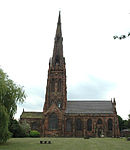
| St Elphin's Church | Warrington | Church | 14th century | 6 December 1949 | SJ6153288397 53°23′28″N 2°34′48″W / 53.3910°N 2.5799°W / 53.3910; -2.5799 (St Elphin's Church) |
The earliest fabric in the church dates from the 14th century. Following damage in the Civil War, the tower was rebuilt in 1696 and the nave in 1770. The south aisle was added in the early 19th century. Most of the fabric of the present church results from an extensive restoration between 1859 and 1867 by Frederick and Horace Francis, during which the spire was added. The spire is 281 feet (86 m) high, and one of the highest in England. The north transept forms the regimental chapel of the South Lancashire Regiment. | 1329734 |  |
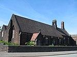
| Church of St Luke | Warrington | Church | 1892–93 | 4 April 1975 | SJ5918687795 53°23′07″N 2°36′54″W / 53.3854°N 2.6151°W / 53.3854; -2.6151 (Church of St Luke) |
A sandstone church with tiled roofs designed by Bodley and Garner, it is now redundant. It consists of a nave, north aisle, chancel and south porch. There is a bellcote on the east end of the nave. The church is unusual in that it has a central nave arcade and another arcade between the nave and the aisle. | 1329757 |  |
| Holy Trinity Church | Warrington | Church | 1758 | 6 December 1949 | SJ6059788168 53°23′22″N 2°35′30″W / 53.3894°N 2.5917°W / 53.3894; -2.5917 (Holy Trinity Church) |
This is a Georgian church designed in the style of James Gibbs. Its front is in sandstone, the back in brick with stone dressings. A clock tower was added to the west of the church in 1862. Further alterations were made during the 20th century. Features include a Doric doorcase, with Ionic pilasters above, a cornice and a plain parapet. In the east wall is a Venetian window. | 1161522 |  |
| Cromwell's House | Warrington | House | 17th century | 6 December 1949 | SJ6130488348 53°23′26″N 2°35′00″W / 53.3905°N 2.5833°W / 53.3905; -2.5833 (Cromwell's House) |
This probably originated as a single house, later divided into three cottages. It is timber-framed with painted brick infill on a stone plinth. There are two storeys, the upper storey being jettied. The windows are casements with wooden mullions. At the rear are single-storey extensions, and three half-dormers. | 1310102 |  |
| Entrance gates, piers and lamps, Town Hall | Warrington | House | 1862 | 4 April 1975 | SJ6022688157 53°23′20″N 2°35′58″W / 53.38876°N 2.59949°W / 53.38876; -2.59949 (Entrance gates, piers and lamps, Town Hall) |
A set of ornate gates in cast iron, partly gilded, designed by Kershaw and Crook, and made at the Coalbrookdale Company at Ironbridge. They were shown at the International Exhibition in London in 1862, and erected here in 1895. Statues depicting Nike by John Bell stand on the four posts. Among the decorations are the Prince of Wales's feathers and his motto. | 1261277 |  |
| Lamps on east and west drives of Town Hall | Warrington | House | 1750 | 4 April 1975 | SJ6018488207 53°23′21″N 2°36′00″W / 53.38923°N 2.60011°W / 53.38923; -2.60011 (Lamps on east and west drives of Town Hall) |
There are lamps part-way down the east and west drives leading to the Town Hall that was designed by James Gibbs. | 1239919 |  Upload Photo |
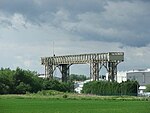
| Warrington Transporter Bridge | Warrington | Transporter Bridge | 1911–14 | 4 April 1975 | SJ5968187619 53°23′02″N 2°36′27″W / 53.38383°N 2.60757°W / 53.38383; -2.60757 (Warrington Transporter Bridge) |
The transporter bridge was built to carry materials across the River Mersey between two parts of the Crosfield's factory. It is a steel structure with a span of 200 feet (61 m) between the towers. The bridge was designed by William Henry Hunter and built by William Arrol. The structure is also a scheduled monument. | 1139433 |  |
| Barley Mow Public House | Warrington | Public House | 1561 | 6 December 1949 | SJ6055388303 53°23′24″N 2°35′41″W / 53.3899°N 2.5946°W / 53.3899; -2.5946 (Barley Mow Public House) |
A timber-framed public house that has been much altered. The front facing Market Place is in elaborate black-and-white work, including quatrefoils, standing on a red sandstone plinth. It is in three storeys, including two jettied gables, and two continuous rows of small-pane windows. Inside the public house is a mixture of original 17th-century and later panelling. | 1139399 |  |
| Barley Mow Public House (side façade) | Warrington | Public House | 19th century | 6 December 1949 | SJ6056088293 53°23′24″N 2°35′40″W / 53.3900°N 2.5945°W / 53.3900; -2.5945 (Barley Mow Public House (side façade)) |
This façade dates from a 19th-century refronting of the public house that originated in the 16th century. It is in brick, with two storeys and an attic. There is a round-arched entrance flanked by wooden pilasters, and a tympanum that incorporates the carving of a barley sheaf. The windows are sashes, and there are two small blocked windows in the attic. | 1310100 |  Upload Photo |
Notes
- ^ The date given is the date used by Historic England as significant for the initial building or that of an important part in the structure's description.
- ^ Sometimes known as OSGB36, the grid reference is based on the British national grid reference system used by the Ordnance Survey.
- ^ The "List Entry Number" is a unique number assigned to each listed building and scheduled monument by Historic England.
See also
- Grade I listed buildings in Cheshire
- Grade II* listed buildings in Cheshire
- Listed buildings in Warrington (unparished area)
References
- Pollard & Pevsner (2006), pp. 526–527
- Historic England, "Sankey Viaduct over Sankey Brook (that part in Warrington district) (1230621)", National Heritage List for England, retrieved 10 February 2013
- Pollard & Pevsner 2006, p. 630
- Historic England, "Church of St Wilfrid, Grappenhall and Thelwall (1139320)", National Heritage List for England, retrieved 26 December 2012
- ^ Hartwell et al. (2011), p. 448
- Historic England, "Lymm Cross (1227014)", National Heritage List for England, retrieved 23 December 2012
- Pollard & Pevsner (2006), pp. 678–682
- Historic England, "Church of St Oswald, Winwick (1278428)", National Heritage List for England, retrieved 5 February 2013
- History, St Oswald, Winwick, archived from the original on 22 July 2012, retrieved 5 February 2013
- ^ Pollard & Pevsner (2006), pp. 611–612
- Historic England, "Eastern Outbuilding to Town Hall, Warrington (1329748)", National Heritage List for England, retrieved 18 February 2013
- Historic England, "Town Hall, Warrington (1329725)", National Heritage List for England, retrieved 18 February 2013
- Historic England, "Western Outbuilding to Town Hall, Warrington (1261276)", National Heritage List for England, retrieved 18 February 2013
- Historic England, "Tanyard Farm Farm-building, Appleton (1139363)", National Heritage List for England, retrieved 26 January 2013
- Pollard & Pevsner (2006), pp. 632–633
- Historic England, "Bewsey Old Hall, Burtonwood and Westbrook (1230619)", National Heritage List for England, retrieved 9 February 2013
- Historic England, "Bewsey Old Hall moated site, fishpond and connecting channel, Burtonwood and Westbrook (1012324)", National Heritage List for England, retrieved 9 February 2013
- Pollard & Pevsner (2006), p. 163
- Historic England, "Gatehouse to Bradlegh Old Hall, Burtonwood and Westbrook (1278505)", National Heritage List for England, retrieved 9 February 2013
- Pollard & Pevsner (2006), p. 168
- Historic England, "Holcroft Hall, Culcheth and Glazebury (1159651)", National Heritage List for England, retrieved 9 February 2013
- Pollard & Pevsner (2006), pp. 175–176
- Historic England, "North Barn at Hurst Hall, Culcheth and Glazebury (1139388)", National Heritage List for England, retrieved 9 February 2013
- Historic England, "Lymm Hall (1265849)", National Heritage List for England, retrieved 24 December 2012
- Pollard & Pevsner (2006), p. 629
- Historic England, "Church of St St John the Evangelist, Walton (1139352)", National Heritage List for England, retrieved 6 February 2013
- Pollard & Pevsner (2006), p. 683
- Historic England, "Myddleton Hall, Winwick (1231049)", National Heritage List for England, retrieved 5 February 2013
- Pollard & Pevsner (2006), p. 621
- Historic England, "Church of St Ann, Warrington (1161591)", National Heritage List for England, retrieved 16 February 2013
- Pollard & Pevsner (2006), pp. 604–607
- Historic England, "Church of St Elphin, Warrington (1329734)", National Heritage List for England, retrieved 27 August 2013
- More, Warrington Parish Church, retrieved 10 February 2013
- Pollard & Pevsner (2006), p. 631
- Historic England, "Church of St Luke, Warrington (1329757)", National Heritage List for England, retrieved 18 February 2013
- Pollard & Pevsner (2006), pp. 607–608
- Historic England, "Church of the Holy Trinity, Warrington (1161522)", National Heritage List for England, retrieved 15 February 2013
- Pollard & Pevsner (2006), p. 618
- Historic England, "Cromwell House, Warrington (1310102)", National Heritage List for England, retrieved 17 February 2013
- Pollard & Pevsner (2006), pp. 612–613
- Historic England, "Entrance gates, piers and lamps at Town Hall, Warrington (1261277)", National Heritage List for England, retrieved 12 February 2013
- Historic England, "Lamps on East and West drives of Town Hall, Warrington (1239919)", National Heritage List for England, retrieved 16 February 2013
- Pollard & Pevsner (2006), p. 616
- Historic England, "Transporter Bridge to part of Joseph Crosfield and Sons Ltd's Works, Warrington (1139433)", National Heritage List for England, retrieved 13 February 2013
- Historic England, "Bank Quay transporter bridge, Warrington (1006768)", National Heritage List for England, retrieved 13 February 2013
- Pollard & Pevsner (2006), p. 620
- Historic England, "Ye Olde Barley Mow Public House (excluding the side facade), Warrington (1139399)", National Heritage List for England, retrieved 11 February 2013
- Historic England, "Ye Olde Barley Mow Public house (only the side facade), Warrington (1310100)", National Heritage List for England, retrieved 10 February 2013
Sources
- Hartwell, Clare; Hyde, Matthew; Hubbard, Edward; Pevsner, Nikolaus (2011) , Cheshire, The Buildings of England, New Haven and London: Yale University Press, ISBN 978-0-300-17043-6
- Pollard, Richard; Pevsner, Nikolaus (2006). Lancashire: Liverpool and the South-West.