Name
Location
Type
Completed Date designated
Grid ref. Entry number Image
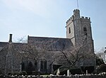
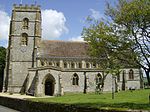
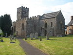
Church of St Michael and All Angels
Awliscombe Parish church Late 15th/early 16th century
27 January 1989
ST1337701829 50°48′34″N 3°13′51″W / 50.809513°N 3.230804°W / 50.809513; -3.230804 (Church of St Michael and All Angels)
1098097 Church of St Michael and All Angels More images
Weycroft Hall
Weycroft , Axminster Manor house c .14006 June 1983
SY3080699851 50°47′39″N 2°58′59″W / 50.794076°N 2.983105°W / 50.794076; -2.983105 (Weycroft Hall)
1098625 Upload Photo
Church of St Michael
Axmouth Parish church
12th century
8 May 1967
SY2563791036 50°42′51″N 3°03′17″W / 50.714178°N 3.054648°W / 50.714178; -3.054648 (Church of St Michael)
1098593 Church of St Michael More images
Stedcombe House
Stedcombe, Axmouth
Country house c .169711 September 1951
SY2641291980 50°43′22″N 3°02′38″W / 50.722765°N 3.043861°W / 50.722765; -3.043861 (Stedcombe House)
1098596 Stedcombe House More images
Palm House including greenhouse to south-east and terrace walls to south-west
Bicton Park , Bicton Greenhouse c. 1820–25
10 February 1987
SY0724085997 50°39′58″N 3°18′50″W / 50.666228°N 3.313892°W / 50.666228; -3.313892 (Palm House including greenhouse to south-east and terrace walls to south-west)
1097548 Palm House including greenhouse to south-east and terrace walls to south-west More images
Rolle Mausoleum including the ruins of the Old Church, adjoining to west
Bicton Park, Bicton
Mausoleum 1850 mausoleum, 15th century church
30 June 1961
SY0726885746 50°39′50″N 3°18′48″W / 50.663975°N 3.313433°W / 50.663975; -3.313433 (Rolle Mausoleum including the ruins of the Old Church, adjoining to west)
1203804 Rolle Mausoleum including the ruins of the Old Church, adjoining to west More images
Church of St Peter
Brampford Speke Parish church
15th century
30 June 1961
SX9274498237 50°46′26″N 3°31′21″W / 50.773766°N 3.522497°W / 50.773766; -3.522497 (Church of St Peter)
1163855 Church of St Peter More images
Church of St Winifred
Branscombe Parish church
Early 12th century
22 February 1955
SY1954788462 50°41′25″N 3°08′25″W / 50.690223°N 3.140328°W / 50.690223; -3.140328 (Church of St Winifred)
1309398 Church of St Winifred More images
Chapel of the Holy Evangelists
Killerton Park, Broadclyst
Chapel
1840–41
20 May 1985
SS9768100339 50°47′37″N 3°27′11″W / 50.793556°N 3.45309°W / 50.793556; -3.45309 (Chapel of the Holy Evangelists)
1098332 Chapel of the Holy Evangelists More images
Church of St John the Baptist
Broadclyst
Parish church
14th century
20 May 1985
SX9817897271 50°45′58″N 3°26′43″W / 50.766063°N 3.44519°W / 50.766063; -3.44519 (Church of St John the Baptist)
1170465 Church of St John the Baptist More images
Church of St Andrew
Broadhembury Parish church
14th/15th century
22 February 1955
ST1018404708 50°50′06″N 3°16′37″W / 50.834909°N 3.276816°W / 50.834909; -3.276816 (Church of St Andrew)
1281269 Church of St Andrew More images
Grange
Broadhembury
Country house
c . early 16th century27 January 1989
ST0928404212 50°49′49″N 3°17′22″W / 50.830309°N 3.28947°W / 50.830309; -3.28947 (Grange)
1098064 Grange More images
Church of St Andrew
Clyst Hydon Parish church
15th century
30 June 1961
ST0354201675 50°48′24″N 3°22′13″W / 50.806572°N 3.37031°W / 50.806572; -3.37031 (Church of St Andrew)
1162001 Church of St Andrew More images
Church of St Lawrence
Clyst St Lawrence Parish church
15th century
30 June 1961
SY0266499975 50°47′28″N 3°22′56″W / 50.791142°N 3.382316°W / 50.791142; -3.382316 (Church of St Lawrence)
1333709 Church of St Lawrence More images
Church of St Andrew
Colyton Parish church
15th century
8 May 1967
SY2459994093 50°44′30″N 3°04′12″W / 50.74153°N 3.069974°W / 50.74153; -3.069974 (Church of St Andrew)
1306053 Church of St Andrew More images
The Chantry
Combe Raleigh Chantry houseLate 15th century
22 February 1955
ST1594602372 50°48′53″N 3°11′40″W / 50.814774°N 3.194475°W / 50.814774; -3.194475 (The Chantry)
1098020 Upload Photo
Church of St Mary
Combpyne , Combpyne Rousdon Parish church
13th century
8 May 1967
SY2901592384 50°43′36″N 3°00′25″W / 50.726722°N 3.00707°W / 50.726722; -3.00707 (Church of St Mary)
1170551 Church of St Mary More images
Church of St Peter
Dalwood Parish church
15th century
8 May 1967
ST2479000537 50°47′58″N 3°04′07″W / 50.799493°N 3.068587°W / 50.799493; -3.068587 (Church of St Peter)
1170586 Church of St Peter More images
Church of All Saints
East Budleigh Parish church
15th century
30 June 1961
SY0661884922 50°39′23″N 3°19′21″W / 50.656463°N 3.322419°W / 50.656463; -3.322419 (Church of All Saints)
1204468 Church of All Saints More images
A La Ronde
Withycombe Raleigh , Exmouth Cottage orné 1798
6 December 1949
SY0048083390 50°38′30″N 3°24′32″W / 50.641673°N 3.408813°W / 50.641673; -3.408813 (A La Ronde)
1164838 A La Ronde More images
The Manse of the Point in View
Withycombe Raleigh, Exmouth
Manse 1825
15 June 1978
SY0083083523 50°38′35″N 3°24′14″W / 50.642928°N 3.403901°W / 50.642928; -3.403901 (The Manse of the Point in View)
1103806 Upload Photo
The Point in View
Withycombe Raleigh, Exmouth
Chapel, school and almshouses
1811
6 December 1949
SY0078883506 50°38′34″N 3°24′16″W / 50.642768°N 3.40449°W / 50.642768; -3.40449 (The Point in View)
1164937 The Point in View More images
Church of St Michael
Gittisham Parish church
Possibly 14th century
22 February 1955
SY1337398366 50°46′42″N 3°13′48″W / 50.778378°N 3.230043°W / 50.778378; -3.230043 (Church of St Michael)
1097994 Church of St Michael More images
Combe House
Combe, Gittisham
House
17th century
22 February 1955
SY1427397863 50°46′26″N 3°13′02″W / 50.77399°N 3.217163°W / 50.77399; -3.217163 (Combe House)
1098026 Combe House More images
Church of St John the Baptist
Hawkchurch Parish church
12th century
8 May 1967
ST3431500414 50°47′58″N 2°56′00″W / 50.799547°N 2.933427°W / 50.799547; -2.933427 (Church of St John the Baptist)
1098492 Church of St John the Baptist More images
Church of St Mary
Luppitt Parish church
Late 13th/early 14th century
22 February 1955
ST1690406758 50°51′16″N 3°10′55″W / 50.854345°N 3.181876°W / 50.854345; -3.181876 (Church of St Mary)
1307043 Church of St Mary More images
Church of St John the Baptist
Membury Parish church
12th century
8 May 1967
ST2762702941 50°49′17″N 3°01′44″W / 50.82147°N 3.028812°W / 50.82147; -3.028812 (Church of St John the Baptist)
1170817 Church of St John the Baptist More images
Church of St Michael
Musbury Parish church
15th century
8 May 1967
SY2756494564 50°44′46″N 3°01′41″W / 50.746143°N 3.028053°W / 50.746143; -3.028053 (Church of St Michael)
1333564 Church of St Michael More images
Church of St John the Baptist
Nether Exe Parish church
Late 15th century
30 June 1961
SX9312699830 50°47′17″N 3°31′03″W / 50.788157°N 3.517545°W / 50.788157; -3.517545 (Church of St John the Baptist)
1097624 Church of St John the Baptist More images
Church of the Blessed Virgin Mary
Offwell Parish church
13th century
22 February 1955
SY1948599575 50°47′24″N 3°08′37″W / 50.79013°N 3.143637°W / 50.79013; -3.143637 (Church of the Blessed Virgin Mary)
1104090 Church of the Blessed Virgin Mary More images
Cadhay
Ottery St Mary House
16th century
28 April 1952
SY0893796238 50°45′31″N 3°17′33″W / 50.758566°N 3.292417°W / 50.758566; -3.292417 (Cadhay)
1289400 Cadhay More images
Church of St Mary
Ottery St. Mary
Church
1260
28 April 1952
SY0985895567 50°45′10″N 3°16′45″W / 50.752678°N 3.279198°W / 50.752678; -3.279198 (Church of St Mary)
1212599 Church of St Mary More images
Knightstone
Wiggaton, Ottery St Mary
Country house
16th century
28 April 1952
SY1072194156 50°44′24″N 3°16′00″W / 50.740126°N 3.266625°W / 50.740126; -3.266625 (Knightstone)
1213714 Knightstone More images
Church of St Mary
Payhembury Parish church
Early 16th century
22 February 1955
ST0886801793 50°48′31″N 3°17′41″W / 50.808497°N 3.294774°W / 50.808497; -3.294774 (Church of St Mary)
1333739 Church of St Mary More images
Church of St John the Baptist
Plymtree Parish church
15th century
22 February 1955
ST0518102908 50°49′05″N 3°20′51″W / 50.817928°N 3.347375°W / 50.817928; -3.347375 (Church of St John the Baptist)
1333727 Church of St John the Baptist More images
Church of St Mary
Poltimore Parish church
Late 15th century
30 June 1961
SX9659696831 50°45′43″N 3°28′03″W / 50.761827°N 3.467491°W / 50.761827; -3.467491 (Church of St Mary)
1333257 Church of St Mary More images
Church of St Mary
Rewe Parish church
15th century
30 June 1961
SX9456399222 50°46′59″N 3°29′49″W / 50.782955°N 3.496992°W / 50.782955; -3.496992 (Church of St Mary)
1305699 Church of St Mary More images
Rockbeare Manor Including Terraces Adjoining to South
Rockbeare Country house
Mid-18th century
11 November 1952
SY0316294044 50°44′16″N 3°22′25″W / 50.737906°N 3.37369°W / 50.737906; -3.37369 (Rockbeare Manor Including Terraces Adjoining to South)
1203803 Rockbeare Manor Including Terraces Adjoining to South More images
Church of St Gregory
Seaton Parish church
Early 14th century
2 October 1951
SY2471590576 50°42′36″N 3°04′03″W / 50.709924°N 3.067611°W / 50.709924; -3.067611 (Church of St Gregory)
1164812 Church of St Gregory More images
Gate House at Old Shute House Including Flanking Walls and Pavilions
Shute Gatehouse c. 1570 or earlier 16th century
8 May 1967
SY2521497494 50°46′20″N 3°03′43″W / 50.772188°N 3.061951°W / 50.772188; -3.061951 (Gate House at Old Shute House Including Flanking Walls and Pavilions)
1098437 Gate House at Old Shute House Including Flanking Walls and Pavilions More images
Old Shute House
Shute
Manor house
c. 1380
14 December 1955
SY2524497412 50°46′17″N 3°03′41″W / 50.771455°N 3.061509°W / 50.771455; -3.061509 (Old Shute House)
1171033 Old Shute House More images
Church of St Giles and St Peter
Sidbury , Sidmouth Church
12th century
12 October 1951
SY1397091749 50°43′08″N 3°13′12″W / 50.718977°N 3.22003°W / 50.718977; -3.22003 (Church of St Giles and St Peter)
1216540 Church of St Giles and St Peter More images
Royal Glen Hotel
Sidmouth
House
m.SubMatches(0) 1820
12 October 1951
SY1216387222 50°40′41″N 3°14′40″W / 50.678006°N 3.244542°W / 50.678006; -3.244542 (Royal Glen Hotel)
1097909 Royal Glen Hotel More images
The Old Chancel
Sidmouth
House
1864
12 October 1951
SY1246787484 50°40′49″N 3°14′25″W / 50.680407°N 3.240303°W / 50.680407; -3.240303 (The Old Chancel)
1289171 The Old Chancel More images
Bishop's Court
Sowton Country house
1860–64
11 November 1952
SX9807891904 50°43′04″N 3°26′42″W / 50.717797°N 3.445121°W / 50.717797; -3.445121 (Bishop's Court)
1097577 Bishop's Court More images
Church of St Michael and All Angels
Sowton
Parish church
1844–45
19 March 1987
SX9758792513 50°43′23″N 3°27′08″W / 50.723185°N 3.452243°W / 50.723185; -3.452243 (Church of St Michael and All Angels)
1334001 Church of St Michael and All Angels More images
Stable Block Adjoining Tithe Barn to North-north-west
Sowton
Stable
Early 16th century
19 March 1987
SX9815091812 50°43′01″N 3°26′39″W / 50.716983°N 3.444076°W / 50.716983; -3.444076 (Stable Block Adjoining Tithe Barn to North-north-west)
1333998 Upload Photo
Tithe Barn 150 Metres South-east of Bishop's Court
Sowton
Tithe barn Probably early 14th century
11 November 1952
SX9813091801 50°43′01″N 3°26′40″W / 50.71688°N 3.444357°W / 50.71688; -3.444357 (Tithe Barn 150 Metres South-east of Bishop's Court)
1164637 Tithe Barn 150 Metres South-east of Bishop's Court
Church of St Michael
Stockland Parish church
13th century
8 May 1967
ST2446104528 50°50′07″N 3°04′27″W / 50.835333°N 3.074077°W / 50.835333; -3.074077 (Church of St Michael)
1098406 Church of St Michael More images
Church of St Mary Magdalene
Stoke Canon Parish church
Late 15th century
30 June 1961
SX9395698016 50°46′19″N 3°30′19″W / 50.772003°N 3.505251°W / 50.772003; -3.505251 (Church of St Mary Magdalene)
1333984 Church of St Mary Magdalene More images
Church of St James
Talaton Parish church
15th century
22 February 1955
SY0674599734 50°47′23″N 3°19′28″W / 50.789648°N 3.324373°W / 50.789648; -3.324373 (Church of St James)
1098109 Church of St James More images
Church of Our Lady
Upton Pyne Parish church
15th century
30 June 1961
SX9101997708 50°46′07″N 3°32′48″W / 50.768689°N 3.546795°W / 50.768689; -3.546795 (Church of Our Lady)
1334009 Church of Our Lady More images
Church of St Swithun
Woodbury Parish church
1409
30 June 1961
SY0093887191 50°40′33″N 3°24′12″W / 50.675922°N 3.403356°W / 50.675922; -3.403356 (Church of St Swithun)
1104176 Church of St Swithun More images
Church of St John the Baptist
Yarcombe Parish church
15th century
22 February 1955
ST2455408195 50°52′06″N 3°04′25″W / 50.868315°N 3.073514°W / 50.868315; -3.073514 (Church of St John the Baptist)
1098193 Church of St John the Baptist More images


