Name
Location
Type
Completed Date designated
Grid ref. Entry number Image
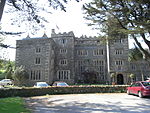
Boringdon Hall
Boringdon, City of Plymouth
Great House
Medieval
20 February 1952
SX5393157780 50°24′06″N 4°03′24″W / 50.401696°N 4.056712°W / 50.401696; -4.056712 (Boringdon Hall)
1330575 Boringdon Hall More images
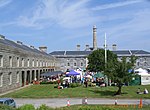
Brewhouse, Royal William Victualling Yard
Stonehouse , PlymouthOrdnance Factory
1929
13 August 1999
SX4601653553 50°21′42″N 4°09′59″W / 50.361687°N 4.166271°W / 50.361687; -4.166271 (Brewhouse, Royal William Victualling Yard)
1378528 Brewhouse, Royal William Victualling Yard
Charles Church
City of Plymouth
Parish Church
1640–1658
25 January 1954
SX4821654605 50°22′18″N 4°08′09″W / 50.371713°N 4.135788°W / 50.371713; -4.135788 (Charles Church)
1130021 Charles Church More images
Church of St Andrew
City of Plymouth
Parish Church
Mid to Late 15th century
25 January 1954
SX4792054395 50°22′11″N 4°08′24″W / 50.369749°N 4.139862°W / 50.369749; -4.139862 (Church of St Andrew)
1130012 Church of St Andrew More images
Clarence Steps, South West Quay Wall and 2 Bollards, Royal William Victualling Yard
Stonehouse , PlymouthGate
1826–1831
13 August 1999
SX4595153405 50°21′37″N 4°10′02″W / 50.36034°N 4.167124°W / 50.36034; -4.167124 (Clarence Steps, South West Quay Wall and 2 Bollards, Royal William Victualling Yard)
1378526 Clarence Steps, South West Quay Wall and 2 Bollards, Royal William Victualling Yard
Clarence Store, Royal William Victualling Yard
Stonehouse , PlymouthNaval Storehouse
1829–1831
13 August 1999
SX4597153460 50°21′39″N 4°10′01″W / 50.360839°N 4.166865°W / 50.360839; -4.166865 (Clarence Store, Royal William Victualling Yard)
1378527 Clarence Store, Royal William Victualling Yard
Devonport Column
Devonport , City of PlymouthColumn
1824
25 January 1954
SX4531654402 50°22′09″N 4°10′35″W / 50.369133°N 4.176454°W / 50.369133; -4.176454 (Devonport Column)
1322008 Devonport Column More images
Devonport Guildhall and Attached Walls
Devonport, City of Plymouth
Wall
1821–1822
25 January 1954
SX4532854385 50°22′08″N 4°10′35″W / 50.368983°N 4.176279°W / 50.368983; -4.176279 (Devonport Guildhall and Attached Walls)
1322009 Devonport Guildhall and Attached WallsMore images
Dock Basin Walls and 6 Associated Bollards, Royal William Victualling Yard
Stonehouse , PlymouthMooring Bollard
1826–1832
13 August 1999
SX4612253626 50°21′45″N 4°09′53″W / 50.362371°N 4.164812°W / 50.362371; -4.164812 (Dock Basin Walls and 6 Associated Bollards, Royal William Victualling Yard)
1378529 Dock Basin Walls and 6 Associated Bollards, Royal William Victualling Yard
East Ropery, Formerly Spinning House (S 132), and Attached Retaining Walls
Devonport Dockyard, City of Plymouth
Fireproof Factory
Rebuilt 1813–1817
13 August 1999
SX4518854215 50°22′03″N 4°10′41″W / 50.367419°N 4.178176°W / 50.367419; -4.178176 (East Ropery, Formerly Spinning House (S 132), and Attached Retaining Walls)
1388400 Upload Photo
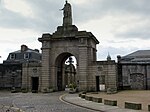
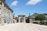
Main Gate, Royal William Victualling Yard
Stonehouse , PlymouthGate
1829–1833
13 August 1999
SX4626053635 50°21′45″N 4°09′46″W / 50.362487°N 4.162877°W / 50.362487; -4.162877 (Main Gate, Royal William Victualling Yard)
1378530 Main Gate, Royal William Victualling Yard More images
Melville, Royal William Victualling Yard
Stonehouse , PlymouthFireproof Building
1828–1832
13 August 1999
SX4616253536 50°21′42″N 4°09′51″W / 50.361572°N 4.164213°W / 50.361572; -4.164213 (Melville, Royal William Victualling Yard)
1378531 Melville, Royal William Victualling Yard
Mills and Bakery, Royal William Victualling Yard
Stonehouse , PlymouthBakery
1830–1834
13 August 1999
SX4618553628 50°21′45″N 4°09′50″W / 50.362405°N 4.163928°W / 50.362405; -4.163928 (Mills and Bakery, Royal William Victualling Yard)
1378532 Mills and Bakery, Royal William Victualling Yard
North East Quay Wall and 2 Bollards, Royal William Victualling Yard
Stonehouse , PlymouthWall
1826–1831
13 August 1999
SX4612353659 50°21′46″N 4°09′53″W / 50.362667°N 4.164811°W / 50.362667; -4.164811 (North East Quay Wall and 2 Bollards, Royal William Victualling Yard)
1378533 North East Quay Wall and 2 Bollards, Royal William Victualling Yard
Oddfellows Hall
Devonport, City of Plymouth
Oddfellows Hall
1823
21 January 1954
SX4538054413 50°22′09″N 4°10′32″W / 50.369248°N 4.17556°W / 50.369248; -4.17556 (Oddfellows Hall)
1322006 Oddfellows Hall More images
Old Cooperage, Royal William Victualling Yard
Stonehouse , PlymouthOrdnance Factory
1891
13 August 1999
SX4604253476 50°21′40″N 4°09′57″W / 50.361002°N 4.165874°W / 50.361002; -4.165874 (Old Cooperage, Royal William Victualling Yard)
1378536 Old Cooperage, Royal William Victualling Yard
Plympton House (St Peter's Convent)
Plympton St Maurice Country House
1952
23 April 1952
SX5466055896 50°23′06″N 4°02′45″W / 50.384944°N 4.045732°W / 50.384944; -4.045732 (Plympton House (St Peter's Convent))
1113363 Plympton House (St Peter's Convent)More images
Police Buildings, Royal William Victualling Yard
Stonehouse , PlymouthHouse
Before 1891
13 August 1999
SX4625653615 50°21′44″N 4°09′47″W / 50.362307°N 4.162925°W / 50.362307; -4.162925 (Police Buildings, Royal William Victualling Yard)
1378534 Police Buildings, Royal William Victualling Yard
Prysten House
City of Plymouth
Merchants House
c. 1498
25 January 1954
SX4792354371 50°22′10″N 4°08′23″W / 50.369534°N 4.139811°W / 50.369534; -4.139811 (Prysten House)
1067152 Prysten House More images
Royal Albert Bridge and 17 Approach Spans
Riverside
Suspension Bridge
1848
17 January 1952
SX4351558740 50°24′28″N 4°12′13″W / 50.40764°N 4.203566°W / 50.40764; -4.203566 (Royal Albert Bridge and 17 Approach Spans)
1159292 Royal Albert Bridge and 17 Approach SpansMore images
Saltram House
Saltram Park, City of Plymouth
Country House
18th century
23 April 1952
SX5203855605 50°22′54″N 4°04′57″W / 50.381675°N 4.082474°W / 50.381675; -4.082474 (Saltram House)
1386230 Saltram House More images
Slaughterhouse and Attached Yard Wall, Royal William Victualling Yard
Stonehouse , PlymouthWall
1830–1831
13 August 1999
SX4620853669 50°21′46″N 4°09′49″W / 50.362779°N 4.163621°W / 50.362779; -4.163621 (Slaughterhouse and Attached Yard Wall, Royal William Victualling Yard)
1378535 Slaughterhouse and Attached Yard Wall, Royal William Victualling Yard
The Quadrangle (n 173-177, 186-191, 203)
Devonport Dockyard, City of Plymouth
Boiler House
1852–1861
13 August 1999
SX4490255661 50°22′49″N 4°10′58″W / 50.380338°N 4.182791°W / 50.380338; -4.182791 (The Quadrangle (n 173-177, 186-191, 203))
1378566 The Quadrangle (n 173-177, 186-191, 203)
Smeaton's Tower
Hoe , City of PlymouthLighthouse
1759
25 January 1954
SX4776253799 50°21′52″N 4°08′31″W / 50.364352°N 4.141841°W / 50.364352; -4.141841 (Smeaton's Tower)
1386470 Smeaton's Tower More images
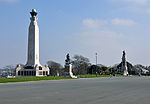
Plymouth Naval War Memorial
The Promenade, Plymouth
War Memorial
1924
1 May 1975
SX4774053940 50°21′56″N 4°08′32″W / 50.365614°N 4.142208°W / 50.365614; -4.142208 (Plymouth Naval War Memorial)
1386464 Plymouth Naval War Memorial More images
