Misplaced Pages

Grade I listed buildings in Torbay

Article snapshot taken from Wikipedia with creative commons attribution-sharealike license. Give it a read and then ask your questions in the chat. We can research this topic together.

Map all coordinates using OpenStreetMap

Download coordinates as:

There are more than 9000 Grade I listed buildings in England. This page is a list of these buildings in the district of Torbay in Devon.

Torbay

Name Location Type Completed Date designated Grid ref.
Geo-coordinates
Entry number Image
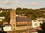
Parish Church of All Saints Babbacombe, Torbay Parish Church 1868-1874 20 November 1952 SX9247665274
50°28′39″N 3°31′00″W / 50.477391°N 3.51673°W / 50.477391; -3.51673 (Parish Church of All Saints)
1280043
Parish Church of All Saints
More images
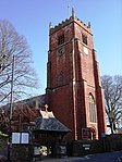
Parish Church of St John the Baptist Torbay Parish Church 12th century 13 March 1951 SX8863460836
50°26′12″N 3°34′10″W / 50.436777°N 3.569534°W / 50.436777; -3.569534 (Parish Church of St John the Baptist)
1195097
Parish Church of St John the Baptist
More images
Parish Church of St John the Evangelist Torbay Parish Church 1861-1873 20 November 1952 SX9188663653
50°27′46″N 3°31′28″W / 50.46271°N 3.524573°W / 50.46271; -3.524573 (Parish Church of St John the Evangelist)
1206814
Parish Church of St John the Evangelist
More images
The Spanish Barn, Torre Abbey Torbay Abbey Could be as early as 13th century 20 November 1952 SX9072263746
50°27′48″N 3°32′28″W / 50.46333°N 3.540994°W / 50.46333; -3.540994 (The Spanish Barn, Torre Abbey)
1280012
The Spanish Barn, Torre Abbey
More images
Torre Abbey Torbay Abbey Founded 1196 20 November 1952 SX9074863816
50°27′50″N 3°32′26″W / 50.463964°N 3.540648°W / 50.463964; -3.540648 (Torre Abbey)
1206852
Torre Abbey
Torre Abbey
More images
Roman Church of Our Lady, Help of Christians and St Denis Torquay Roman Catholic church 1865-9 14 February 1972 SX9191465881
50°28′58″N 3°31′29″W / 50.482742°N 3.524850°W / 50.482742; -3.524850 (Roman Church of Our Lady, Help of Christians and St Denis)
1206830
Roman Church of Our Lady, Help of Christians and St Denis
More images

Notes

  1. The date given is the date used by Historic England as significant for the initial building or that of an important part in the structure's description.
  2. Sometimes known as OSGB36, the grid reference is based on the British national grid reference system used by the Ordnance Survey.
  3. The "List Entry Number" is a unique number assigned to each listed building and scheduled monument by Historic England.

External links

Grade I listed buildings in England
Counties
Districts
Towns and cities
By type
Categories: