| Grand-Santi | |
|---|---|
| Commune | |
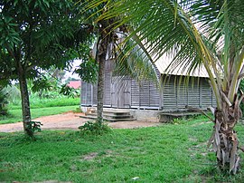
 Church of Grand-Santi Church of Grand-Santi | |
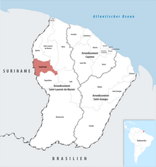
 Location of the commune (in red) within French Guiana Location of the commune (in red) within French Guiana | |
| Location of Grand-Santi | |
| Coordinates: 4°16′26″N 54°22′58″W / 4.2739°N 54.3828°W / 4.2739; -54.3828 | |
| Country | France |
| Overseas region and department | French Guiana |
| Arrondissement | Saint-Laurent-du-Maroni |
| Intercommunality | Ouest Guyanais |
| Government | |
| • Mayor (2020–2026) | Felix Dada |
| Area | 2,112 km (815 sq mi) |
| Population | 9,120 |
| • Density | 4.3/km (11/sq mi) |
| Time zone | UTC−03:00 |
| INSEE/Postal code | 97357 /97340 |
| French Land Register data, which excludes lakes, ponds, glaciers > 1 km (0.386 sq mi or 247 acres) and river estuaries. | |
Grand-Santi (French pronunciation: [ɡʁɑ̃ sɑ̃ti]; French Guianese Creole: Gransanti) is a commune of French Guiana, an overseas region and department of France located in South America. Most of the inhabitants are Ndyuka Maroons and Surinamese immigrants.
History
The commune was originally called Grand-Santi-Papaichton and included the now independent communes of Apatou and Papaichton. On 12 November 1976 Apatou was detached from Grand-Santi-Papaichton and became an independent commune. On 1 January 1993 Papaichton was also detached from Grand-Saint-Papaichton and became an independent commune. On that occasion, the name of the commune was shortened into Grand-Santi. The commune mainly lives from small-scale agriculture and fishing. The commune also contains other villages like Belikampoe [nl].
Population
| Year | Pop. | ±% p.a. |
|---|---|---|
| 1967 | 723 | — |
| 1974 | 1,041 | +5.35% |
| 1982 | 754 | −3.95% |
| 1990 | 1,786 | +11.38% |
| 1999 | 2,862 | +5.38% |
| 2007 | 3,427 | +2.28% |
| 2012 | 6,029 | +11.96% |
| 2017 | 7,918 | +5.60% |
| 2021 | 9,120 | +3.60% |
| Source: INSEE | ||
Transport

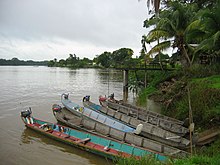
The commune can only be reached by boat or airplane. The Grand-Santi Airport is located 1 km (0.54 NM) northeast of Grand-Santi.
See also
References
- "Répertoire national des élus: les maires" (in French). data.gouv.fr, Plateforme ouverte des données publiques françaises. 4 May 2022.
- "Populations légales 2021" (in French). The National Institute of Statistics and Economic Studies. 28 December 2023.
- ^ "Grand-Santi". Petit Futé (in French). Retrieved 8 June 2020.
- "Parcours La Source". Parc-Amazonien-Guyane (in French). Archived from the original on 31 December 2022. Retrieved 8 June 2020.
- "Grand-Santi: visite de Grand-Santi". Americas-fr (in French). Retrieved 8 June 2020.
- "Carbets de Belikampoe". Guyane Amazonie (in French). Retrieved 26 June 2022.
- Population en historique depuis 1968, INSEE
- SOGS – GRAND SANTI. AIP from French Service d'information aéronautique, effective 28 November 2024.
External links
- Official site (in French)
This French Guiana (Guyane) location article is a stub. You can help Misplaced Pages by expanding it. |